MyTopo
Isabel Valley California US Topo Map
Couldn't load pickup availability
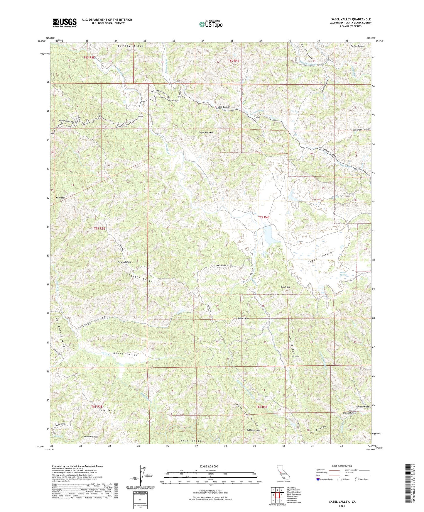
2021 topographic map quadrangle Isabel Valley in the state of California. Scale: 1:24000. Based on the newly updated USGS 7.5' US Topo map series, this map is in the following counties: Santa Clara. The map contains contour data, water features, and other items you are used to seeing on USGS maps, but also has updated roads and other features. This is the next generation of topographic maps. Printed on high-quality waterproof paper with UV fade-resistant inks.
Quads adjacent to this one:
West: Lick Observatory
Northwest: Mount Day
North: Eylar Mountain
Northeast: Mount Boardman
East: Mount Stakes
Southeast: Mississippi Creek
South: Mount Sizer
Southwest: Morgan Hill
This map covers the same area as the classic USGS quad with code o37121c5.
Contains the following named places: Bollinger Canyon, Bollinger Mountain, Bollinger Ridge, Brush Mountain, Castle Canyon, Castle Ridge, Cow Hill, Grizzly Flats, Henderson Ridge, Horse Valley, Indian Springs, Isabel Valley, Jack Canyon, Jays Ridge, Jumpoff Creek, Lion Canyon, Los Huecos, Martys Ranch, Mount Helen, Mount Isabel, North Fork Grizzly Creek, Pyramid Rock, Round Mountain, Ruff Ranch, Sawtooth Canyon, Skunk Hollow, Soup Bowl Creek, Sugarloaf Mountain, Wiel Ranch