MyTopo
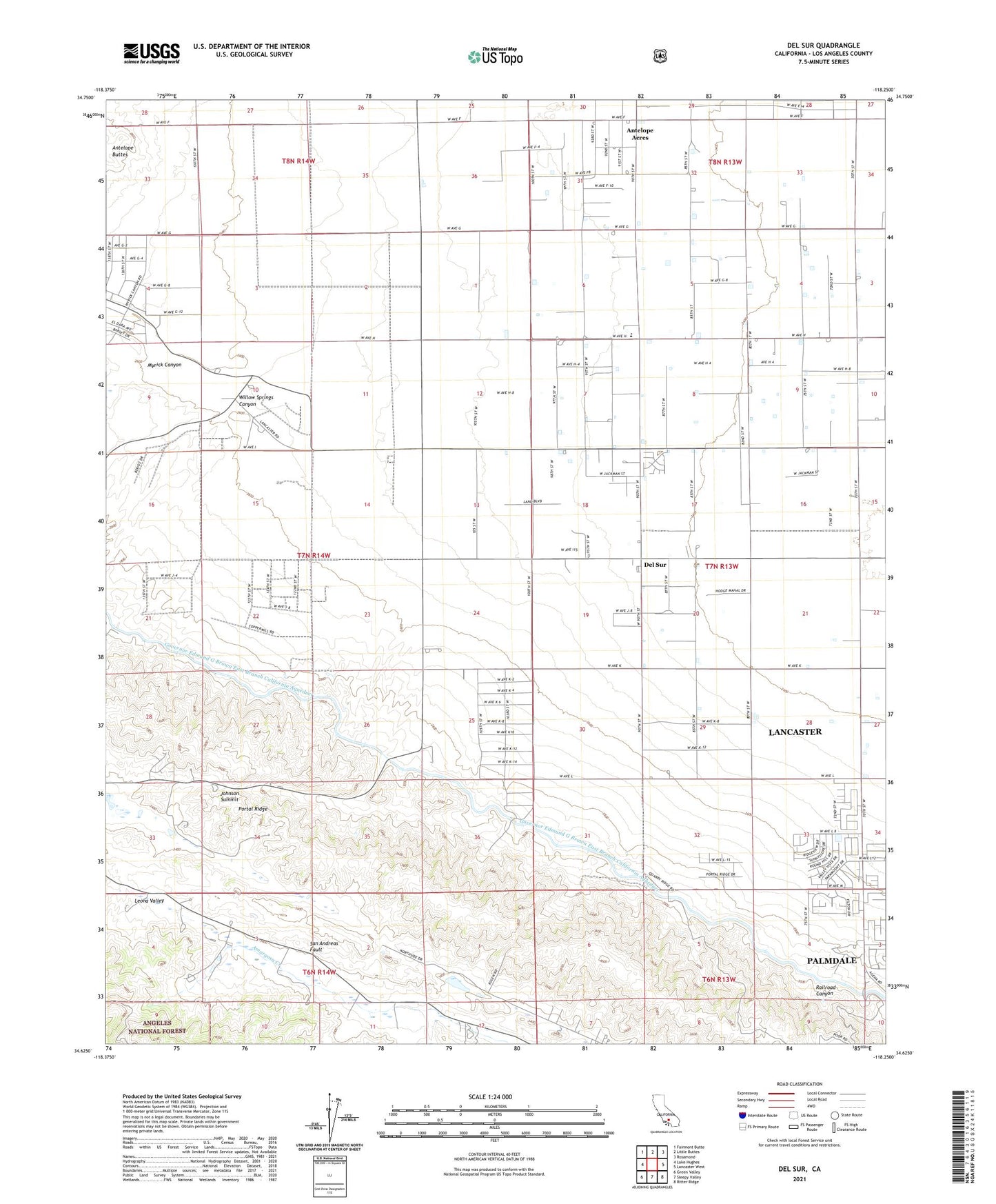
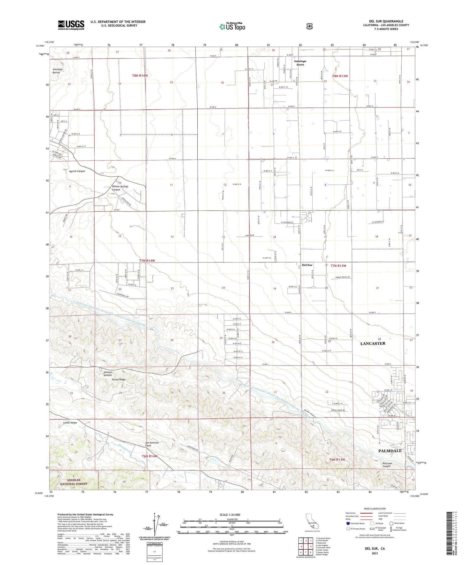
Del Sur California US Topo Map
Couldn't load pickup availability
Also explore the Del Sur Forest Service Topo of this same quad for updated USFS data
2021 topographic map quadrangle Del Sur in the state of California. Scale: 1:24000. Based on the newly updated USGS 7.5' US Topo map series, this map is in the following counties: Los Angeles. The map contains contour data, water features, and other items you are used to seeing on USGS maps, but also has updated roads and other features. This is the next generation of topographic maps. Printed on high-quality waterproof paper with UV fade-resistant inks.
Quads adjacent to this one:
West: Lake Hughes
Northwest: Fairmont Butte
North: Little Buttes
Northeast: Rosamond
East: Lancaster West
Southeast: Ritter Ridge
South: Sleepy Valley
Southwest: Green Valley
This map covers the same area as the classic USGS quad with code o34118f3.
Contains the following named places: Antelope Substation, Bohunk's Airpark, Cochems Ranch, Del Sur, Del Sur Senior Elementary School, Eric Munz Ranch, Esperanza School, Foothill Ranch, Governor Edmund G Brown East Branch California Aqueduct, Johnson Siphon, Johnson Summit, Leona Valley Ranch, Myrick Canyon, Pitchfork Ranch, Railroad Canyon, University of California Agricultural Field, Valley View Ranch, Willow Springs Canyon, ZIP Code: 93536