
MyTopo
Richgrove California US Topo Map
Couldn't load pickup availability
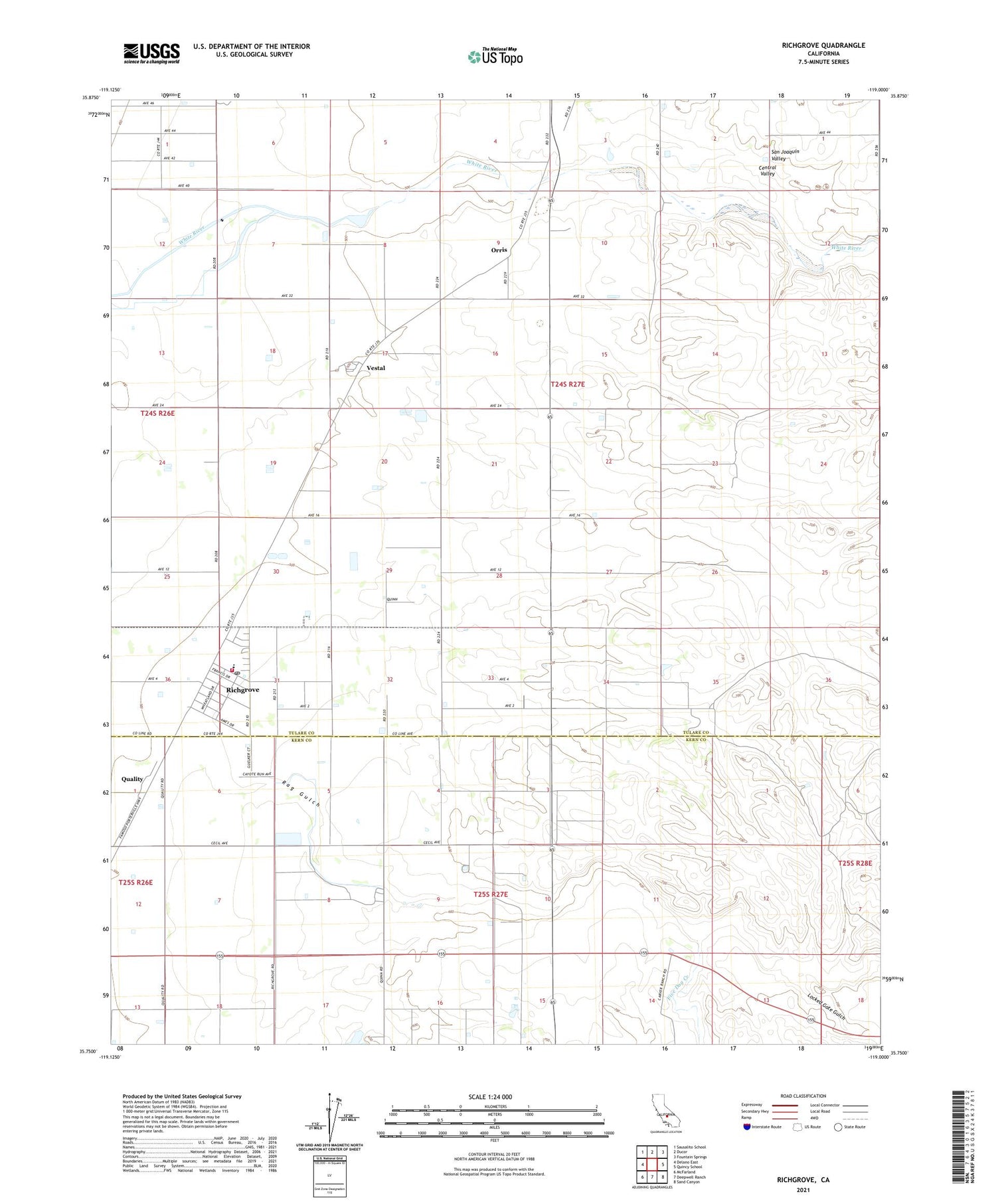
2021 topographic map quadrangle Richgrove in the state of California. Scale: 1:24000. Based on the newly updated USGS 7.5' US Topo map series, this map is in the following counties: Tulare, Kern. The map contains contour data, water features, and other items you are used to seeing on USGS maps, but also has updated roads and other features. This is the next generation of topographic maps. Printed on high-quality waterproof paper with UV fade-resistant inks.
Quads adjacent to this one:
West: Delano East
Northwest: Sausalito School
North: Ducor
Northeast: Fountain Springs
East: Quincy School
Southeast: Sand Canyon
South: Deepwell Ranch
Southwest: McFarland
This map covers the same area as the classic USGS quad with code o35119g1.
Contains the following named places: Bartoldus Ranch, Five Dog Creek, Locked Gate Gulch, Nielson Ranch, Orris, Quality, Quality Ranch, Quinn Ranch, Richgrove, Richgrove Census Designated Place, Richgrove Elementary School, Richgrove Post Office, Thermal School, Tulare County Fire Department Battalion 2 Richgrove Fire Station 10, Vestal, Vestal Sub Station, White River Dairy, ZIP Code: 93218


