MyTopo
McGuire Ridge California US Topo Map
Couldn't load pickup availability
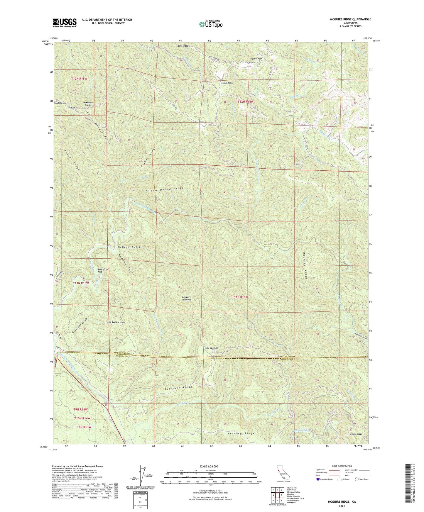
2023 topographic map quadrangle McGuire Ridge in the state of California. Scale: 1:24000. Based on the newly updated USGS 7.5' US Topo map series, this map is in the following counties: Mendocino, Sonoma. The map contains contour data, water features, and other items you are used to seeing on USGS maps, but also has updated roads and other features. This is the next generation of topographic maps. Printed on high-quality waterproof paper with UV fade-resistant inks.
Quads adjacent to this one:
West: Gualala
Northwest: Eureka Hill
North: Zeni Ridge
Northeast: Ornbaun Valley
East: Gube Mountain
Southeast: Annapolis
South: Stewarts Point
Southwest: Stewarts Point OE W
This map covers the same area as the classic USGS quad with code o38123g4.
Contains the following named places: Bear Creek, Big Pepperwood Creek, Billings Creek, Ciapusci Ranch, Cox Opening, Dry Creek, Fisher Ridge, Gianoli Ranch, Groshong Gulch, Hayfield Creek, Hoodoo Gulch, Horsethief Canyon, Jackknife Tunnel, Jackknife Turn, Johnny Woodin Ridge, Little Red Rock Mountain, Log Cabin Ranch, Lowrey Openings, McGann Gulch, McGuire Ridge, McKenzie Grade, North Fork Gualala River, Old Red Rock Place, Palmer Creek, Peachtree Flat, Rickard Ranch, Robinson Creek, Robinson Ridge, Rockpile Creek, School Ridge, Signal Ridge, South Fork Gualala River, Squaw Rock, Stanley Ridge, Stewart Creek, Tindall Camp, Y Ranch, Yellow Hound Ridge, Zeni Ranch, ZIP Code: 95445