
MyTopo
Eureka Hill California US Topo Map
Couldn't load pickup availability
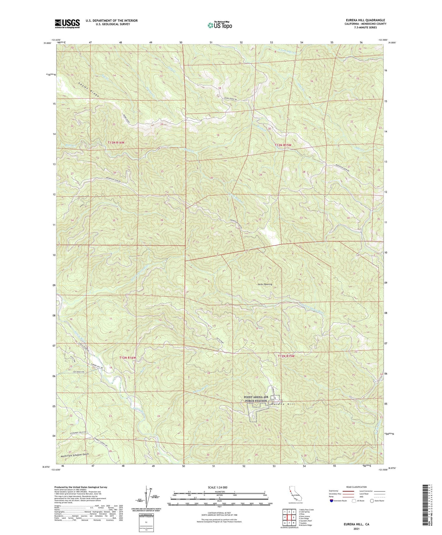
2021 topographic map quadrangle Eureka Hill in the state of California. Scale: 1:24000. Based on the newly updated USGS 7.5' US Topo map series, this map is in the following counties: Mendocino. The map contains contour data, water features, and other items you are used to seeing on USGS maps, but also has updated roads and other features. This is the next generation of topographic maps. Printed on high-quality waterproof paper with UV fade-resistant inks.
Quads adjacent to this one:
West: Point Arena
Northwest: Mallo Pass Creek
North: Cold Spring
Northeast: Philo
East: Zeni Ridge
Southeast: McGuire Ridge
South: Gualala
Southwest: Saunders Reef
This map covers the same area as the classic USGS quad with code o38123h5.
Contains the following named places: Adams Ridge, Brayton Ranch, Buckridge Ranch, Campbell Ranch, Dunbar Ranch, Eureka Hill, Garcia River Forest, Jacks Opening, Lee Creek, Lookout Ranch, Moungovans Ranch, Mount View Ranch, North Fork Alder Creek, North Fork Garcia River, Piper Ranch, Point Arena Air Force Station, Point Arena Division, Rolling Brook, Signal Creek, South Fork Brush Creek, ZIP Codes: 95459, 95468


