MyTopo
Zeni Ridge California US Topo Map
Couldn't load pickup availability
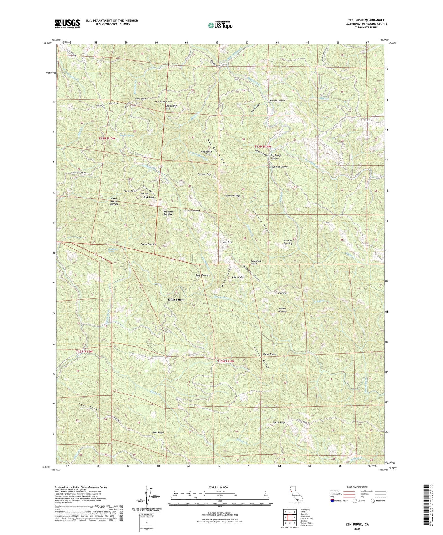
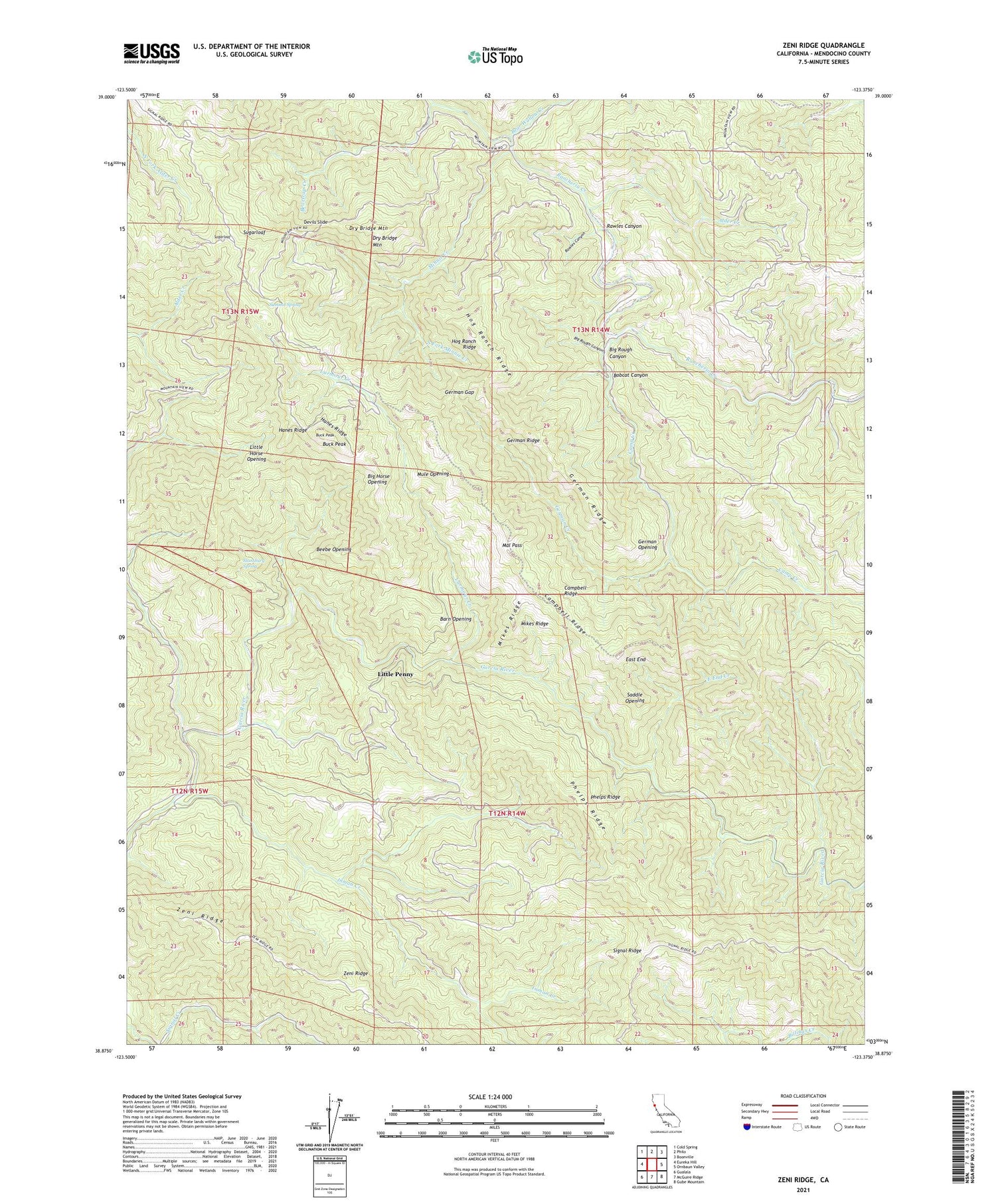
2021 topographic map quadrangle Zeni Ridge in the state of California. Scale: 1:24000. Based on the newly updated USGS 7.5' US Topo map series, this map is in the following counties: Mendocino. The map contains contour data, water features, and other items you are used to seeing on USGS maps, but also has updated roads and other features. This is the next generation of topographic maps. Printed on high-quality waterproof paper with UV fade-resistant inks.
Quads adjacent to this one:
West: Eureka Hill
Northwest: Cold Spring
North: Philo
Northeast: Boonville
East: Ornbaun Valley
Southeast: Gube Mountain
South: McGuire Ridge
Southwest: Gualala
This map covers the same area as the classic USGS quad with code o38123h4.
Contains the following named places: Alder Creek, Barn Opening, Bear Wallow Creek, Beartrap Creek, Beebe Opening, Big Horse Opening, Big Rough Canyon, Bobcat Canyon, Buck Peak, Camp Creek, Campbell Ridge, Devils Slide, Dry Bridge Mountain, East End, East End Creek, German Creek, German Gap, German Opening, German Ridge, Hanes Ridge, Helvetian Gun Club, Hog Ranch Ridge, Inman Creek, Larmour Creek, Little Horse Opening, Little Penny, Mal Pass, Mikes Ridge, Minnie Creek, Mule Opening, Phelps Ridge, Rawles Canyon, Saddle Opening, South Fork Minnie Creek, Stansbury Spring, Sugarloaf, Summit Spring, Zeni Ridge