MyTopo
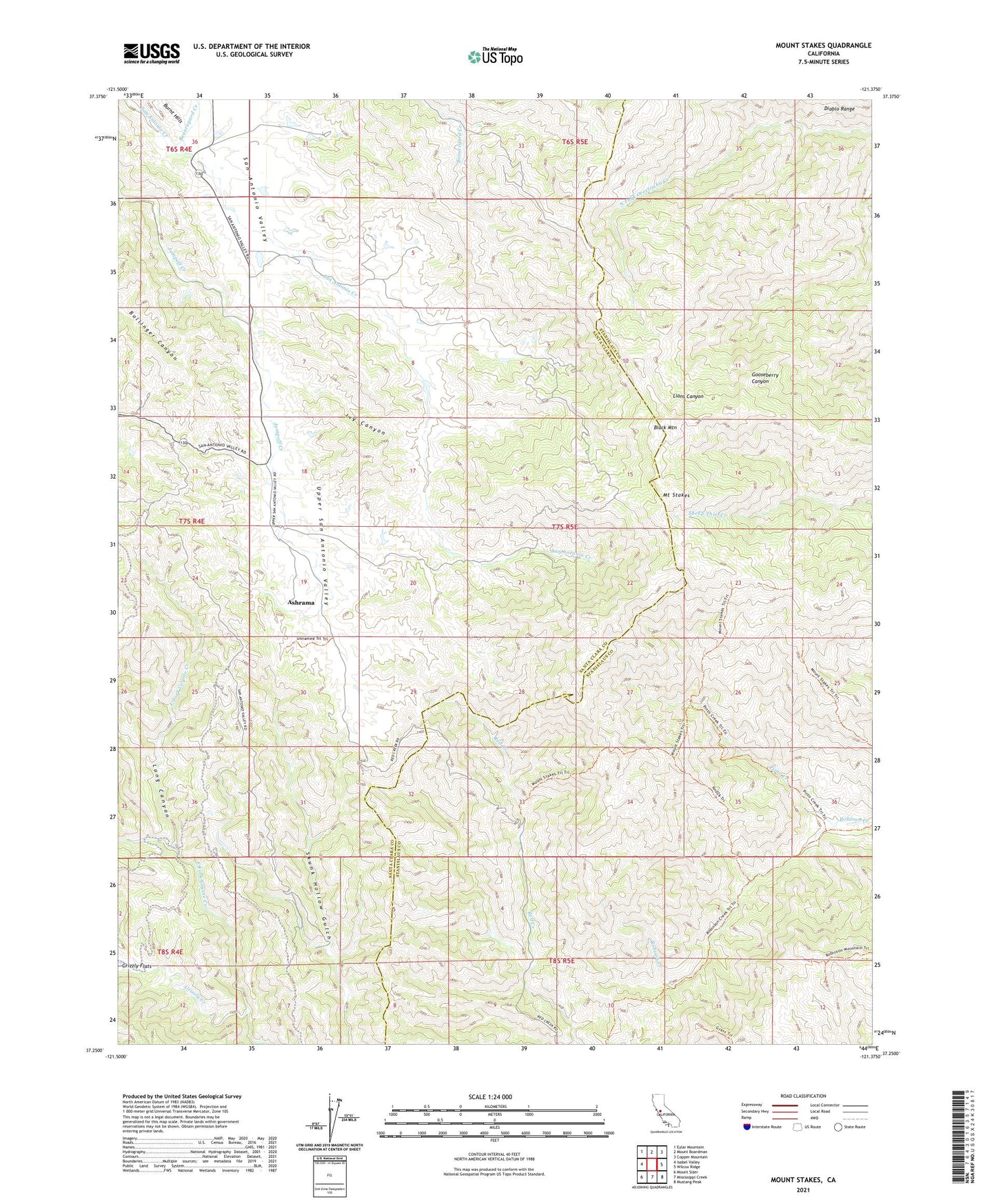
Mount Stakes California US Topo Map
Couldn't load pickup availability
2021 topographic map quadrangle Mount Stakes in the state of California. Scale: 1:24000. Based on the newly updated USGS 7.5' US Topo map series, this map is in the following counties: Santa Clara, Stanislaus. The map contains contour data, water features, and other items you are used to seeing on USGS maps, but also has updated roads and other features. This is the next generation of topographic maps. Printed on high-quality waterproof paper with UV fade-resistant inks.
Quads adjacent to this one:
West: Isabel Valley
Northwest: Eylar Mountain
North: Mount Boardman
Northeast: Copper Mountain
East: Wilcox Ridge
Southeast: Mustang Peak
South: Mississippi Creek
Southwest: Mount Sizer
This map covers the same area as the classic USGS quad with code o37121c4.
Contains the following named places: Ashrama, Beauregard Creek, Black Mountain, Capell Ranch, Fellmoth Ranch, Gerber Ranch, Grizzly Creek, Henry W. Coe State Wilderness, Ivy Canyon, Jordan Ranch, Mount Stakes, Pinto Creek, San Antonio Valley, San Antonio Valley School, Shanti, Skunk Hollow Gulch, Stadler Ranch, Upper San Antonio Valley, Wiesendanger Ranch