MyTopo
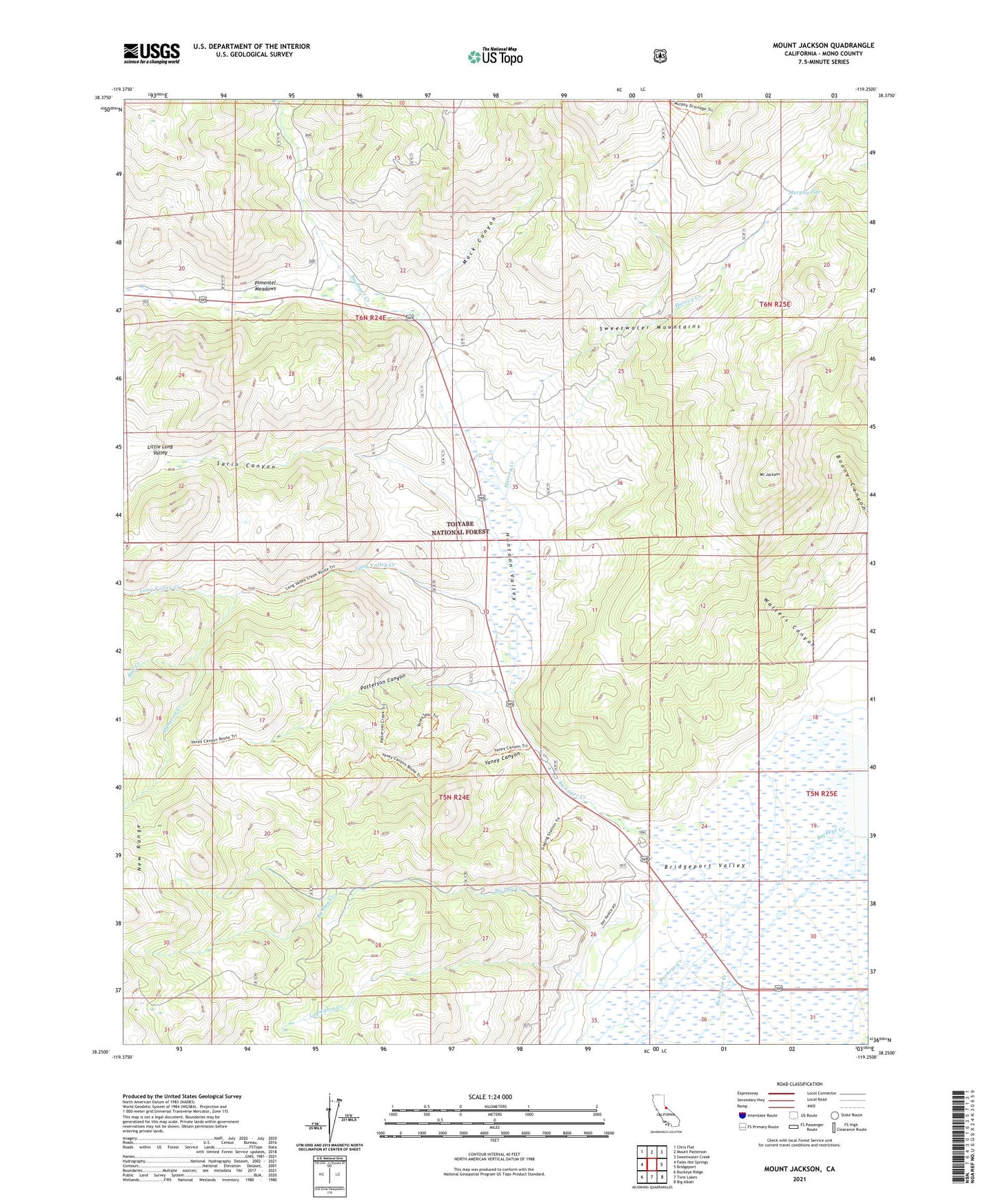
Mount Jackson California US Topo Map
Couldn't load pickup availability
Also explore the Mount Jackson Forest Service Topo of this same quad for updated USFS data
2021 topographic map quadrangle Mount Jackson in the state of California. Scale: 1:24000. Based on the newly updated USGS 7.5' US Topo map series, this map is in the following counties: Mono. The map contains contour data, water features, and other items you are used to seeing on USGS maps, but also has updated roads and other features. This is the next generation of topographic maps. Printed on high-quality waterproof paper with UV fade-resistant inks.
Quads adjacent to this one:
West: Fales Hot Springs
Northwest: Chris Flat
North: Mount Patterson
Northeast: Sweetwater Creek
East: Bridgeport
Southeast: Big Alkali
South: Twin Lakes
Southwest: Buckeye Ridge
This map covers the same area as the classic USGS quad with code o38119c3.
Contains the following named places: Bridgeport Ranger Station, Buckeye Creek, Bull Creek, By-Day Creek, Harvey Creek, Huntoon Camp, Huntoon Creek, Huntoon Valley, Log Cabin Creek, Long Valley Creek, Mack Canyon, Mount Jackson, Murphy Flat, North Mono Division, Patterson Canyon, Pimentel Meadows, Robinson Creek, Sario Canyon, Sario Ranch, Swauger Creek, United States Forest Service Heliport, Walters Canyon, Yaney Canyon