MyTopo
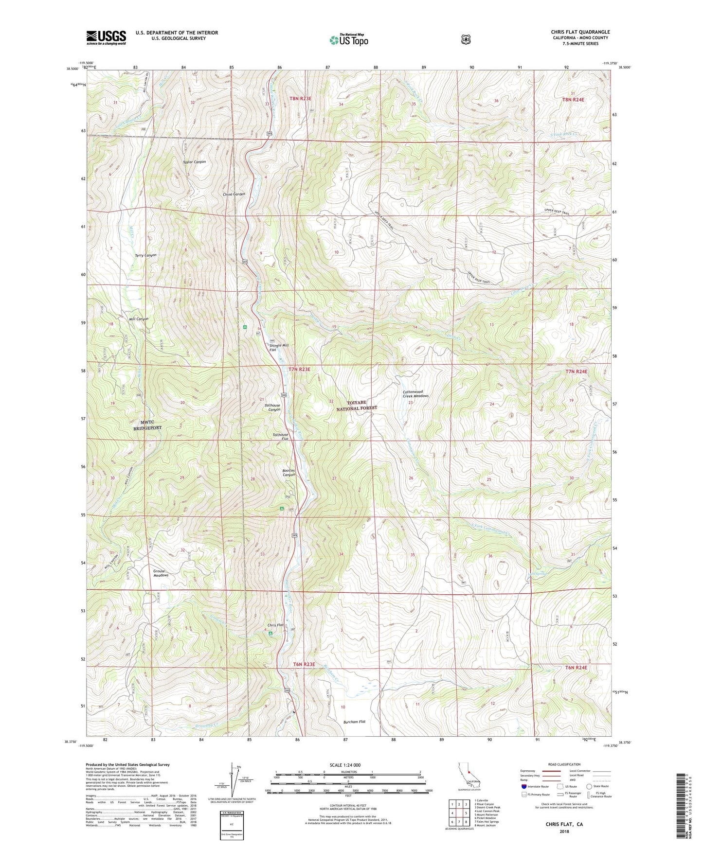
Chris Flat California US Topo Map
Couldn't load pickup availability
Also explore the Chris Flat Forest Service Topo of this same quad for updated USFS data
2021 topographic map quadrangle Chris Flat in the state of California. Scale: 1:24000. Based on the newly updated USGS 7.5' US Topo map series, this map is in the following counties: Mono. The map contains contour data, water features, and other items you are used to seeing on USGS maps, but also has updated roads and other features. This is the next generation of topographic maps. Printed on high-quality waterproof paper with UV fade-resistant inks.
Quads adjacent to this one:
West: Lost Cannon Peak
Northwest: Coleville
North: Risue Canyon
Northeast: Desert Creek Peak
East: Mount Patterson
Southeast: Mount Jackson
South: Fales Hot Springs
Southwest: Pickel Meadow
This map covers the same area as the classic USGS quad with code o38119d4.
Contains the following named places: Bootleg Campground, Bootles Canyon, Burcham Creek, China Garden, Chris Flat, Chris Flat Campground, Cottonwood Creek, Cottonwood Creek Meadows, Deep Creek, Deep Creek Mine, Driveway Creek, Fremont Carson Route, Grouse Creek, Grouse Meadows, Lava Springs, Little Deep Creek, Little Walker River, Lost Cannon Creek, North Fork Cottonwood Creek, Shingle Mill Flat, Shingle Mill FLat, South Fork Cottonwood Creek, Terry Canyon, Tollhouse Canyon, Tollhouse Flat, ZIP Code: 96107