MyTopo
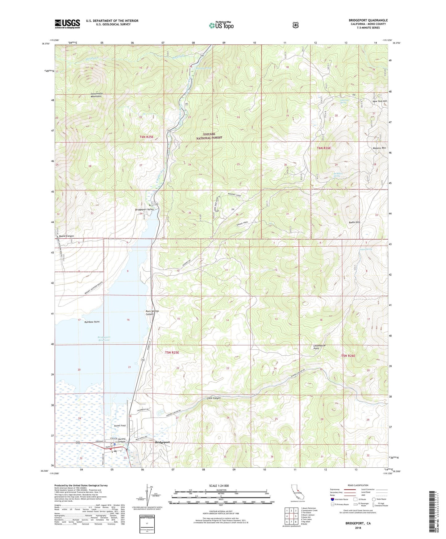
Bridgeport California US Topo Map
Couldn't load pickup availability
Also explore the Bridgeport Forest Service Topo of this same quad for updated USFS data
2021 topographic map quadrangle Bridgeport in the state of California. Scale: 1:24000. Based on the newly updated USGS 7.5' US Topo map series, this map is in the following counties: Mono. The map contains contour data, water features, and other items you are used to seeing on USGS maps, but also has updated roads and other features. This is the next generation of topographic maps. Printed on high-quality waterproof paper with UV fade-resistant inks.
Quads adjacent to this one:
West: Mount Jackson
Northwest: Mount Patterson
North: Sweetwater Creek
Northeast: The Elbow
East: Dome Hill
Southeast: Bodie
South: Big Alkali
Southwest: Twin Lakes
This map covers the same area as the classic USGS quad with code o38119c2.
Contains the following named places: Aurora Canyon, Boone Canyon, Bridgeport, Bridgeport 70-002 Dam, Bridgeport Cemetery, Bridgeport Census Designated Place, Bridgeport Elementary School, Bridgeport Fire Department, Bridgeport Post Office, Bridgeport Reservation, Bridgeport Reservoir, Bridgeport Valley, Bryant Field, Chemung Mine, Clark Canyon, Lakeview Spring, Locomotive Point, Logan Spring, Masonic Mountain, McMillan Spring, Mono County Paramedics Station 7, Mono General Hospital Heliport, Murphy Creek, Murphy Pond, New York Hill, Rainbow Point, Rock Springs Canyon, Serita Mine, Success Mine