MyTopo
Dinkey Creek California US Topo Map
Couldn't load pickup availability
Also explore the Dinkey Creek Forest Service Topo of this same quad for updated USFS data
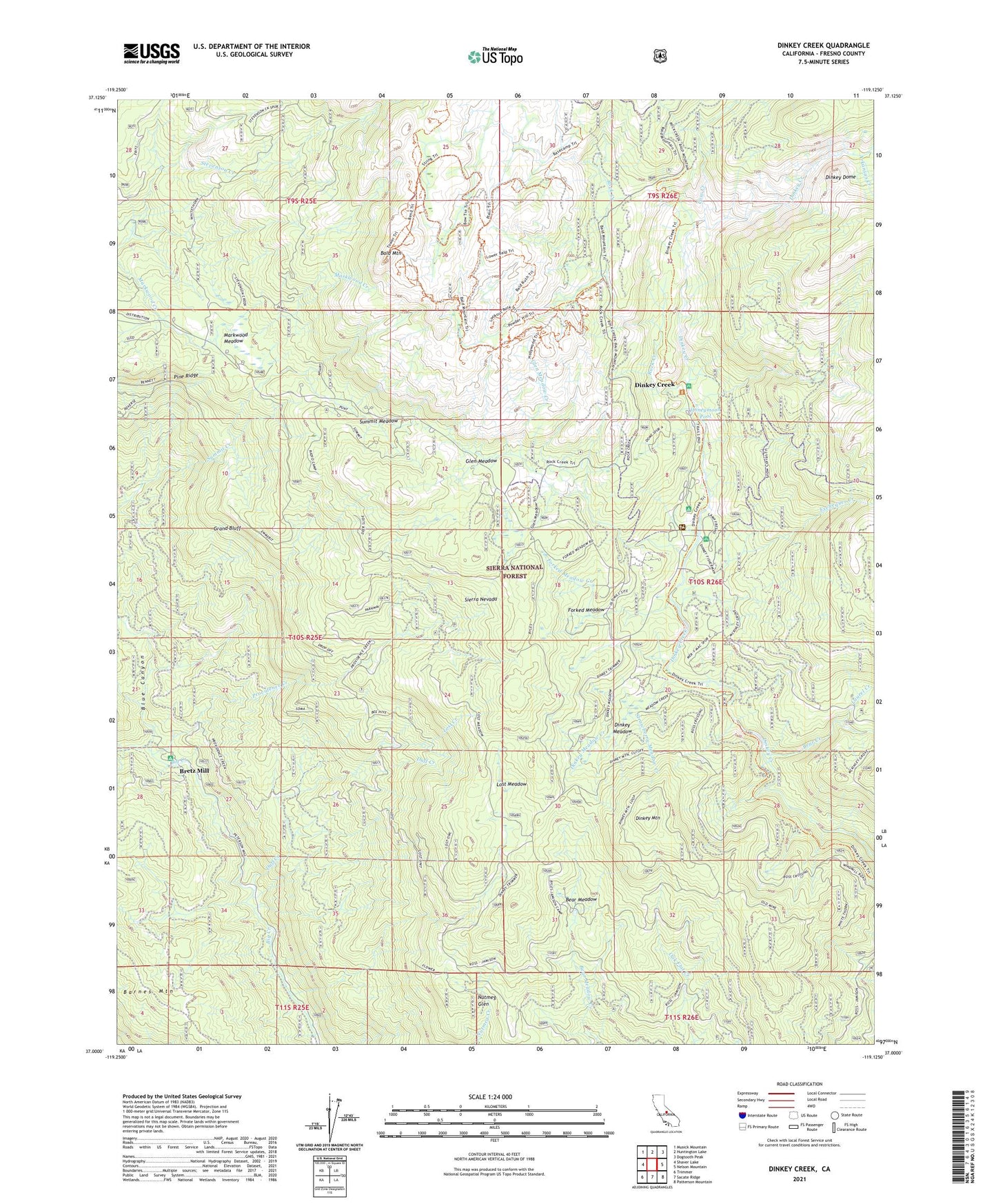
2021 topographic map quadrangle Dinkey Creek in the state of California. Scale: 1:24000. Based on the newly updated USGS 7.5' US Topo map series, this map is in the following counties: Fresno. The map contains contour data, water features, and other items you are used to seeing on USGS maps, but also has updated roads and other features. This is the next generation of topographic maps. Printed on high-quality waterproof paper with UV fade-resistant inks.
Quads adjacent to this one:
West: Shaver Lake
Northwest: Musick Mountain
North: Huntington Lake
Northeast: Dogtooth Peak
East: Nelson Mountain
Southeast: Patterson Mountain
South: Sacate Ridge
Southwest: Trimmer
This map covers the same area as the classic USGS quad with code o37119a2.
Contains the following named places: Arkansas Creek, Bald Mountain, Bald Mountain Lookout, Barnes Mountain, Bear Creek, Bear Meadow, Blue Canyon Work Center, Bretz Mill, Byles Johnson Camp, Camp EL-O-Win, Camp Fresno, Camp Mary-Y-Mac, Cow Creek, D and D Pack Station, Dinkey Creek, Dinkey Creek Post Office, Dinkey Creek Ranger Station, Dinkey Creek Resort, Dinkey Creek Trailhead, Dinkey Creek Work Center, Dinkey Dome, Dinkey Fisherman Picnic Area, Dinkey Meadow, Dinkey Meadow Creek, Dinkey Mountain, Duff Creek, Duff Creek Campground, Exchequer Creek, Forked Meadow, Forked Meadow Creek, Glen Meadow, Glen Meadow Creek, Glenn Meadow Forest Service Facility, Grand Bluff, Honeymoon Pool, Laurel Creek, Lost Creek, Lost Meadow, Lower Dinkey Creek Campground, Markwood Meadow, Nutmeg Glen, Oakie Bear Campground, Pine Logging Camp, Pine Ridge, Pollard Camp, Providence Creek, Providence Quarry, Reese Creek, Rock Creek, Sawmill Campground, Soaproot Campground, Strawberry Meadow, Strawberry Meadow Creek, Summit Meadow, Summit Meadow Campground, Upper Dinkey Creek Campground