MyTopo
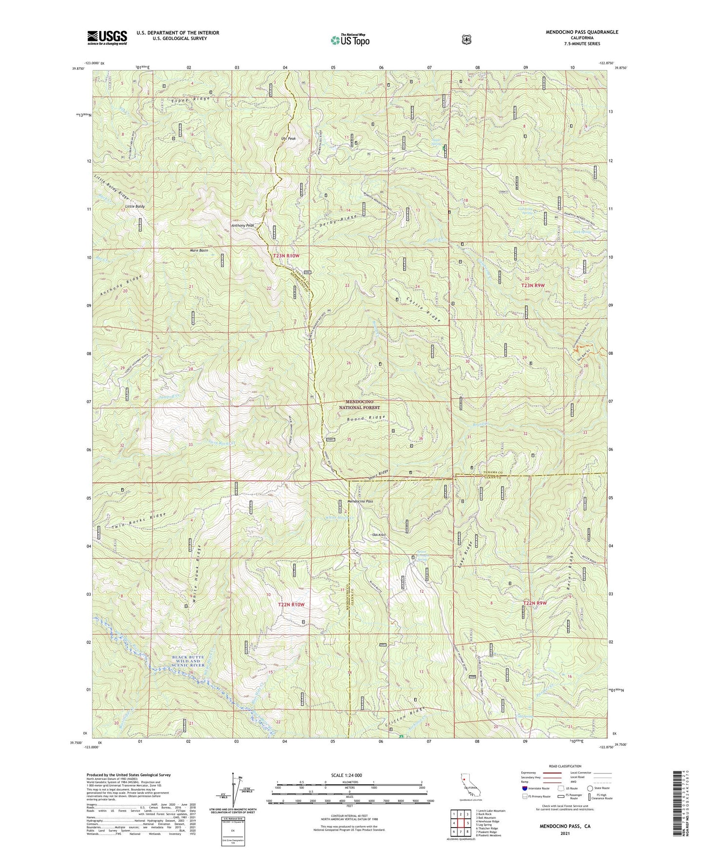
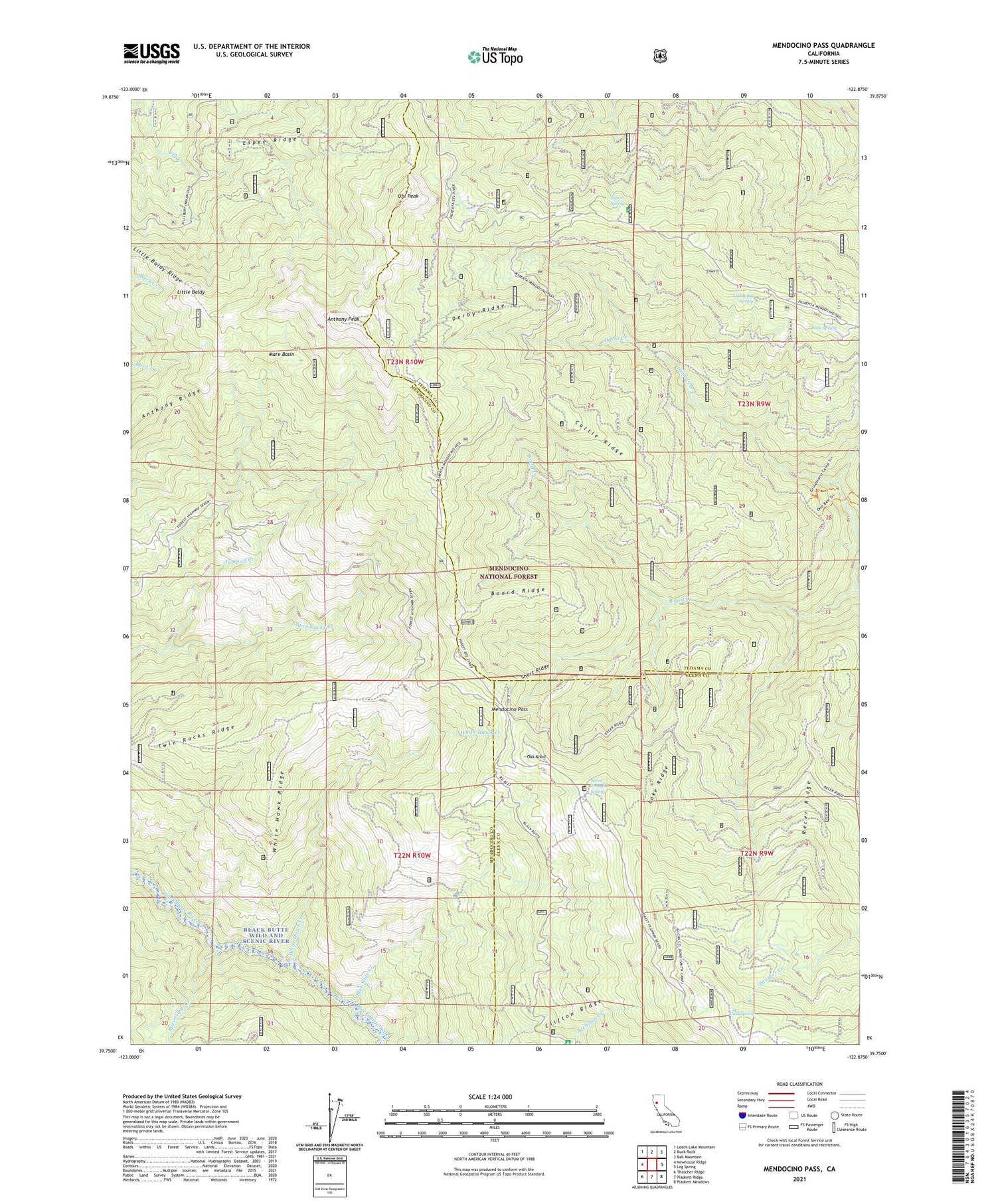
Mendocino Pass California US Topo Map
Couldn't load pickup availability
Also explore the Mendocino Pass Forest Service Topo of this same quad for updated USFS data
2021 topographic map quadrangle Mendocino Pass in the state of California. Scale: 1:24000. Based on the newly updated USGS 7.5' US Topo map series, this map is in the following counties: Mendocino, Tehama, Glenn. The map contains contour data, water features, and other items you are used to seeing on USGS maps, but also has updated roads and other features. This is the next generation of topographic maps. Printed on high-quality waterproof paper with UV fade-resistant inks.
Quads adjacent to this one:
West: Newhouse Ridge
Northwest: Leech Lake Mountain
North: Buck Rock
Northeast: Ball Mountain
East: Log Spring
Southeast: Plaskett Meadows
South: Plaskett Ridge
Southwest: Thatcher Ridge
This map covers the same area as the classic USGS quad with code o39122g8.
Contains the following named places: Anthony Peak, Anthony Peak Lookout Tower, Anthony Ridge, Atchison Campground, Barras Ranch, Black Butte Wild and Scenic River, Blue Slide Creek, Board Ridge, Bollinger Place, Bredehoft Place, Brewer Oak Recreation Site, Burnt Creek, Buttermilk Trail, Cattle Ridge, Clifton Ridge, Cold Spring, Derby Ridge, Espee Ridge, Government Flat, Grindstone Recreation Site, Hardy Place, Lake Ridge, Lightning Spring, Little Baldy, Little Baldy Ridge, Low Gap Station, Mare Basin, Mendocino Pass, Mississippi Creek, Oak Knoll, Recer Ridge, Rock Spring, Seven Troughs Spring, Short Ridge, Smith Camp, Sugar Spring, Sugar Spring Campground, Surveyor Campground, Templeton Cabin, Twin Rocks Creek, Twin Rocks Ridge, Uhl Peak, Wells Cabin Campground, White Hawk Creek, White Hawk Ridge