MyTopo
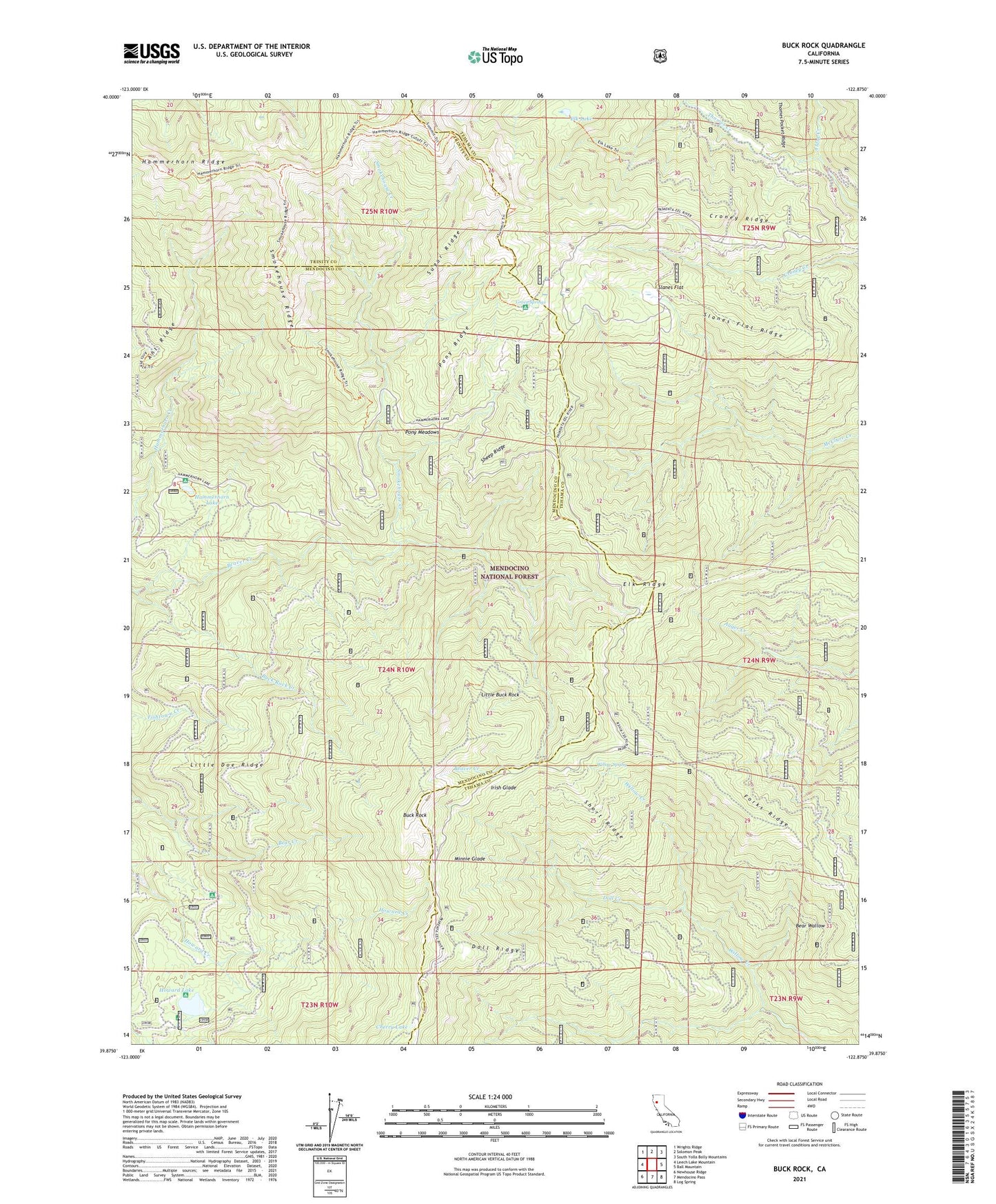
Buck Rock California US Topo Map
Couldn't load pickup availability
Also explore the Buck Rock Forest Service Topo of this same quad for updated USFS data
2021 topographic map quadrangle Buck Rock in the state of California. Scale: 1:24000. Based on the newly updated USGS 7.5' US Topo map series, this map is in the following counties: Mendocino, Tehama, Trinity. The map contains contour data, water features, and other items you are used to seeing on USGS maps, but also has updated roads and other features. This is the next generation of topographic maps. Printed on high-quality waterproof paper with UV fade-resistant inks.
Quads adjacent to this one:
West: Leech Lake Mountain
Northwest: Wrights Ridge
North: Solomon Peak
Northeast: South Yolla Bolly Mountains
East: Ball Mountain
Southeast: Log Spring
South: Mendocino Pass
Southwest: Newhouse Ridge
This map covers the same area as the classic USGS quad with code o39122h8.
Contains the following named places: Alder Creek, Ant Ridge, Bear Wallow, Beaver Glade Station, Buck Rock, Buck Rock Creek, Cherry Lake, Croney Ridge, Doll Camp, Doll Creek, Doll Ridge, Elk Lake, Elk Ridge, Forks Ridge, Green Springs, Hammerhorn Campground, Hammerhorn Lake, Henderson Cabin, Howard Lake, Irish Glade, Little Buck Rock, Little Doe Campground, Little Doe Ridge, Minnie Glade, Pony Meadows, Pony Ridge, Sheep Ridge, Short Ridge, Slanes Flat, Slanes Flat Ridge, Smoke Howe Trail, Smokehouse Creek, Smokehouse Ridge, Sugar Ridge, Summit Trail, Tantrum Glade Guard Station, Willow Spring