MyTopo
Paraiso Springs California US Topo Map
Couldn't load pickup availability
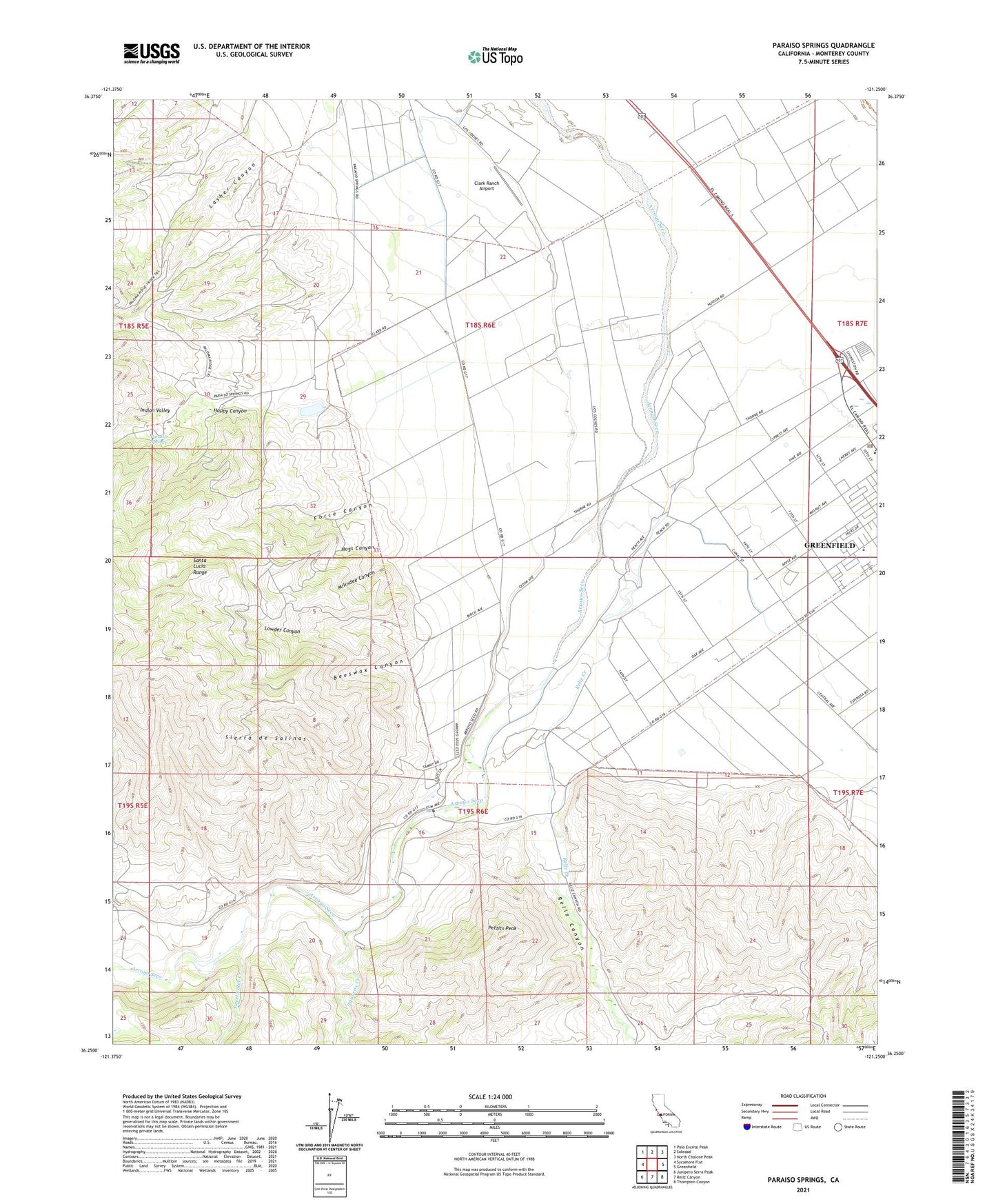
2021 topographic map quadrangle Paraiso Springs in the state of California. Scale: 1:24000. Based on the newly updated USGS 7.5' US Topo map series, this map is in the following counties: Monterey. The map contains contour data, water features, and other items you are used to seeing on USGS maps, but also has updated roads and other features. This is the next generation of topographic maps. Printed on high-quality waterproof paper with UV fade-resistant inks.
Quads adjacent to this one:
West: Sycamore Flat
Northwest: Palo Escrito Peak
North: Soledad
Northeast: North Chalone Peak
East: Greenfield
Southeast: Thompson Canyon
South: Reliz Canyon
Southwest: Junipero Serra Peak
This map covers the same area as the classic USGS quad with code o36121c3.
Contains the following named places: Arroyo Seco, Arroyo Seco School, Beeswax Canyon, Clark Ranch Airport, Force Canyon, Greenfield Memorial Building, Happy Canyon, Hogs Canyon, Indian Valley, Lasher Canyon, Los Coches Substation, Lowder Canyon, Milindee Canyon, Oak Avenue Elementary School, Olson Ranch, Paraiso Springs, Paraiso Springs School, Pettits Peak, Reliz Canyon, Reliz Creek, Sweetwater Creek, Vaqueros Creek, Vineyard of Mission Soledad