MyTopo
Soledad California US Topo Map
Couldn't load pickup availability
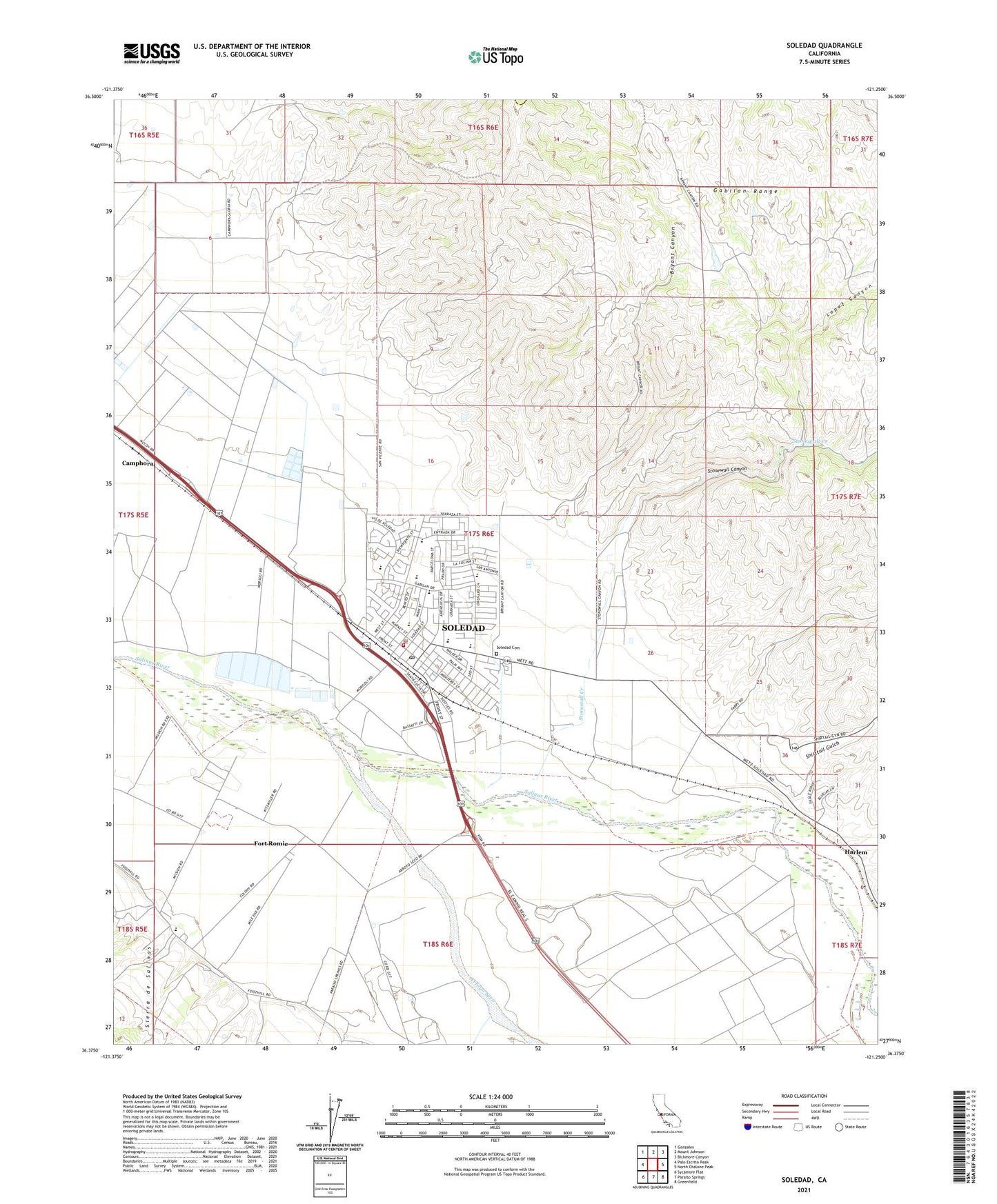
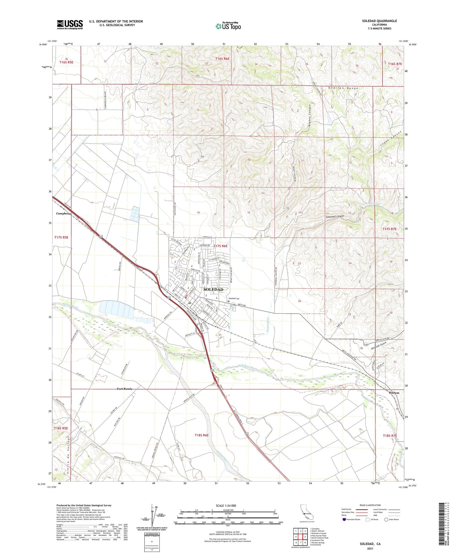
2021 topographic map quadrangle Soledad in the state of California. Scale: 1:24000. Based on the newly updated USGS 7.5' US Topo map series, this map is in the following counties: Monterey, San Benito. The map contains contour data, water features, and other items you are used to seeing on USGS maps, but also has updated roads and other features. This is the next generation of topographic maps. Printed on high-quality waterproof paper with UV fade-resistant inks.
Quads adjacent to this one:
West: Palo Escrito Peak
Northwest: Gonzales
North: Mount Johnson
Northeast: Bickmore Canyon
East: North Chalone Peak
Southeast: Greenfield
South: Paraiso Springs
Southwest: Sycamore Flat
This map covers the same area as the classic USGS quad with code o36121d3.
Contains the following named places: American Medical Response Soledad, Arroyo Seco, Bill Ramos Park, Bryant Canyon, Camphora, City of Soledad, Correctional Training Facility Heliport, Fort Romie, Frank Ledesma Elementary School, Gabilan Elementary School, Hall Ranch, Harlem, Jack Franscioni Elementary School, KOJY-AM (Soledad), KSUR-FM (Greenfield), Little League Park, Lopez Canyon, Los Coche Adobe, Los Coches, Main Street Middle School, Mission Elementary School, Mission Soledad, Paul Masson Vineyards, Pinnacles High School, Rose Ferrero Elementary School, San Vicente Elementary School, Shirttail Gulch, Smith and Hook Winery, Soledad, Soledad Branch Monterey County Free Libraries, Soledad Cemetery, Soledad Christian Academy, Soledad Community Education Center, Soledad Fire Department, Soledad High School, Soledad Police Department, Soledad Post Office, Stonewall Canyon, Stonewall Creek, Upper Lateral Number Two and One Half, Vosti Park, ZIP Code: 93960