MyTopo
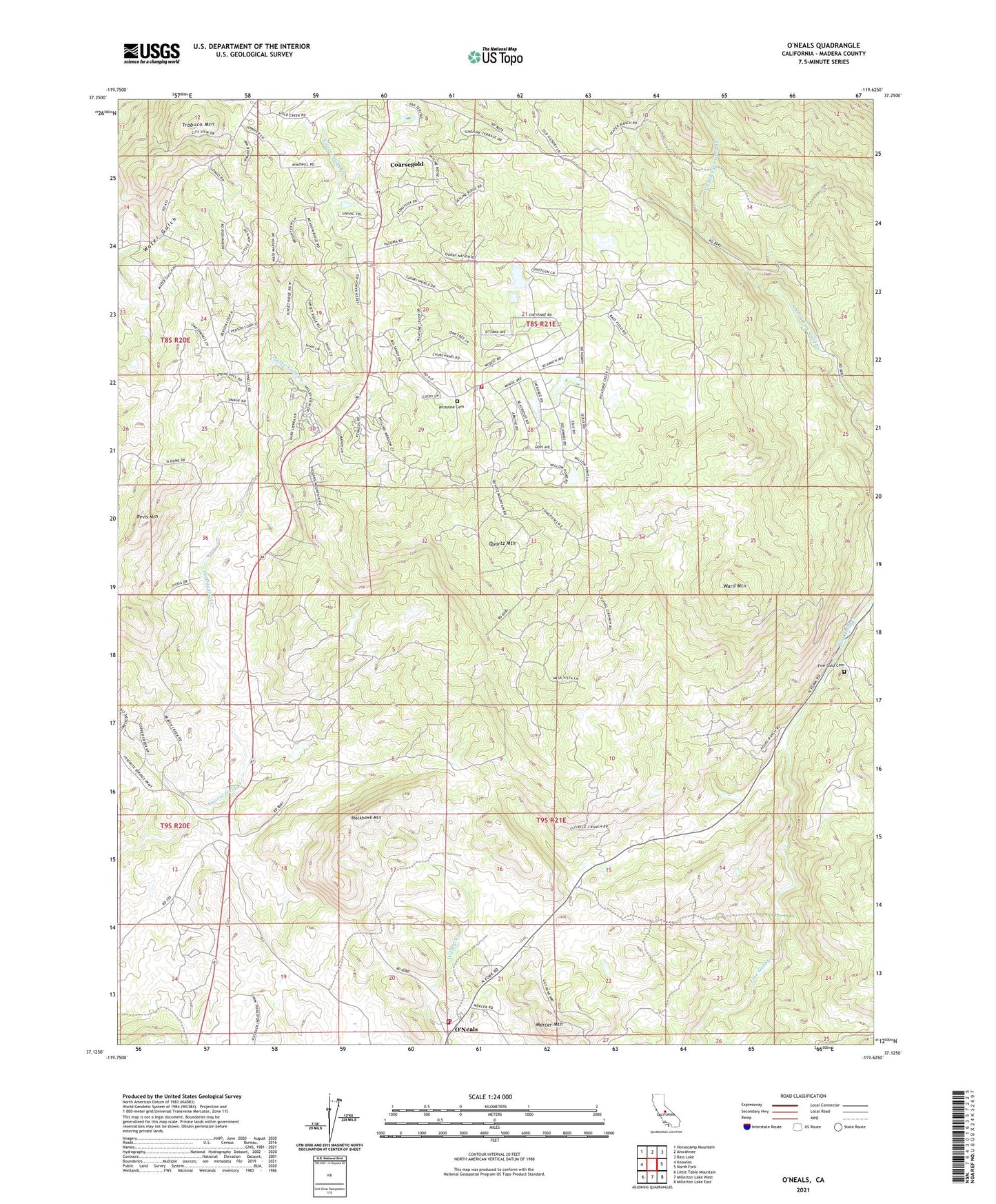
O'Neals California US Topo Map
Couldn't load pickup availability
Also explore the O'Neals Forest Service Topo of this same quad for updated USFS data
2021 topographic map quadrangle O'Neals in the state of California. Scale: 1:24000. Based on the newly updated USGS 7.5' US Topo map series, this map is in the following counties: Madera. The map contains contour data, water features, and other items you are used to seeing on USGS maps, but also has updated roads and other features. This is the next generation of topographic maps. Printed on high-quality waterproof paper with UV fade-resistant inks.
Quads adjacent to this one:
West: Knowles
Northwest: Horsecamp Mountain
North: Ahwahnee
Northeast: Bass Lake
East: North Fork
Southeast: Millerton Lake East
South: Millerton Lake West
Southwest: Little Table Mountain
Contains the following named places: 101 Ranch, 93614, 93645, Bigelow Ranch, Blackhawk Mountain, California Youth Authority Camp, Carnation Mine, Carter Creek, Coarse Gold Fire Station, Coarsegold Census Designated Place, Coon Creek, Ecker Ranch, Fine Gold Cemetery, Green School, House Ranch, Indian Lakes Estates, Indian Lakes Park, Kelshaw Corners, Ladd Creek, Ladd Ranch, Lewis Ranch, Madera County Fire Department Station 17 O'Neals Volunteer Fire Department, Madera County Fire Department Station 8, Magnet, Mercer Mountain, Narbo, O'Neals, O'Neals Post Office, Picayune Cemetery, Picayune Creek, Picayune Rancheria, Quartz Mine, Quartz Mountain, Revis Mountain, Rosedale Ranch, Sierra Ambulance Service - Coarsegold Station, State of California, Trabuco Mountain, Veater Ranch, Ward Mountain, Willow Glen, Yosemite South Camp