MyTopo
Leggett California US Topo Map
Couldn't load pickup availability
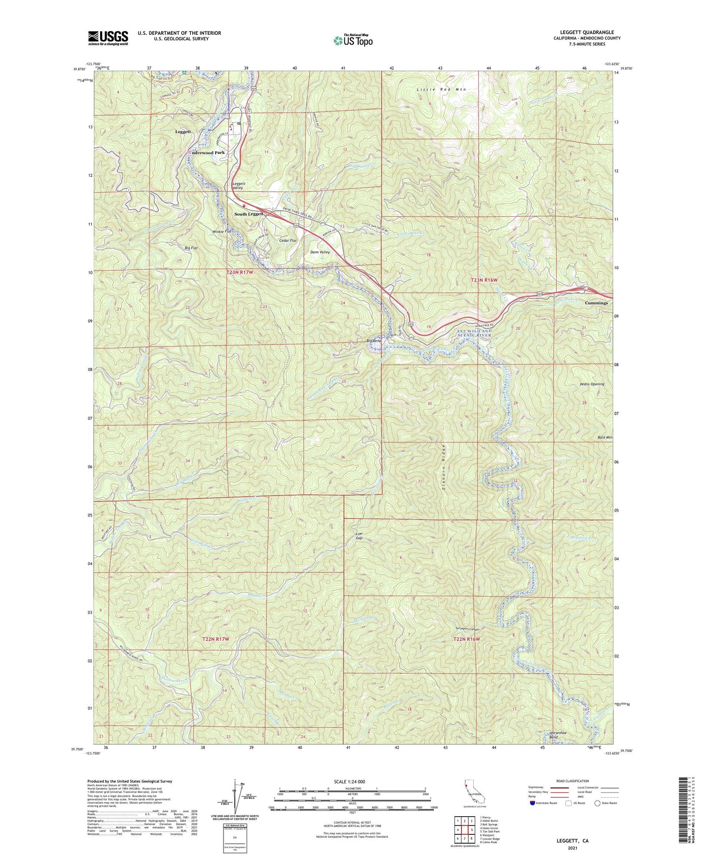
2023 topographic map quadrangle Leggett in the state of California. Scale: 1:24000. Based on the newly updated USGS 7.5' US Topo map series, this map is in the following counties: Mendocino. The map contains contour data, water features, and other items you are used to seeing on USGS maps, but also has updated roads and other features. This is the next generation of topographic maps. Printed on high-quality waterproof paper with UV fade-resistant inks.
Quads adjacent to this one:
West: Hales Grove
Northwest: Piercy
North: Noble Butte
Northeast: Bell Springs
East: Tan Oak Park
Southeast: Cahto Peak
South: Lincoln Ridge
Southwest: Westport
This map covers the same area as the classic USGS quad with code o39123g6.
Contains the following named places: Big Bend, Big Dann Creek, Big Flat, Bond Creek, Camp Saint Michael, Cedar Creek, Cedar Flat, Chandelier Tree, Cummings, Dann Valley, Doctors Creek, Elkhorn Ridge, Elkhorn Ridge Wilderness, Grizzly Creek, Hogshed Creek, Hollow Tree Creek, Horseshoe Bend, Islam John Creek, Laytonville-Leggett Division, Leggett, Leggett Census Designated Place, Leggett Post Office, Leggett Valley, Leggett Valley Elementary School, Leggett Valley High School, Leggett Valley Volunteer Fire Department, Little Dann Creek, Little Low Gap Creek, Little Red Mountain, Lookout Trail, Lost Man Creek, Lost Pipe Creek, Low Gap, Low Gap Creek, Lynch Creek, Measly Creek, Michaels Creek, Pedro Opening, Rattlesnake Creek, Redwood Continuation High School, Rock Creek, South Leggett, Squaw Creek, Surveyors Canyon, Tenmile Creek, The Hermitage, Underwood Park, Waldron Creek, Walters Creek, Wilson Creek, Winkie Flat, ZIP Code: 95585