MyTopo
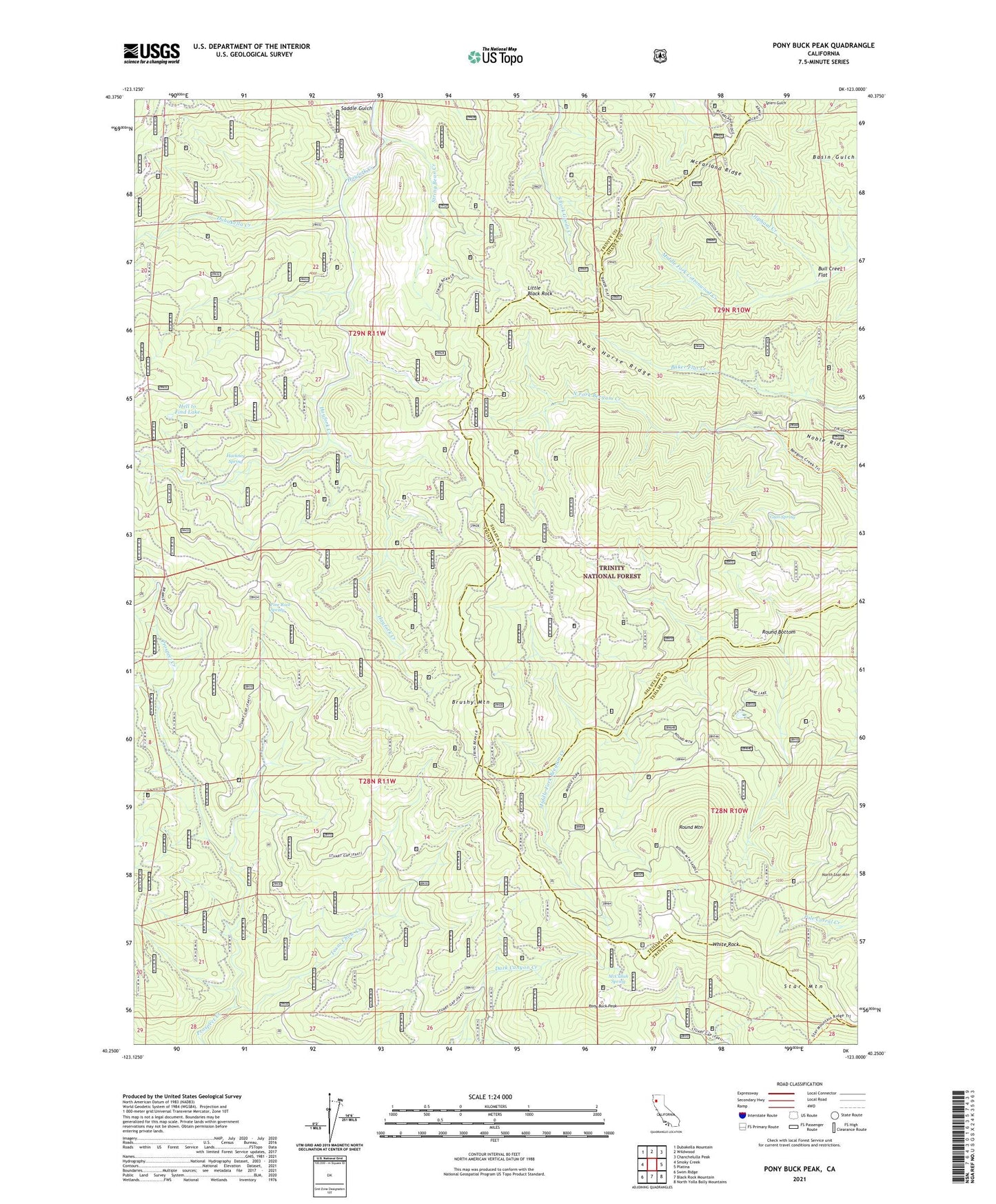
Pony Buck Peak California US Topo Map
Couldn't load pickup availability
Also explore the Pony Buck Peak Forest Service Topo of this same quad for updated USFS data
2021 topographic map quadrangle Pony Buck Peak in the state of California. Scale: 1:24000. Based on the newly updated USGS 7.5' US Topo map series, this map is in the following counties: Trinity, Shasta, Tehama. The map contains contour data, water features, and other items you are used to seeing on USGS maps, but also has updated roads and other features. This is the next generation of topographic maps. Printed on high-quality waterproof paper with UV fade-resistant inks.
Quads adjacent to this one:
West: Smoky Creek
Northwest: Dubakella Mountain
North: Wildwood
Northeast: Chanchelulla Peak
East: Platina
Southeast: North Yolla Bolly Mountains
South: Black Rock Mountain
Southwest: Swim Ridge
This map covers the same area as the classic USGS quad with code o40123c1.
Contains the following named places: Brushy Mountain, Dead Horse Ridge, Devil Camp, Dubakella Creek, Flyblow Camp, Goat Camp, Gum Spring, Hackney Spring, Hell to Find Lake, Little Black Rock, McCullah Spring, McFarland Ridge, North Fork Beegum Campground, Old Bill Mine, Oliphant Creek, Pine Root Forest Service Station, Pine Root Spring, Pine Root Spring Campground, Pony Buck Peak, Ragen Meadow Ranger Station, Regan Meadow, Round Bottom, Round Bottom Ranger Station, Round Mountain, Round Mountain Number One Camp, Round Mountain Number Two Camp, Saddle Gulch, Spider Mine, Star Mountain, String Bean Creek, Texas Chow Creek, White Rock, White Rock Campground, White Rock Guard Station