MyTopo
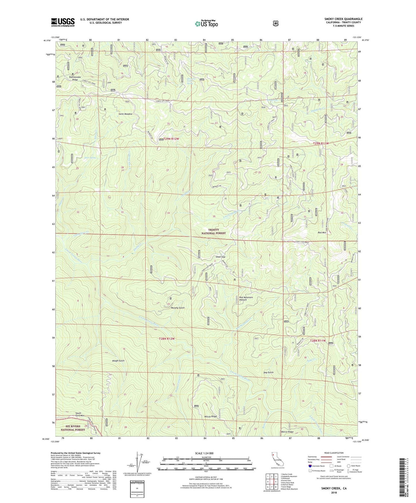
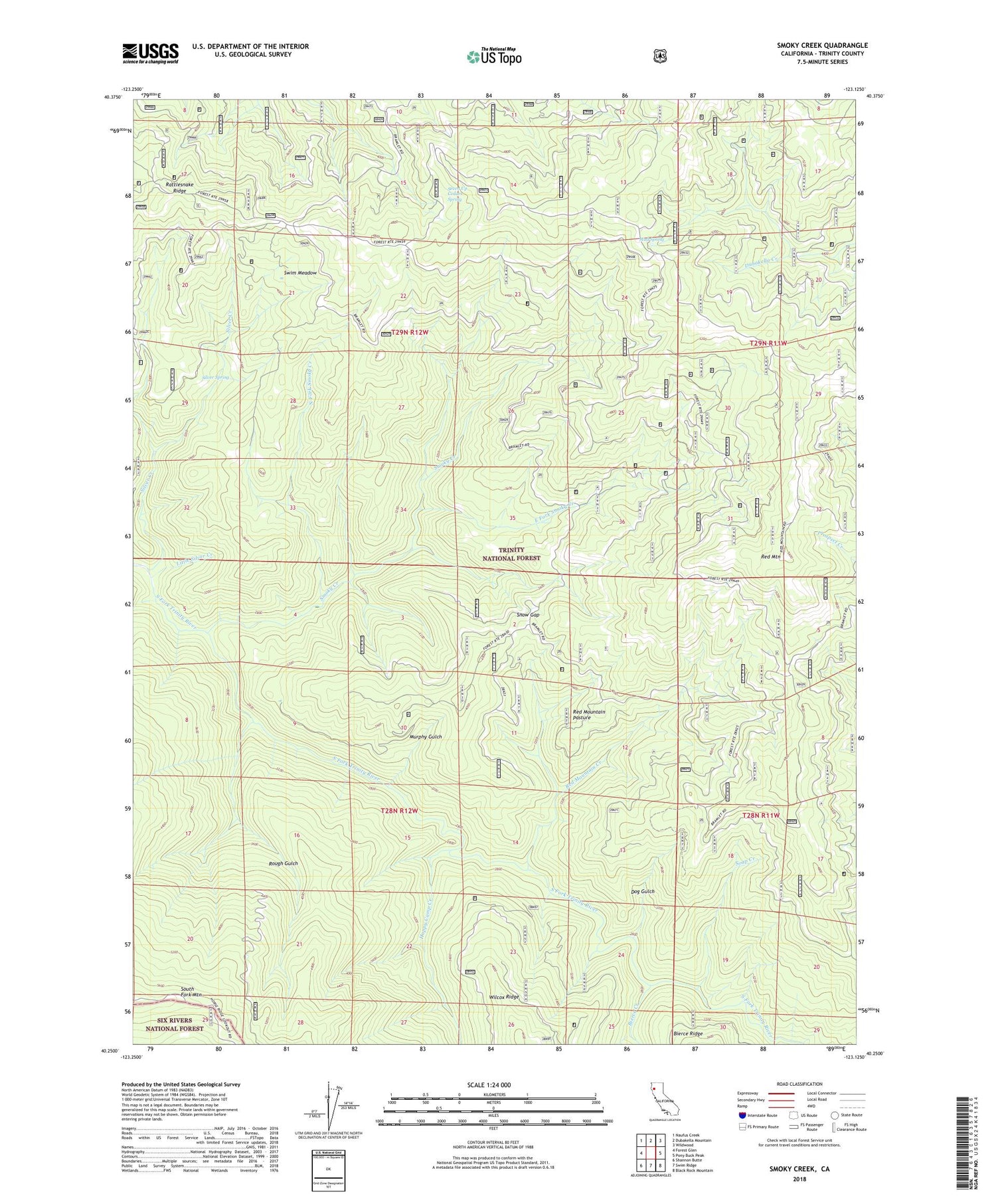
Smoky Creek California US Topo Map
Couldn't load pickup availability
Also explore the Smoky Creek Forest Service Topo of this same quad for updated USFS data
2022 topographic map quadrangle Smoky Creek in the state of California. Scale: 1:24000. Based on the newly updated USGS 7.5' US Topo map series, this map is in the following counties: Trinity. The map contains contour data, water features, and other items you are used to seeing on USGS maps, but also has updated roads and other features. This is the next generation of topographic maps. Printed on high-quality waterproof paper with UV fade-resistant inks.
Quads adjacent to this one:
West: Forest Glen
Northwest: Naufus Creek
North: Dubakella Mountain
Northeast: Wildwood
East: Pony Buck Peak
Southeast: Black Rock Mountain
South: Swim Ridge
Southwest: Shannon Butte
This map covers the same area as the classic USGS quad with code o40123c2.
Contains the following named places: Bierce Creek, Bramlet Place, Dog Gulch, East Fork Smoky Creek, Foss Camp, Happy Camp Creek, Little Silver Creek, Mud Spring, Murphy Gulch, Murphy Place, North Fork Smoky Creek, Rattlesnake Ridge, Red Mountain, Red Mountain Creek, Red Mountain Pasture, Rough Gulch, Saint Jacques Place, Seven Up Cedars, Seven Up Cedars Spring, Silver Creek, Silver Spring, Smoky Creek, Snow Gap, Soap Creek, Swim Meadow