MyTopo
Wildwood California US Topo Map
Couldn't load pickup availability
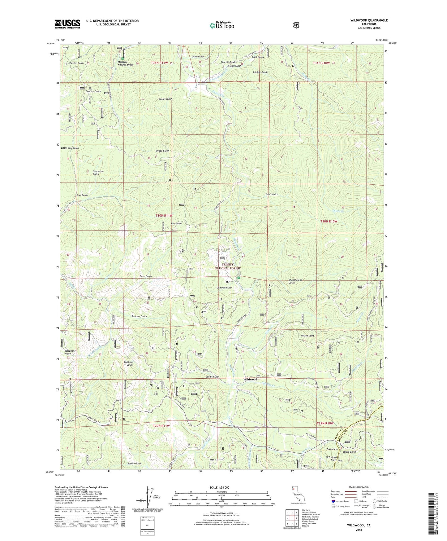
2022 topographic map quadrangle Wildwood in the state of California. Scale: 1:24000. Based on the newly updated USGS 7.5' US Topo map series, this map is in the following counties: Trinity, Shasta. The map contains contour data, water features, and other items you are used to seeing on USGS maps, but also has updated roads and other features. This is the next generation of topographic maps. Printed on high-quality waterproof paper with UV fade-resistant inks.
Quads adjacent to this one:
West: Dubakella Mountain
Northwest: Hayfork
North: Hayfork Summit
Northeast: Hoosimbim Mountain
East: Chanchelulla Peak
Southeast: Platina
South: Pony Buck Peak
Southwest: Smoky Creek
This map covers the same area as the classic USGS quad with code o40123d1.
Contains the following named places: Chanchelulla Gulch, China Gulch, Cow Gulch, Deer Gulch, Divide Trail, Fall Creek, Fourbit Gulch, Gant Gulch, Gemmill Gulch, Gemmill Gulch Picnic Area, Goods Creek, Goods Mountain, Grapevine Gulch, Gurley Gulch, Hall City Creek, Landis Gulch, Massacre Natural Bridge, Muldoon Gulch, Natural Bridge Picnic Area, Panther Gulch, Riewerts Ranch, Salt Creek Campground, Shiell Gulch, Shiell Ranch, South Fork Goods Creek, Sulphur Gulch, Twobit Gulch, West Fork Salt Creek, Wildwood, Wildwood School, Wilson Creek, Wilson Point