MyTopo
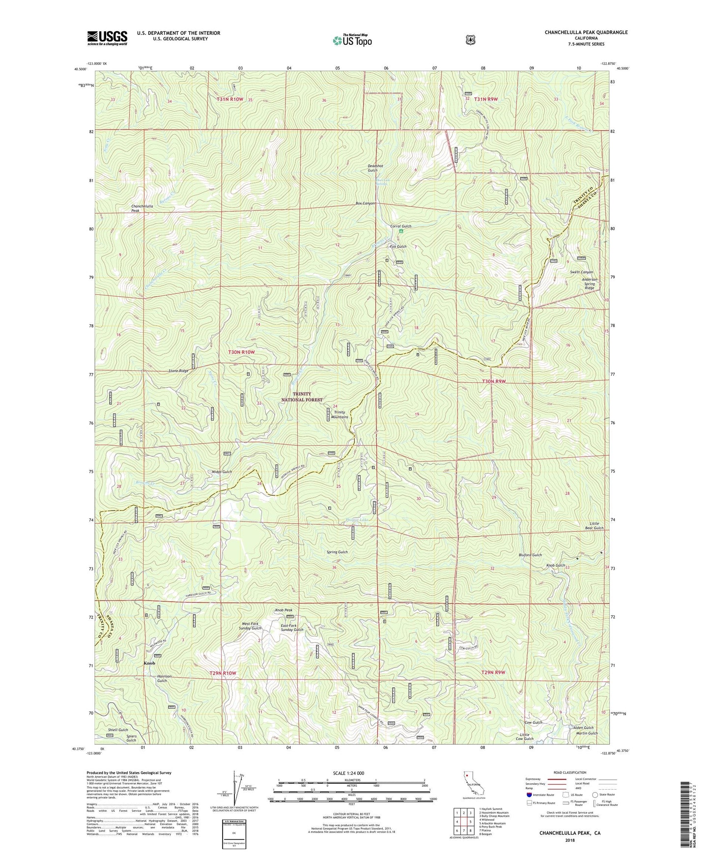
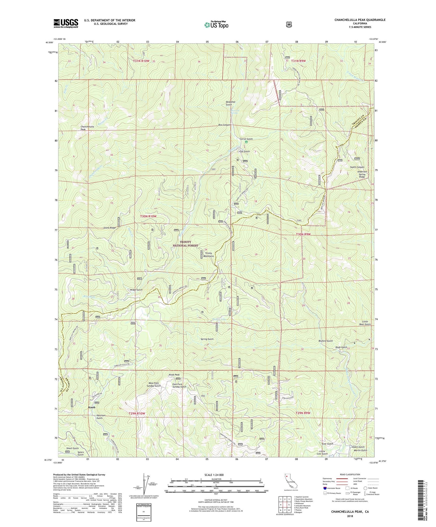
Chanchelulla Peak California US Topo Map
Couldn't load pickup availability
Also explore the Chanchelulla Peak Forest Service Topo of this same quad for updated USFS data
2022 topographic map quadrangle Chanchelulla Peak in the state of California. Scale: 1:24000. Based on the newly updated USGS 7.5' US Topo map series, this map is in the following counties: Trinity, Shasta. The map contains contour data, water features, and other items you are used to seeing on USGS maps, but also has updated roads and other features. This is the next generation of topographic maps. Printed on high-quality waterproof paper with UV fade-resistant inks.
Quads adjacent to this one:
West: Wildwood
Northwest: Hayfork Summit
North: Hoosimbim Mountain
Northeast: Bully Choop Mountain
East: Arbuckle Mountain
Southeast: Beegum
South: Platina
Southwest: Pony Buck Peak
This map covers the same area as the classic USGS quad with code o40122d8.
Contains the following named places: Alder Gulch, Anderson Spring Ridge, Bluford Gulch, Bluford Trail, Chanchelulla Creek, Chanchelulla Peak, Chanchelulla Wilderness, Corral Gulch, Cow Gulch, Deadshot Gulch, Deer Lick Guard Station, Deer Lick Springs, Fox Gulch, Knob, Knob Gulch, Knob Peak, Little Bark Shanty Creek, Martin Gulch, Midas Gulch, Midas Mine, Philpot Lake, Shiell Gulch, Spring Gulch, Stone Creek, Stone Ridge, Williams Ranch, ZIP Code: 96076