MyTopo
Ritter Ridge California US Topo Map
Couldn't load pickup availability
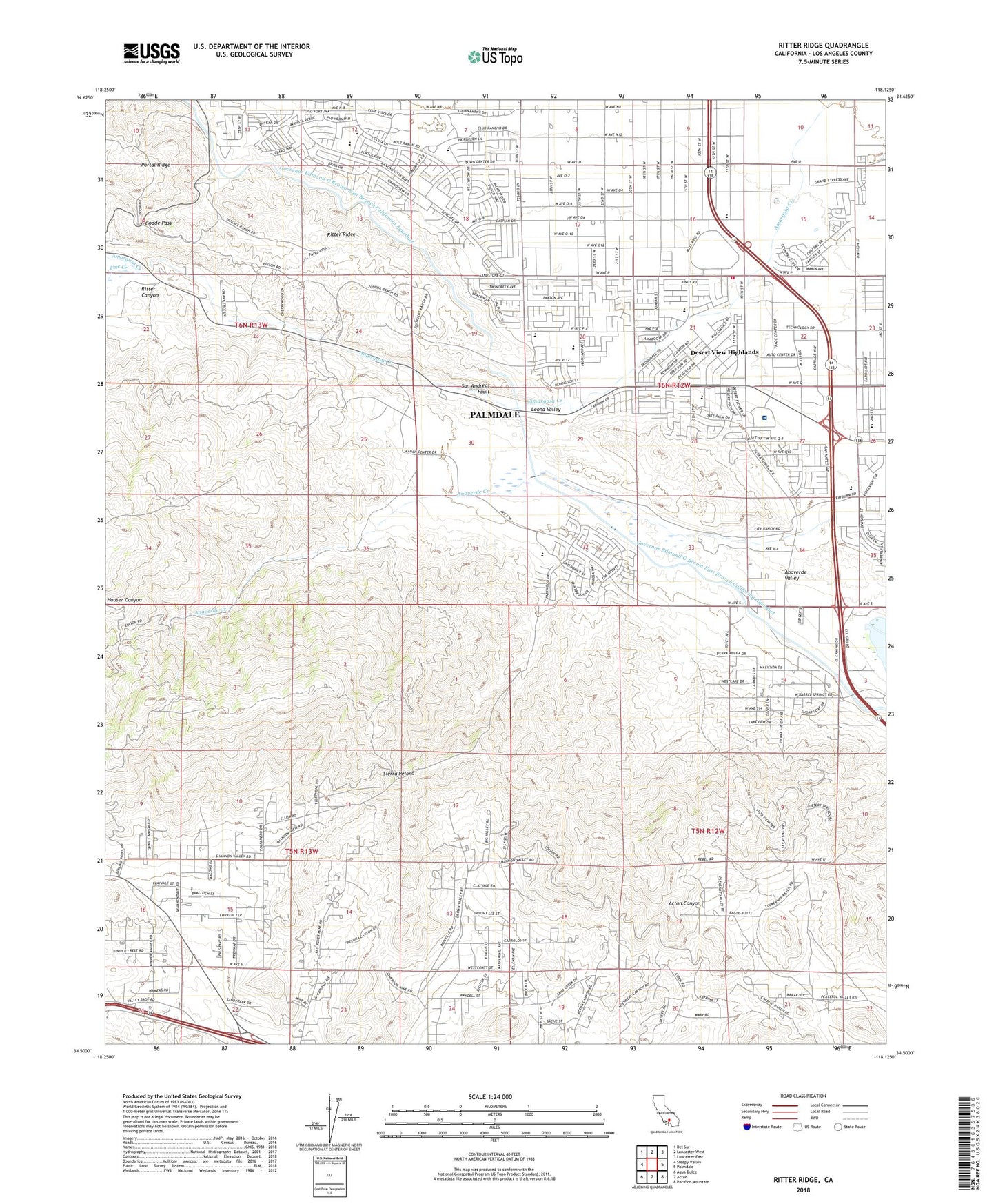
2022 topographic map quadrangle Ritter Ridge in the state of California. Scale: 1:24000. Based on the newly updated USGS 7.5' US Topo map series, this map is in the following counties: Los Angeles. The map contains contour data, water features, and other items you are used to seeing on USGS maps, but also has updated roads and other features. This is the next generation of topographic maps. Printed on high-quality waterproof paper with UV fade-resistant inks.
Quads adjacent to this one:
West: Sleepy Valley
Northwest: Del Sur
North: Lancaster West
Northeast: Lancaster East
East: Palmdale
Southeast: Pacifico Mountain
South: Acton
Southwest: Agua Dulce
This map covers the same area as the classic USGS quad with code o34118e2.
Contains the following named places: Anaverde Creek, Anaverde Valley, Antelope Valley Country Club, Antelope Valley Mal Shopping Center, Casa Juvan, City Ranch, Desert Highlands Baptist Church, Desert View Highlands, Desert View Highlands Census Designated Place, Godde Pass, Governor Mine, Harold Beacon, Hauser Microwave Station, Juniper Middle School, Lakeview, Leona Siphon, Leona Valley, Los Angeles County Fire Department Station 24, Messer Ranch, Mission, Ocotillo Elementary School, Palmdale Regional Medical Center, Palmdale United Methodist Church, Pine Creek, Puritan Mine, Rancho Vista, Red Rover Mine, Ritter Canyon, Ritter Ridge, Ritter Siphon, Summit, Sunset Ranch, Tuckerway Ranch, Yucca Elementary School, ZIP Code: 93551