MyTopo
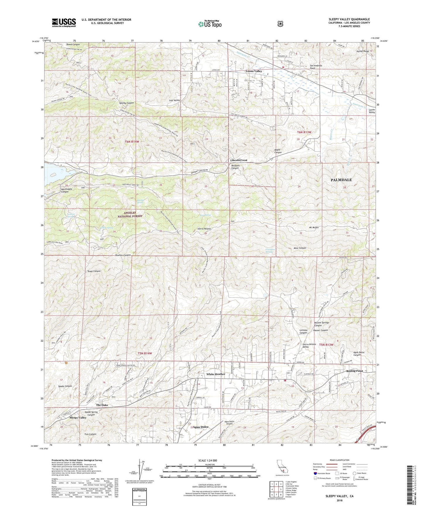
Sleepy Valley California US Topo Map
Couldn't load pickup availability
Also explore the Sleepy Valley Forest Service Topo of this same quad for updated USFS data
2022 topographic map quadrangle Sleepy Valley in the state of California. Scale: 1:24000. Based on the newly updated USGS 7.5' US Topo map series, this map is in the following counties: Los Angeles. The map contains contour data, water features, and other items you are used to seeing on USGS maps, but also has updated roads and other features. This is the next generation of topographic maps. Printed on high-quality waterproof paper with UV fade-resistant inks.
Quads adjacent to this one:
West: Green Valley
Northwest: Lake Hughes
North: Del Sur
Northeast: Lancaster West
East: Ritter Ridge
Southeast: Acton
South: Agua Dulce
Southwest: Mint Canyon
This map covers the same area as the classic USGS quad with code o34118e3.
Contains the following named places: Agua Dulce Airport, Agua Dulce Census Designated Place, Agua Dulce School, Annan Ranch, Artesian Spring, Artesian Spring Campgrounds, Bear Spring, Big Oak Spring, Boiling Point, Fryingpan Springs, Grass Mountain Leona Divide Truck Trail, Gray Eagle Mine, Hauser Canyon, Lannan Ranch, Leona School, Leona Valley, Leona Valley Census Designated Place, Leona Valley Elementary School, Letteau Canyon, Lincoln Crest, Los Angeles County Fire Department Station 140, Los Angeles County Fire Department Station 81, Los Robles Ranch, Lost Valley, Maple Canyon, Martindale Canyon, Mount McDill, Pelona Lookout, R and H Trail, Ritter Ranch, Rogers Creek, Sierra Pelona, Sleepy Valley, Spade Canyon, Spade Spring Canyon, The Oaks, Two Shay Ranch, White Heather, Willow Spring, Willow Springs Canyon