MyTopo
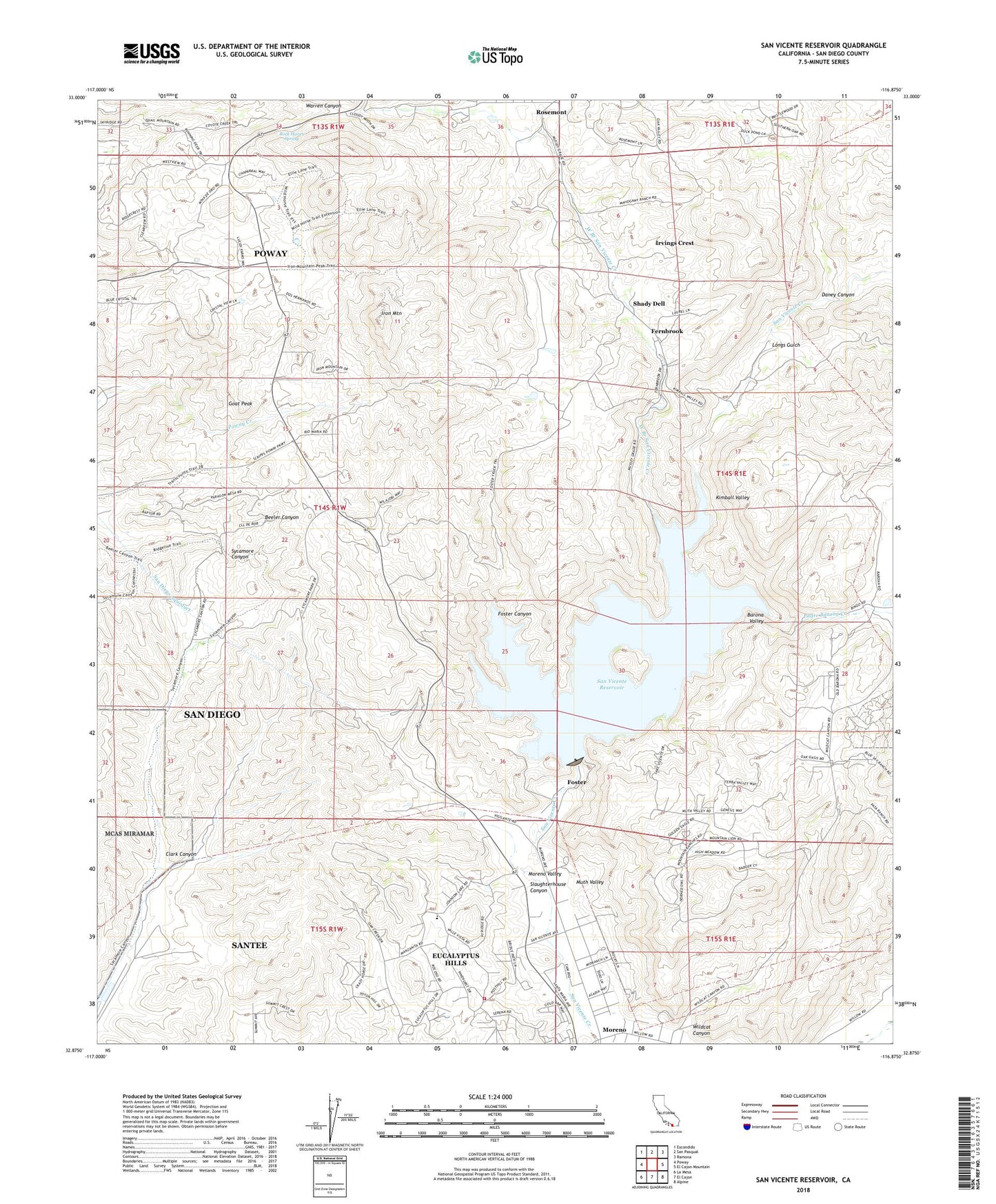
San Vicente Reservoir California US Topo Map
Couldn't load pickup availability
2021 topographic map quadrangle San Vicente Reservoir in the state of California. Scale: 1:24000. Based on the newly updated USGS 7.5' US Topo map series, this map is in the following counties: San Diego. The map contains contour data, water features, and other items you are used to seeing on USGS maps, but also has updated roads and other features. This is the next generation of topographic maps. Printed on high-quality waterproof paper with UV fade-resistant inks.
Quads adjacent to this one:
West: Poway
Northwest: Escondido
North: San Pasqual
Northeast: Ramona
East: El Cajon Mountain
Southeast: Alpine
South: El Cajon
Southwest: La Mesa
This map covers the same area as the classic USGS quad with code o32116h8.
Contains the following named places: Barona Baptist Church, Barona Valley, Boulder Oaks, Clark Canyon, Daney Canyon, Dos Picos County Park, Eucalyptus Hills, Eucalyptus Hills Census Designated Place, Eucalyptus Hills Elementary School, Fernbrook, Foster, Foster Canyon, Foster Truck Trail, Friendship Presbyterian Church, Goat Peak, Goat Ranch, Goodan Ranch, Iron Mountain, Irvings Crest, KECR-AM (El Cajon), Kimball Valley, KIRS-AM (San Diego), Lakeside Fire Administration Office, Longs Gulch, Louis A Stelzer County Park, Mussey Grove, Muth Valley, Oak Oasis County Park, Padre Barona Creek, Rock Haven, Rock Haven Spring, San Vicente 8-009 Dam, San Vicente Reservoir, Santee Lake Regional Park, Shady Dell, Slaughterhouse Canyon, Slaughterhouse Canyon Quarry, Sycamore Canyon Open Space Preserve, Tekakwitcha Church, Vallecitos, Warren Ranch, West Branch San Vicente Creek, Wildcat Canyon, Wildwood Ranch, ZIP Code: 92040