MyTopo
Ramona California US Topo Map
Couldn't load pickup availability
Also explore the Ramona Forest Service Topo of this same quad for updated USFS data
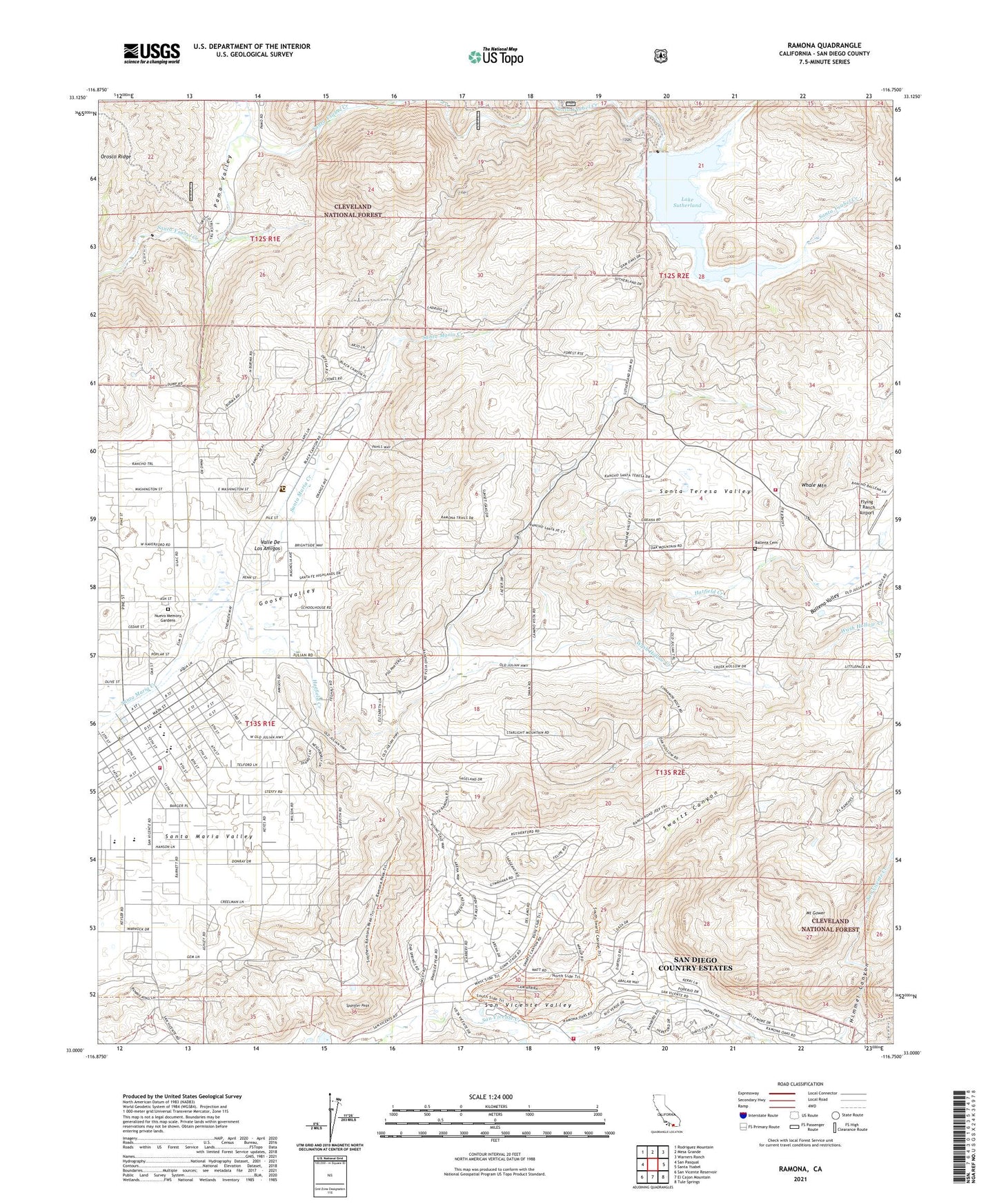
2021 topographic map quadrangle Ramona in the state of California. Scale: 1:24000. Based on the newly updated USGS 7.5' US Topo map series, this map is in the following counties: San Diego. The map contains contour data, water features, and other items you are used to seeing on USGS maps, but also has updated roads and other features. This is the next generation of topographic maps. Printed on high-quality waterproof paper with UV fade-resistant inks.
Quads adjacent to this one:
West: San Pasqual
Northwest: Rodriguez Mountain
North: Mesa Grande
Northeast: Warners Ranch
East: Santa Ysabel
Southeast: Tule Springs
South: El Cajon Mountain
Southwest: San Vicente Reservoir
This map covers the same area as the classic USGS quad with code o33116a7.
Contains the following named places: Ballena Cemetery, Ballena Valley, Barnett Elementary School, Bassett Ranch, Bloomdale Creek, CAL FIRE Ramona Fire Station 80, CAL FIRE Ramona Fire Station 81, Calvary Chapel, Collier Park, First Church of Christ Scientist, First Congregational Church, Flying T Ranch Airport, Goose Valley, Goose Valley Ranger Station, Grace Community Church, Hatfield Creek, Himmel Canyon, Homestar Shopping Center, Immaculate Heart of Mary Catholic Church, Inter Mountain Fire and Rescue Department, James Dukes Elementary School, Lake Sutherland, Lutheran Church of Ramona, Mesa Grande Reservation, Montecito High School, Mount Gower, Mount Gower Open Space Preserve, Neighborhood Baptist Church, Nuevo Memory Gardens, Olive Pierce Middle School, Orosco Truck Trail, Palomar Ranger Station, Pamo Ranger Station, Pamo Valley, Pine Hill Egg Ranch, Ramona, Ramona Branch San Diego County Library, Ramona Chamber of Commerce, Ramona Community Center, Ramona Community Park, Ramona Division, Ramona Duck Farm, Ramona Elementary School, Ramona First Baptist Church, Ramona High School, Ramona Landfill, Ramona Shopping Center, Rincon Refugio, Saint Marys in the Valley Episcopal Church, San Diego Country Estates, San Diego Country Estates Census Designated Place, San Diego County, San Vincente Community Church, San Vincente Country Club and Golf Course, Santa Teresa Valley, Santa Ysabel Truck Trail, Spangler Peak, Sutherland 8-010 Dam, Sutherland Dam, Swartz Canyon, Temescal Creek, The Church of Jesus Christ of Latter Day Saints, Valle De Los Amigos, Wash Hollow Creek, Whale Mountain, ZIP Code: 92065