MyTopo
Sand Canyon California US Topo Map
Couldn't load pickup availability
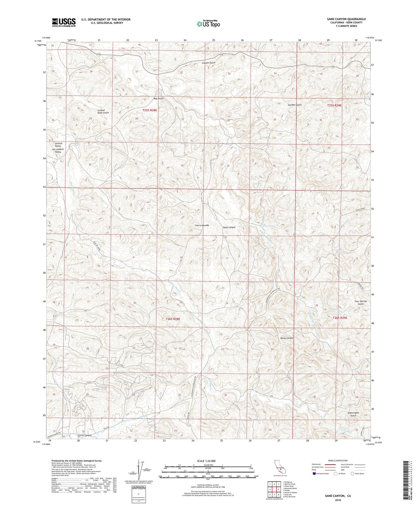
2021 topographic map quadrangle Sand Canyon in the state of California. Scale: 1:24000. Based on the newly updated USGS 7.5' US Topo map series, this map is in the following counties: Kern. The map contains contour data, water features, and other items you are used to seeing on USGS maps, but also has updated roads and other features. This is the next generation of topographic maps. Printed on high-quality waterproof paper with UV fade-resistant inks.
Quads adjacent to this one:
West: Deepwell Ranch
Northwest: Richgrove
North: Quincy School
Northeast: White River
East: Woody
Southeast: Pine Mountain
South: Knob Hill
Southwest: North of Oildale
This map covers the same area as the classic USGS quad with code o35118f8.
Contains the following named places: Carlton Ranch, Carver Spring, Corral Canyon, Coyote Gulch, Dead Ox Creek, Four Springs Gulch, Gordon Gulch, Horse Canyon, Horseshoe Ranch, Nightingale Gulch, Sand Canyon, Villard Ranch, Willow Spring, Willow Spring Creek