MyTopo
Santa Cruz California US Topo Map
Couldn't load pickup availability
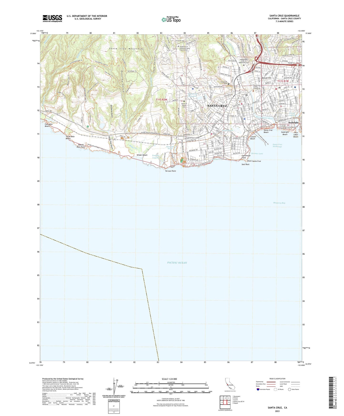
2021 topographic map quadrangle Santa Cruz in the state of California. Scale: 1:24000. Based on the newly updated USGS 7.5' US Topo map series, this map is in the following counties: Santa Cruz. The map contains contour data, water features, and other items you are used to seeing on USGS maps, but also has updated roads and other features. This is the next generation of topographic maps. Printed on high-quality waterproof paper with UV fade-resistant inks.
Quads adjacent to this one:
West: Santa Cruz OE W
Northwest: Davenport
North: Felton
Northeast: Laurel
East: Soquel
This map covers the same area as the classic USGS quad with code o36122h1.
Contains the following named places: Agroecology Program Farm, Allegro Heights, American Medical Response Santa Cruz Division, Antonelli Pond, Ark Alternative School, Baldwin Creek, Bay Street Reservoir, Bay Street Reservoir 23-003 Dam, Bay View Elementary School, Bayside Children's College, Bolcoff Hill, Branciforte Branch Santa Cruz City-County Library, Branciforte Creek, Branciforte Elementary School, Branciforte Middle School, Branciforte Small Schools Campus, Branciforte Small Schools Campus - Castanoa High School, Calvary Epsicopal Church, Carbonera Creek, Cave Gulch, Central Branch Santa Cruz City-County Library, Central Presbyterian Church, Christian Life Center, Church In Santa Cruz, City of Santa Cruz, Cooper Street Plaza Shopping Center, Cooperhouse Shopping Center, Cowell Beach, Cowell Reservoir 1-060 Dam, Crown College, Derby Park, Dominican Hospital - Santa Cruz / Frederick, Dominican Rehabilitation Center, East Santa Cruz Post Office, Eastside Park, Eastside Public Library, Evergreen Cemetery, First Church of Christ Scientist, First Foursquare Church, First Presbyterian Church, First Principle Church, First United Church of Christ, First United Methodist Church, Four Mile Beach, Frederick Street Park, Garfield Park, Garfield Park Branch Santa Cruz City-County Library, Garfield Park Christian Church, Garfield Park School, Gateway School, Gault Elementary School, Georgiana Bruce Kirby Preparatory School, Grace United Methodist Church, Grant Park, Grant School, Harvey West Park, Harvey West Stadium, Holy Cross Catholic Church, Holy Cross High School, Holy Cross School, Home of Peace Cemetery, Independent Order of Oddfellows Cemetery, Isbel Grove, Isbel Grove Camp, Joseph M Long Marine Laboratory, KFER-FM (Santa Cruz), Kingdom Hall of Jehovahs Witnesses, Landmark Missionary Baptist Church, Laurel Park, Laurel School, Lighthouse Field, Lighthouse Field State Beach, Lighthouse Point Park, Live Oak Branch Santa Cruz City-County Library, Louden Nelson Community Center, Meder Creek, Merrill College, Mesa de Ojo de Agua, Messiah Lutheran Church, Mike Fox Park, Mission Hill Middle School, Mission Hospital, Mission Lands of Santa Cruz, Mission Santa Cruz, Mitchell Cove, Monarch Butterfly Natural Preserve, Moore Creek, Moore Creek Wetland Natural Preserve, Natural Bridge Elementary School, Natural Bridges State Beach, Neary Lagoon Park, Nearys Lagoon, Needle Rock Point, New Life Center, Oceanview Park, Old Dairy Gulch, Pacific Avenue Historic District, Pacific Collegiate School, Peasley Gulch, Point Santa Cruz, Potrero Y Rincon De San Padro De Reglado, Progressive Missionary Baptist Church, Prophet Elias Greek Orthodox Church, Pueblo de Figueroa, Rapetti, Roy C Kepler Library on Nonviolence and Social Change, Saint Josephs Shrine, San Lorenzo Park Plaza Shopping Center, San Lorenzo River, Sandy Flat Gulch, Santa Cruz, Santa Cruz Adult School, Santa Cruz Anchorage, Santa Cruz Art League Galleries, Santa Cruz Beach, Santa Cruz Bible Church, Santa Cruz Children's School, Santa Cruz City Chamber of Commerce, Santa Cruz City Hall, Santa Cruz City Museum, Santa Cruz Civic Auditorium, Santa Cruz Community Hospital, Santa Cruz County Adult Detention Facility, Santa Cruz County Courthouse, Santa Cruz County Historical Trust Archives, Santa Cruz County Hospital, Santa Cruz County Jail, Santa Cruz County Law Library, Santa Cruz County Sheriff's Office Santa Cruz, Santa Cruz Downtown Historic District, Santa Cruz Fire Department Administration, Santa Cruz Fire Department Station 1, Santa Cruz Fire Department Station 2, Santa Cruz Fire Department Station 3, Santa Cruz High School, Santa Cruz Lighthouse, Santa Cruz Looff Carousel and Roller Coaster, Santa Cruz Mission State Historic Park, Santa Cruz Missionary Baptist Church, Santa Cruz Municipal Wharf, Santa Cruz Police Department, Santa Cruz Post Office, Santa Cruz Small Craft Harbor, Santa Cruz Surfing Museum, Schwan Station, Seabright, Seabright Beach, Seal Rock, Seventh Day Adventist Church, Sisters Hospital, Society of Abidence In Truth, Sojourn Middle Charter School, Springhill School, Star of the Sea Church, Steamer Lane, Steamship Wharf, Stevenson College, Terrace Point, The Church of Jesus Christ of Latter Day Saints, The Circles, Three Mile Beach, Tres Ojos De Agua, Trescony Park, Trinity Presbyterian Church, Twin Lakes Beach, Twin Lakes State Beach, Tyrre Park, Unity Temple of Santa Cruz, University Baptist Church, University House, University of California Santa Cruz, University of California Santa Cruz Campus, Westlake Elementary School, Westlake Park, Wilder Beach, Wilder Beach Natural Preserve, Wilder Creek, Wilder Dairy Cultural Preserve, Wilder Ranch State Park, Wilder Spur, Woods Lagoon, Word of Life Church of God, Younger Lagoon, ZIP Code: 95064


