MyTopo
Westwood East California US Topo Map
Couldn't load pickup availability
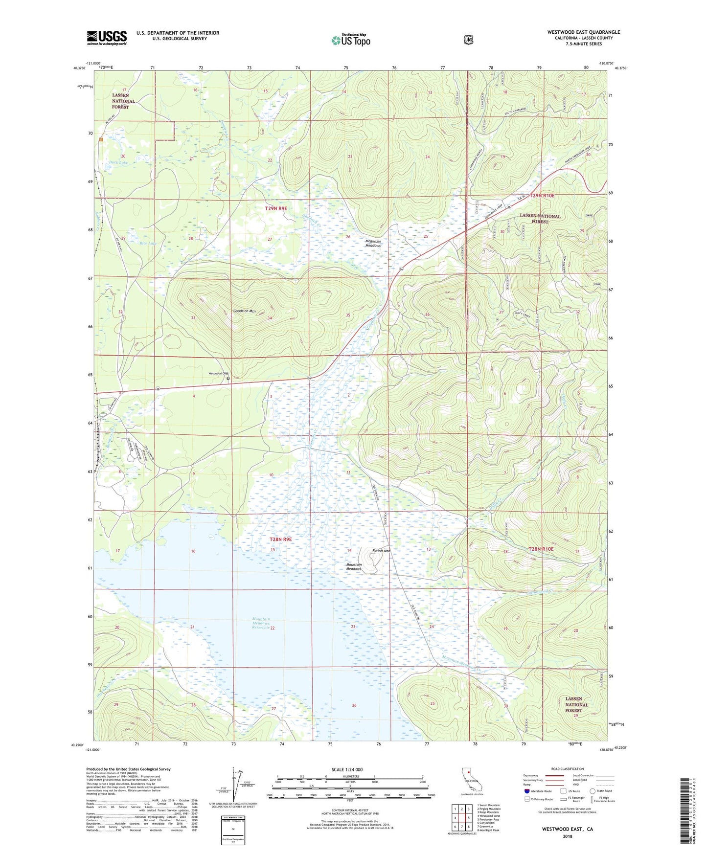
2022 topographic map quadrangle Westwood East in the state of California. Scale: 1:24000. Based on the newly updated USGS 7.5' US Topo map series, this map is in the following counties: Lassen. The map contains contour data, water features, and other items you are used to seeing on USGS maps, but also has updated roads and other features. This is the next generation of topographic maps. Printed on high-quality waterproof paper with UV fade-resistant inks.
Quads adjacent to this one:
West: Westwood West
Northwest: Swain Mountain
North: Pegleg Mountain
Northeast: Roop Mountain
East: Fredonyer Pass
Southeast: Moonlight Peak
South: Greenville
Southwest: Canyondam
This map covers the same area as the classic USGS quad with code o40120c8.
Contains the following named places: Coppervale, Coppervale Guard Station, Coppervale Ski Tow, Cottonwood Creek, Deerheart Creek, Duck Lake, Duffy Creek, Goodrich Creek, Goodrich Mountain, Home Ranch, McKenzie Meadows, Mountain Meadows, Mountain Meadows Creek, Mountain Meadows Reservoir, One Hundred and One Ranch, Pine Town, Rice Lake, Round Mountain, Westwood Cemetery, Westwood Mill Pond 1250 Dam