
MyTopo
Tar Bully California US Topo Map
Couldn't load pickup availability
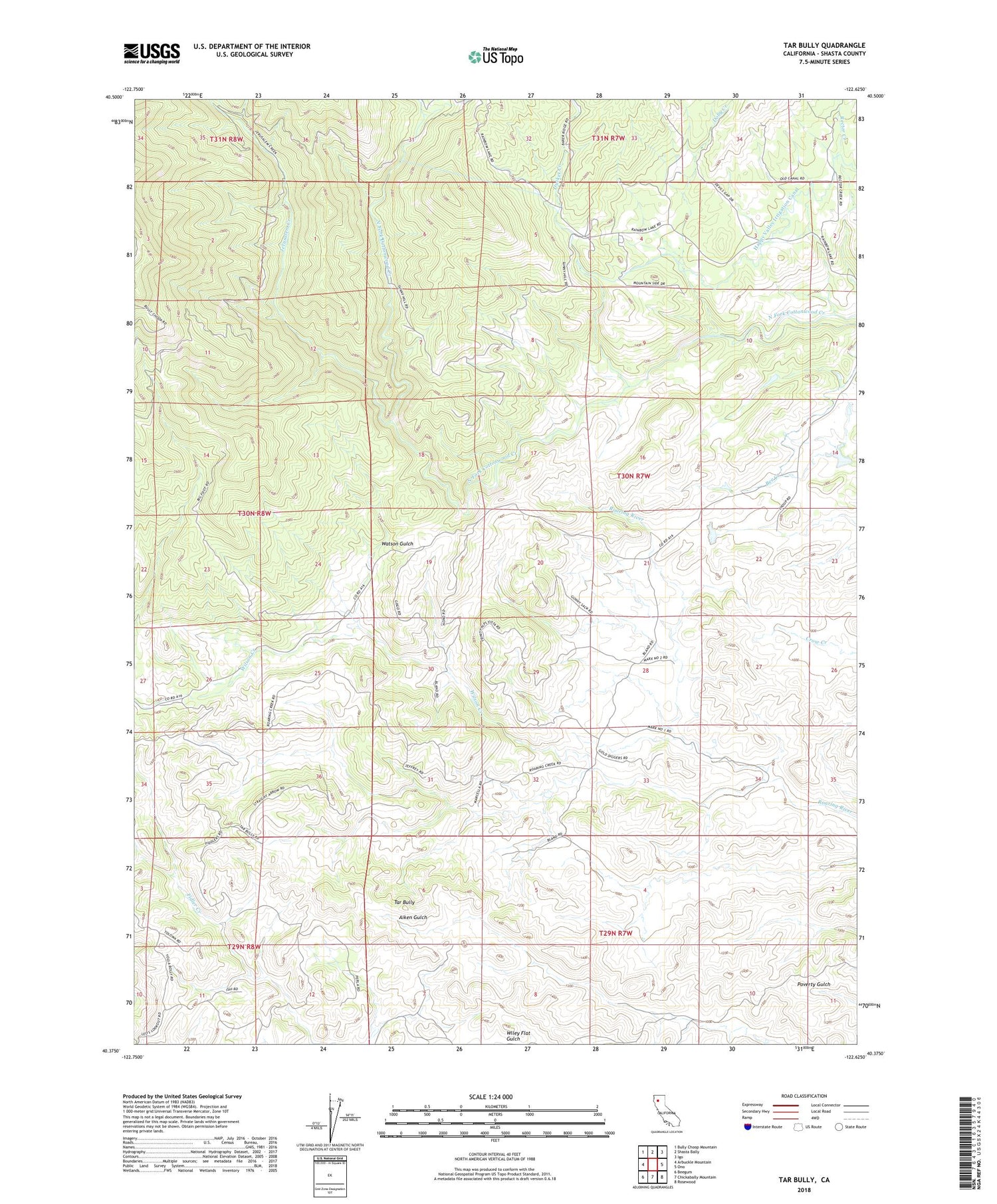
2021 topographic map quadrangle Tar Bully in the state of California. Scale: 1:24000. Based on the newly updated USGS 7.5' US Topo map series, this map is in the following counties: Shasta. The map contains contour data, water features, and other items you are used to seeing on USGS maps, but also has updated roads and other features. This is the next generation of topographic maps. Printed on high-quality waterproof paper with UV fade-resistant inks.
Quads adjacent to this one:
West: Arbuckle Mountain
Northwest: Bully Choop Mountain
North: Shasta Bally
Northeast: Igo
East: Ono
Southeast: Rosewood
South: Chickabally Mountain
Southwest: Beegum
Contains the following named places: A C Graves Ranch, Blue Gravel Mine, Doby Creek, Ducket Creek, Jerusalem Creek, Moon Fork Cottonwood Creek, Ogo State Fire Station, Ono Census Designated Place, Sunny Hill Mine, Tar Bully, Watson Gulch, ZIP Code: 96047


