MyTopo
Arbuckle Mountain California US Topo Map
Couldn't load pickup availability
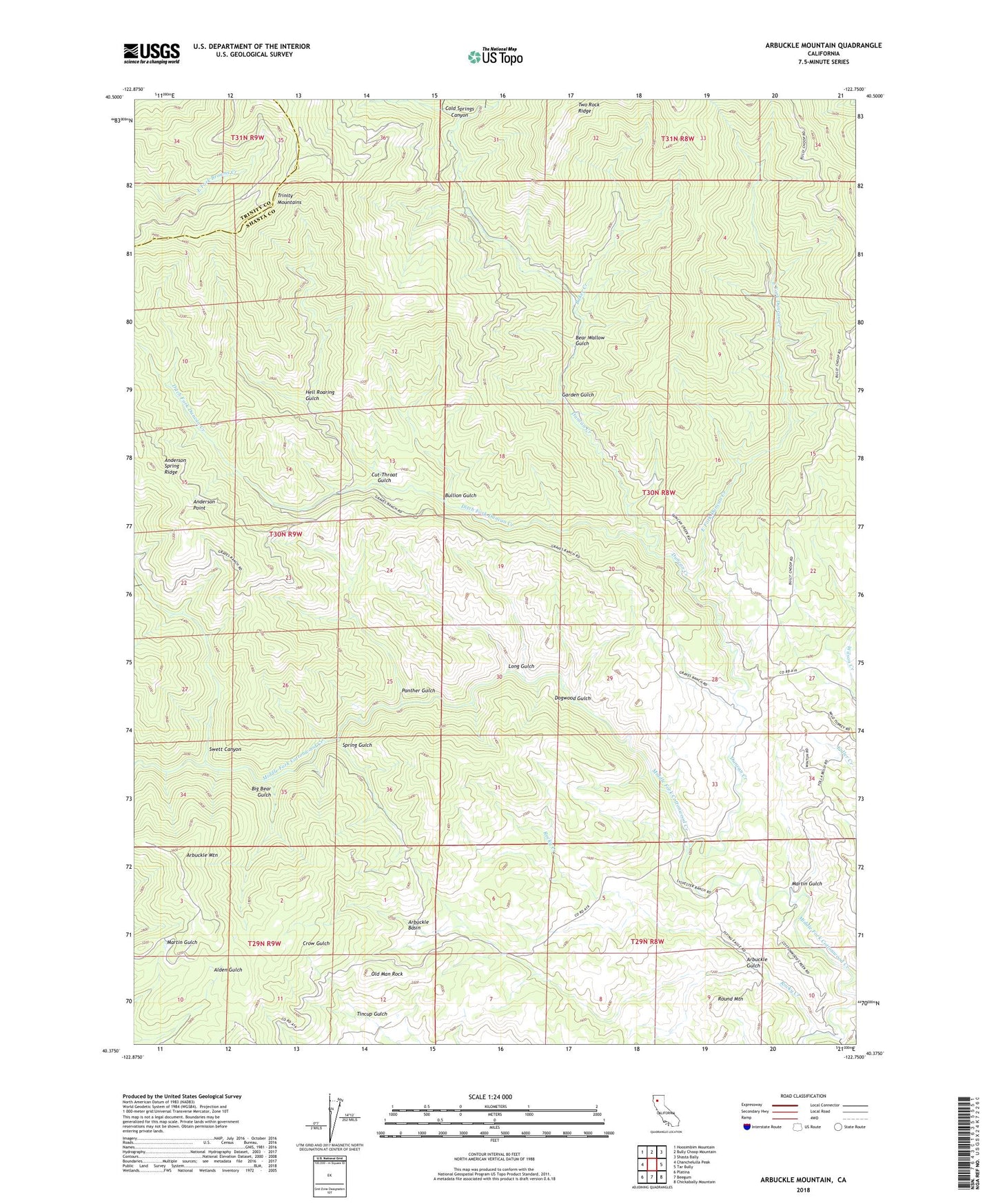
2022 topographic map quadrangle Arbuckle Mountain in the state of California. Scale: 1:24000. Based on the newly updated USGS 7.5' US Topo map series, this map is in the following counties: Shasta, Trinity. The map contains contour data, water features, and other items you are used to seeing on USGS maps, but also has updated roads and other features. This is the next generation of topographic maps. Printed on high-quality waterproof paper with UV fade-resistant inks.
Quads adjacent to this one:
West: Chanchelulla Peak
Northwest: Hoosimbim Mountain
North: Bully Choop Mountain
Northeast: Shasta Bally
East: Tar Bully
Southeast: Chickabally Mountain
South: Beegum
Southwest: Platina
Contains the following named places: AC Graves Ranch, Anderson Point, Arbuckle Basin, Arbuckle Gulch, Arbuckle Mountain, Baker Creek, Bear Wallow Gulch, Big Bear Gulch, Bullion Gulch, Cold Springs Canyon, Cut-Throat Gulch, Ditch Fork Duncan Creek, Dogwood Gulch, Duncan Creek, East Fork Duncan Creek, Garden Gulch, Hell Roaring Gulch, Little Bear Gulch, Long Gulch, Martin Gulch, Old Man Rock, Panther Gulch, Rocky Creek, Round Mountain, Selvester Ranch, Spring Gulch, Swett Canyon, Tincup Gulch, Wilson Creek