MyTopo
Chickabally Mountain California US Topo Map
Couldn't load pickup availability
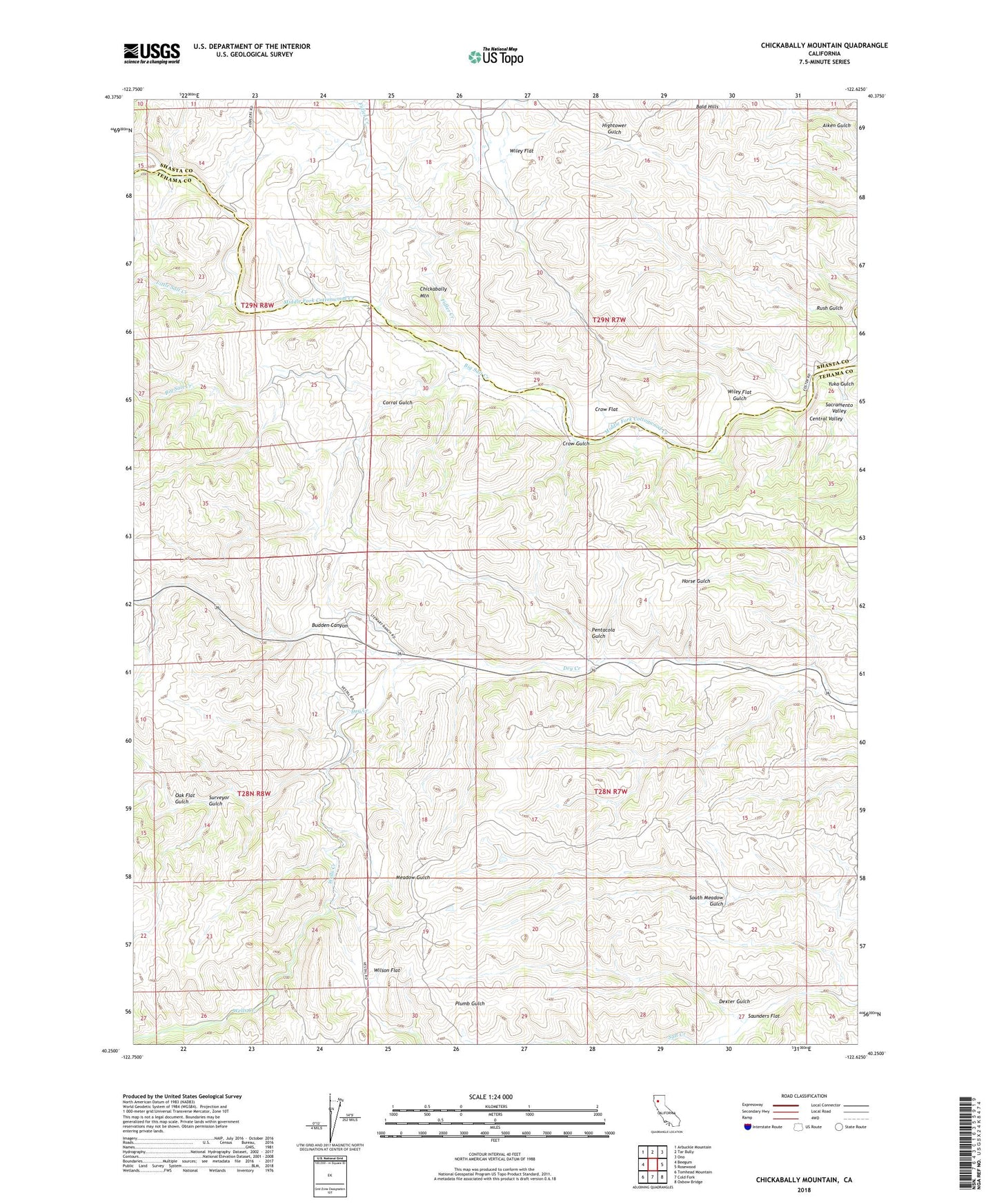
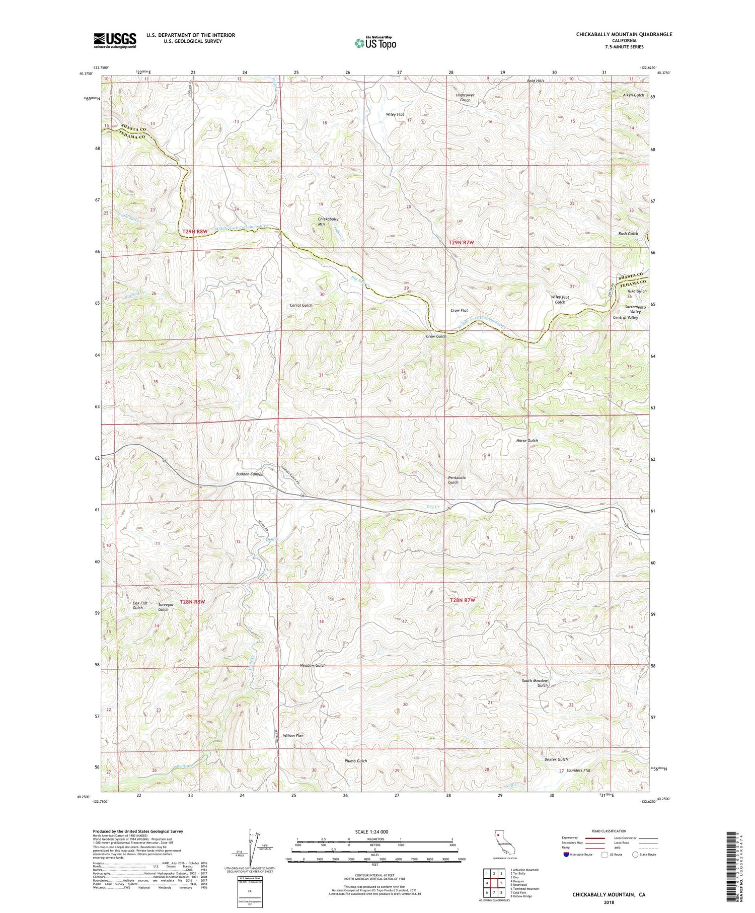
2021 topographic map quadrangle Chickabally Mountain in the state of California. Scale: 1:24000. Based on the newly updated USGS 7.5' US Topo map series, this map is in the following counties: Tehama, Shasta. The map contains contour data, water features, and other items you are used to seeing on USGS maps, but also has updated roads and other features. This is the next generation of topographic maps. Printed on high-quality waterproof paper with UV fade-resistant inks.
Quads adjacent to this one:
West: Beegum
Northwest: Arbuckle Mountain
North: Tar Bully
Northeast: Ono
East: Rosewood
Southeast: Oxbow Bridge
South: Cold Fork
Southwest: Tomhead Mountain
Contains the following named places: Bald Hills, Beegum Creek, Big Salt Creek, Budden Canyon, Chickabally Mountain, Corral Gulch, Crow Flat, Crow Gulch, Dexter Gulch, Fidler Creek, Little Salt Creek, Oak Flat Gulch, Pentacola Field, Pentacola Gulch, Rush Gulch, Saunders Flat, South Meadow Gulch, Surveyor Gulch, Wells Creek, Wiley Flat, Wiley Flat Gulch, Wilson Field, Wilson Flat, Yuka Gulch