MyTopo
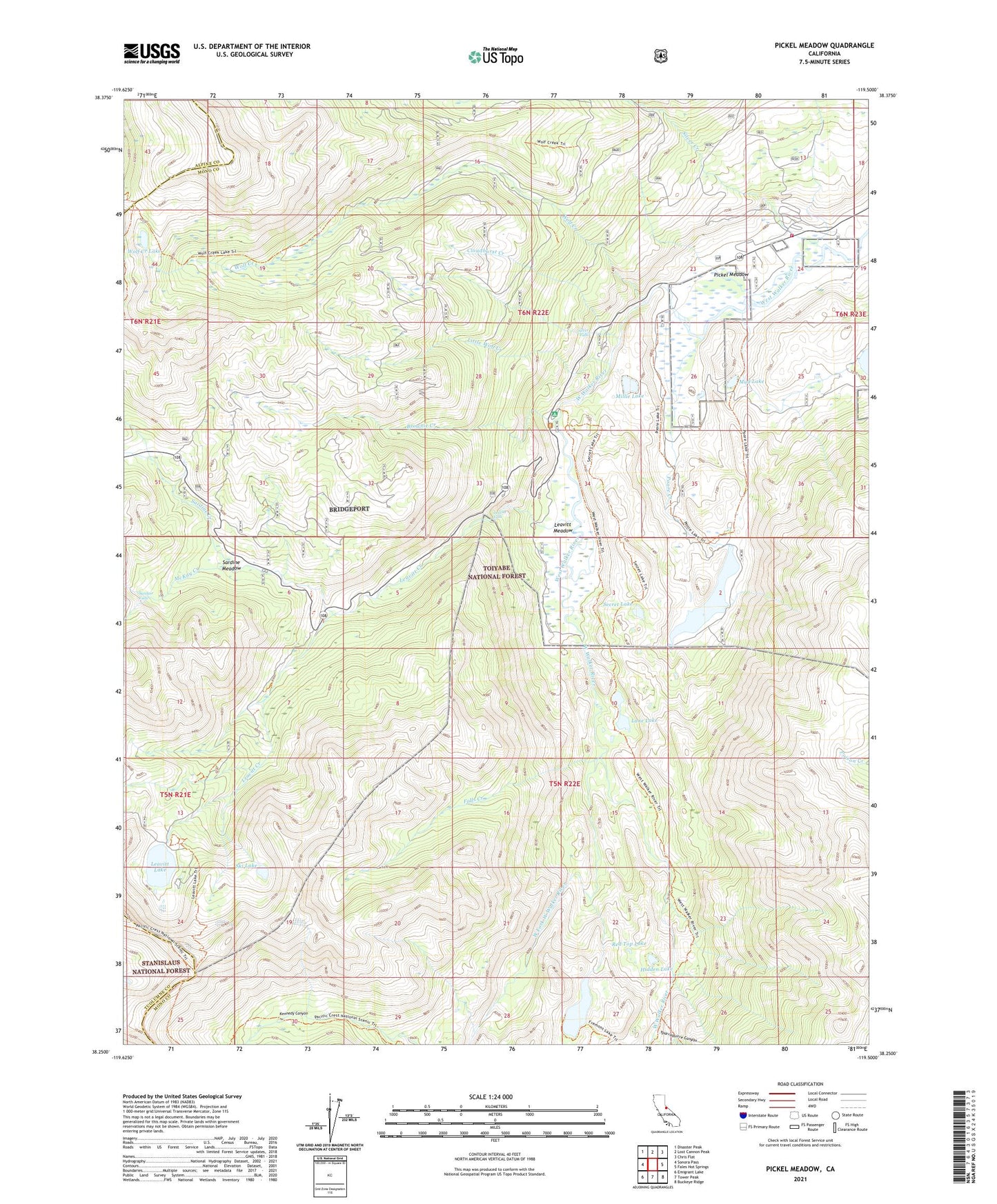
Pickel Meadow California US Topo Map
Couldn't load pickup availability
Also explore the Pickel Meadow Forest Service Topo of this same quad for updated USFS data
2021 topographic map quadrangle Pickel Meadow in the state of California. Scale: 1:24000. Based on the newly updated USGS 7.5' US Topo map series, this map is in the following counties: Mono, Alpine, Tuolumne. The map contains contour data, water features, and other items you are used to seeing on USGS maps, but also has updated roads and other features. This is the next generation of topographic maps. Printed on high-quality waterproof paper with UV fade-resistant inks.
Quads adjacent to this one:
West: Sonora Pass
Northwest: Disaster Peak
North: Lost Cannon Peak
Northeast: Chris Flat
East: Fales Hot Springs
Southeast: Buckeye Ridge
South: Tower Peak
Southwest: Emigrant Lake
This map covers the same area as the classic USGS quad with code o38119c5.
Contains the following named places: Brownie Creek, Cloudburst Creek, Falls Creek, Fremont Lake, Hidden Lake, Lane Lake, Leavitt Creek, Leavitt Falls, Leavitt Lake, Leavitt Meadow, Leavitt Meadows Campground, Leavitt Meadows Lodge Resort, Leavitt Meadows Pack Station, Leavitt Station, Little Wolf Creek, Marine Corps Mountain Warfare Training Center Bridgeport, McKay Creek, Millie Lake, Mud Lake, Pickel Meadow, Poore Creek, Poore Lake, Poore Lake Reservoir 540 Dam, Red Top Lake, Roosevelt Lake, Sardine Creek, Sardine Falls, Sardine Meadow, Secret Lake, Silver Creek, Silver Falls, Ski Lake, United States Marine Corps Mountain Warfare Training Center Fire Department, USMC Mountain Warfare School, West Fork West Walker River, Wolf Creek, Wolf Creek Lake, Yparraquirre Canyon