MyTopo
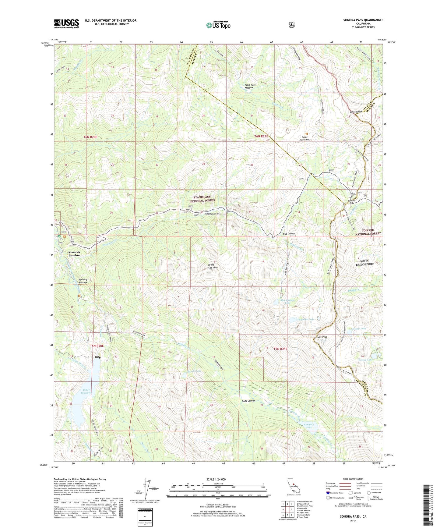
Sonora Pass California US Topo Map
Couldn't load pickup availability
Also explore the Sonora Pass Forest Service Topo of this same quad for updated USFS data
2021 topographic map quadrangle Sonora Pass in the state of California. Scale: 1:24000. Based on the newly updated USGS 7.5' US Topo map series, this map is in the following counties: Tuolumne, Alpine, Mono. The map contains contour data, water features, and other items you are used to seeing on USGS maps, but also has updated roads and other features. This is the next generation of topographic maps. Printed on high-quality waterproof paper with UV fade-resistant inks.
Quads adjacent to this one:
West: Dardanelle
Northwest: Dardanelles Cone
North: Disaster Peak
Northeast: Lost Cannon Peak
East: Pickel Meadow
Southeast: Tower Peak
South: Emigrant Lake
Southwest: Cooper Peak
This map covers the same area as the classic USGS quad with code o38119c6.
Contains the following named places: Blue Canyon, Blue Canyon Lake, Chipmunk Flat, Clark Fork Meadow, Deadman Campground, Deadman Creek, Deadman Flat Scenic Viewpoint, Deadman Lake, Deadman's Creek Grave, East Flange Scenic Viewpoint, Grouse Creek, Kennedy Creek, Kennedy Lake, Kennedy Meadow, Koenig Lake, Latopie Lake, Leavitt Peak, Night Cap Peak, Que De Porka Resort, Relief 97-080 Dam, Relief Reservoir, Saint Marys Pass, Sharon Lake, Silver Mine Creek, Soda Canyon, Sonora Pass, Sonora Peak, Summit Creek