MyTopo
Bachelor Valley California US Topo Map
Couldn't load pickup availability
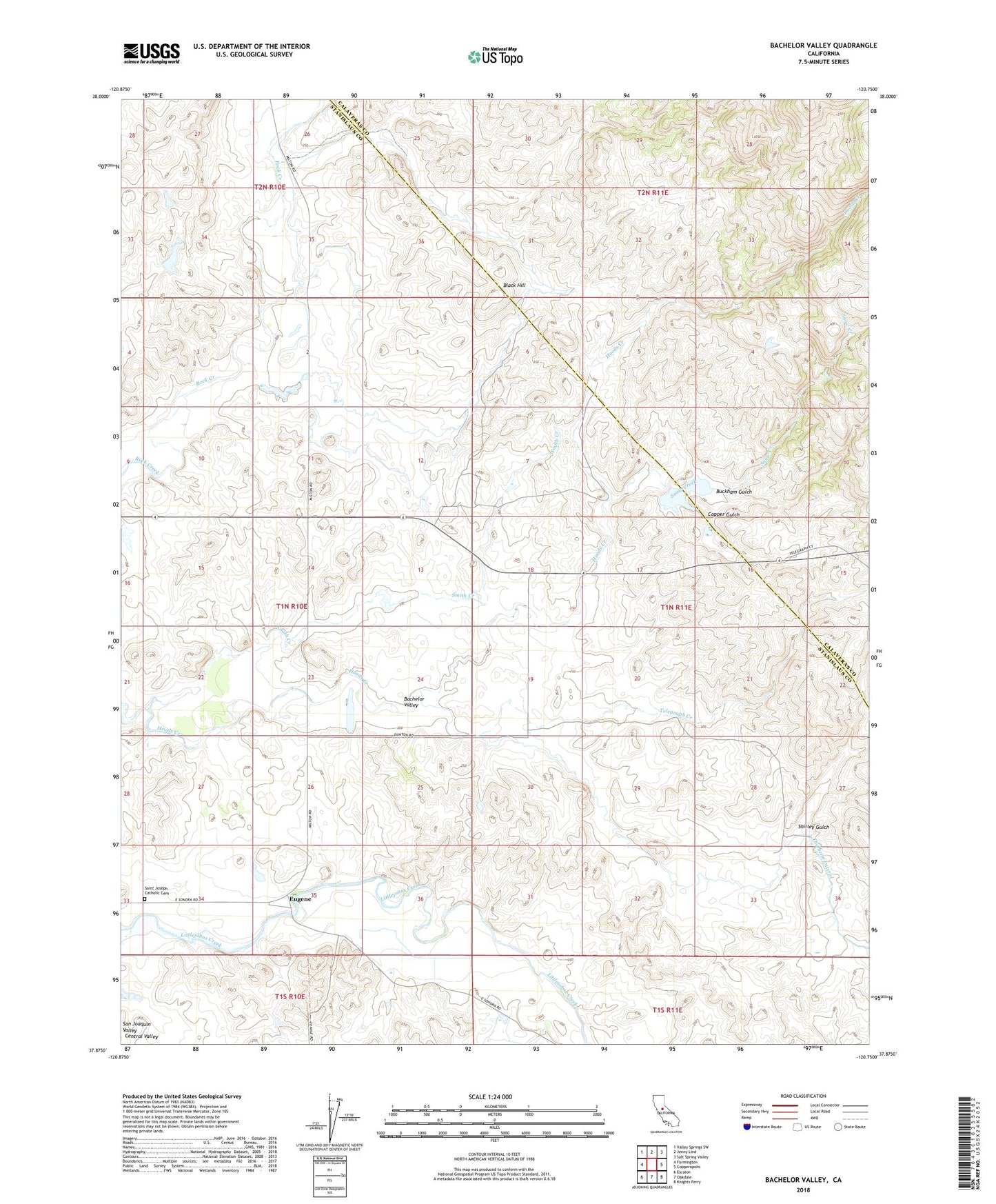
2021 topographic map quadrangle Bachelor Valley in the state of California. Scale: 1:24000. Based on the newly updated USGS 7.5' US Topo map series, this map is in the following counties: Stanislaus, Calaveras. The map contains contour data, water features, and other items you are used to seeing on USGS maps, but also has updated roads and other features. This is the next generation of topographic maps. Printed on high-quality waterproof paper with UV fade-resistant inks.
Quads adjacent to this one:
West: Farmington
Northwest: Valley Springs SW
North: Jenny Lind
Northeast: Salt Spring Valley
East: Copperopolis
Southeast: Knights Ferry
South: Oakdale
Southwest: Escalon
This map covers the same area as the classic USGS quad with code o37120h7.
Contains the following named places: Bachelor Valley, Bachelor Valley School, Black Hill, Black Hill School, Buckham Gulch, Bund Ranch, Copper Gulch, Eugene, Orvis 560 Dam, Orvis Dam, Quail Hill Mine, Rock Creek Ditch, Rosedale School, Saint Joseph Catholic Cemetery, Shirley Creek, Shirley Gulch, Smith Creek, Snow Creek, Snow Ranch, Telegraph Creek