
MyTopo
Warners Ranch California US Topo Map
Couldn't load pickup availability
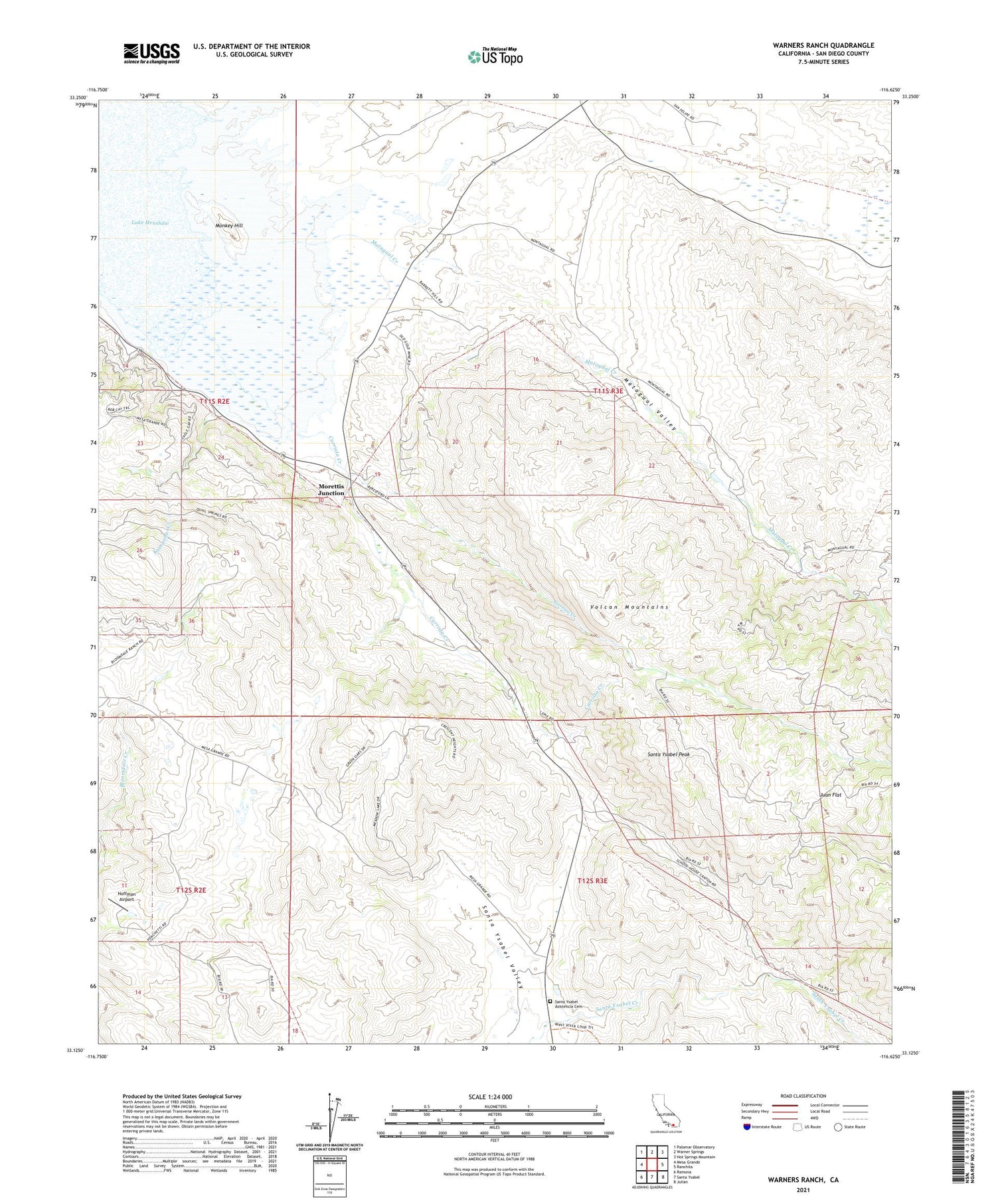
2021 topographic map quadrangle Warners Ranch in the state of California. Scale: 1:24000. Based on the newly updated USGS 7.5' US Topo map series, this map is in the following counties: San Diego. The map contains contour data, water features, and other items you are used to seeing on USGS maps, but also has updated roads and other features. This is the next generation of topographic maps. Printed on high-quality waterproof paper with UV fade-resistant inks.
Quads adjacent to this one:
West: Mesa Grande
Northwest: Palomar Observatory
North: Warner Springs
Northeast: Hot Springs Mountain
East: Ranchita
Southeast: Julian
South: Santa Ysabel
Southwest: Ramona
This map covers the same area as the classic USGS quad with code o33116b6.
Contains the following named places: Buena Vista Creek, Butterfield Stage Station, Carrista Creek, Carrizo Creek, Hoffman Airport, Juan Flat, Kumpohui Creek, Lake Henshaw, Matagua Ranch, Matagual Creek, Matagual Valley, Mesa Chiquita Ranch, Monkey Hill, Moretti Pit, Morettis Junction, Palomar-Julian Division, San Ysidro Creek, Santa Ysabel, Santa Ysabel Asistencia Cemetery, Santa Ysabel Chapel, Santa Ysabel Peak, Santa Ysabel Ranch, Santa Ysabel Reservation, Santa Ysabel Valley, Treanor Ranch, Valle De San Jose, Volcan Indian School, Warners Ranch, ZIP Code: 92070


