
MyTopo
Santa Ysabel California US Topo Map
Couldn't load pickup availability
Also explore the Santa Ysabel Forest Service Topo of this same quad for updated USFS data
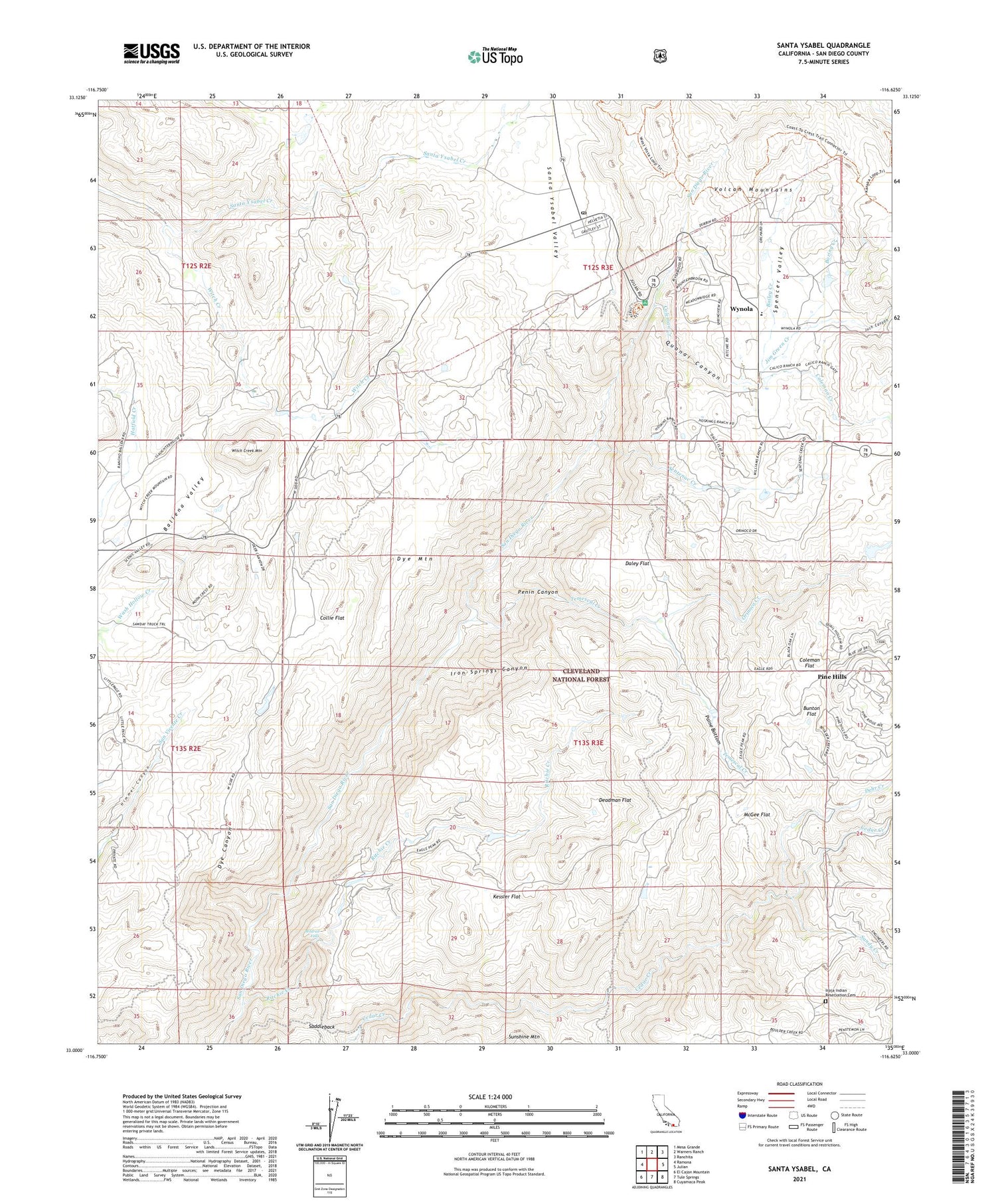
2021 topographic map quadrangle Santa Ysabel in the state of California. Scale: 1:24000. Based on the newly updated USGS 7.5' US Topo map series, this map is in the following counties: San Diego. The map contains contour data, water features, and other items you are used to seeing on USGS maps, but also has updated roads and other features. This is the next generation of topographic maps. Printed on high-quality waterproof paper with UV fade-resistant inks.
Quads adjacent to this one:
West: Ramona
Northwest: Mesa Grande
North: Warners Ranch
Northeast: Ranchita
East: Julian
Southeast: Cuyamaca Peak
South: Tule Springs
Southwest: El Cajon Mountain
This map covers the same area as the classic USGS quad with code o33116a6.
Contains the following named places: Bailey Creek, Ballena, Boring Creek, Bunton Flat, Camp Davidson, Coleman Creek, Coleman Flat, Collie Flat, Daley Flat, Deadman Flat, Dehr Creek, Devils Jumpoff, Dye Canyon, Dye Mountain, Inaja and Cosmit Reservation, Inaja Indian Reservation Cemetery, Inaja Memorial Park, Inaja Nature National Recreation Trail, Iron Springs Canyon, Jim Green Creek, Juch Canyon, Kessler Flat, McGee Flat, Mildred Falls, Nichols Ranch, Old Virginia Mine, Orinoco Creek, Paine Bottom, Peacefield Orchard, Penin Canyon, Pine Hills, Pine Hills Fire Station, Pine Hills Guard Station, Pride of the West Mine, Quanai Canyon, Ritchie Creek, Saddleback, Sandy Creek, Santa Ysabel, Santa Ysabel Post Office, Santa Ysabel School, Sentenac Creek, Spencer Valley, Spencer Valley Elementary School, Temescal Creek, Witch Creek, Witch Creek Fire Control Station, Witch Creek Mountain, Wynola


