MyTopo
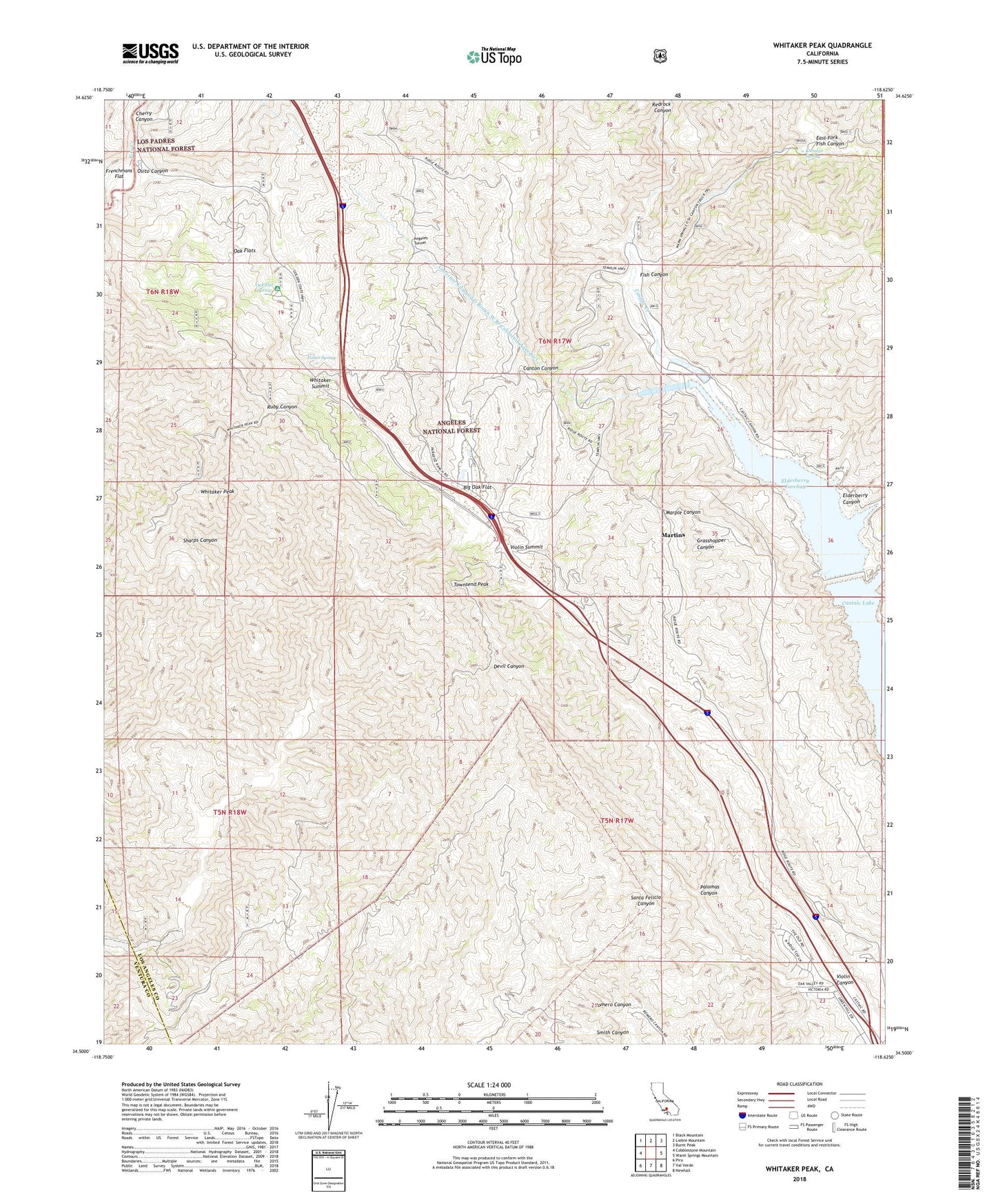
Whitaker Peak California US Topo Map
Couldn't load pickup availability
2022 topographic map quadrangle Whitaker Peak in the state of California. Scale: 1:24000. Based on the newly updated USGS 7.5' US Topo map series, this map is in the following counties: Los Angeles, Ventura. The map contains contour data, water features, and other items you are used to seeing on USGS maps, but also has updated roads and other features. This is the next generation of topographic maps. Printed on high-quality waterproof paper with UV fade-resistant inks.
Quads adjacent to this one:
West: Cobblestone Mountain
Northwest: Black Mountain
North: Liebre Mountain
Northeast: Burnt Peak
East: Warm Springs Mountain
Southeast: Newhall
South: Val Verde
Southwest: Piru
This map covers the same area as the classic USGS quad with code o34118e6.
Contains the following named places: Big Oak Flat, Camp Caula, Canton Canyon Devil Canyon Truck Trail, Canton Canyon Trail, Castaic Powerplant, Cherry Canyon, Cienaga Campground, Cienaga Spring, Cordova Ranch, Devil Canyon Trail, East Fork Fish Canyon, Elderberry Canyon, Elderberry Forebay, Elderberry Forebay 6-049 Dam, Elderberry Lake, Fish Canyon, Fisher Spring, Frenchmans Flat, Frenchmans Flat Campground, Marple Canyon, Martins, Naylor Place, Oak Flat Campground, Oak Flat Spring, Oak Flats, Osito Canyon, Palomas Canyon, Paradise Ranch, Piru Creek Wild and Scenic River, Shelter House, Tailrace Canal, Townsend Peak, United States Forest Service Station, Violin Canyon, Violin Summit, Whitaker Peak, Whitaker Peak Lookout, Whitaker Summit, ZIP Code: 91384