MyTopo
Youngs Peak California US Topo Map
Couldn't load pickup availability
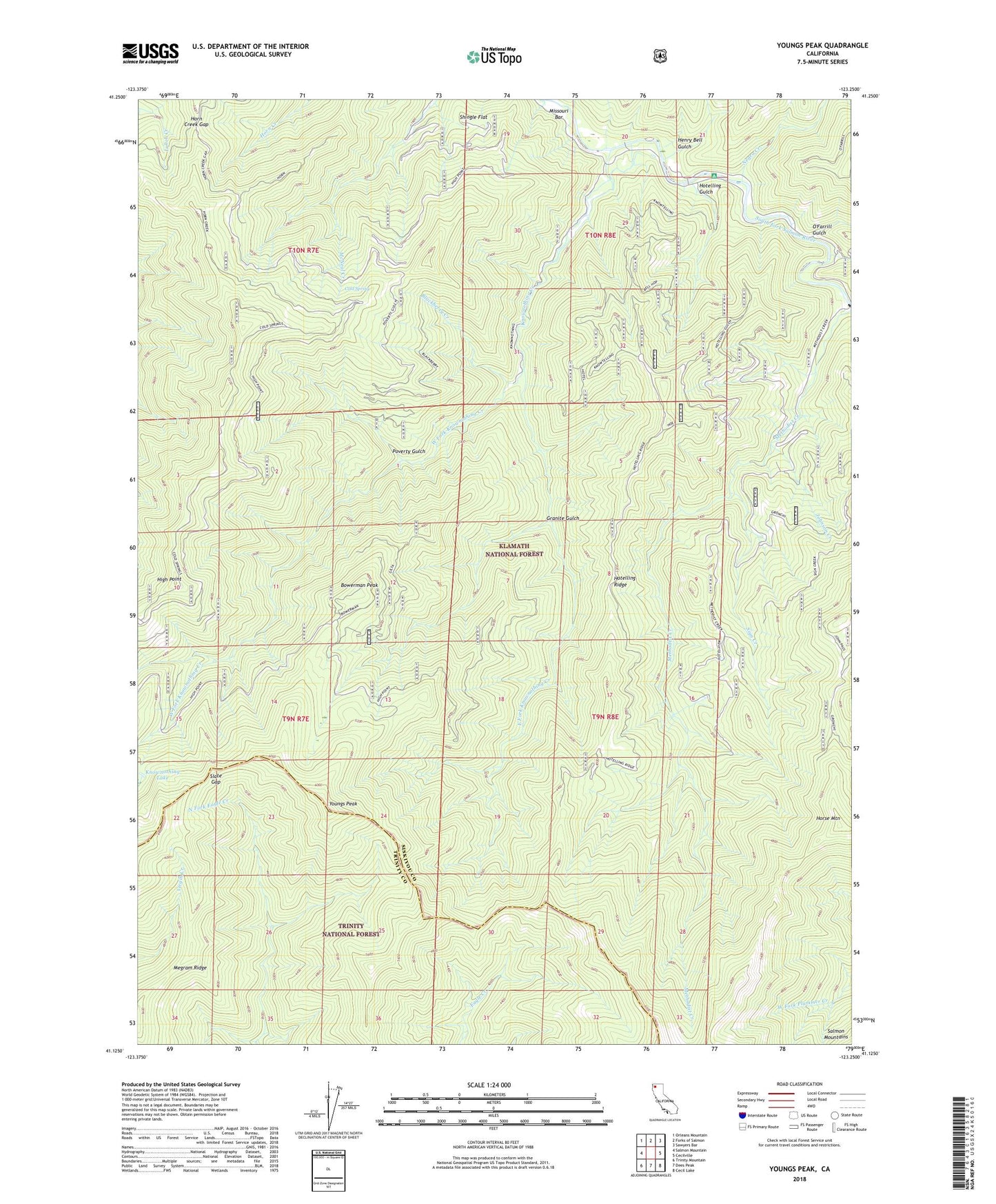
2021 topographic map quadrangle Youngs Peak in the state of California. Scale: 1:24000. Based on the newly updated USGS 7.5' US Topo map series, this map is in the following counties: Siskiyou, Trinity. The map contains contour data, water features, and other items you are used to seeing on USGS maps, but also has updated roads and other features. This is the next generation of topographic maps. Printed on high-quality waterproof paper with UV fade-resistant inks.
Quads adjacent to this one:
West: Salmon Mountain
Northwest: Orleans Mountain
North: Forks of Salmon
Northeast: Sawyers Bar
East: Cecilville
Southeast: Cecil Lake
South: Dees Peak
Southwest: Trinity Mountain
This map covers the same area as the classic USGS quad with code o41123b3.
Contains the following named places: Ball Mine, Barton Cabin, Bell Mine, Blackberry Creek, Bowerman Peak, Brook Mine, Cold Spring, East Fork Knownothing Creek, Gilta, Gilta Mine, Granite Gulch, Hansen, Henry Bell Gulch, High Point, Horn Creek Gap, Horse Mountain, Hotelling Campground, Hotelling Gulch, Hotelling Ridge, Jack Harveys Crossing, Johnson Creek, Knownothing Creek, Knownothing Lake, Knownothing Mine, Megram Ridge, Missouri Bar, Negro Creek, Negro Hill Mine, O'Farrill Gulch, Poverty Gulch, Red Hill Mine, Salmon Summit Mine, Shingle Flat, Sign Creek, Slate Gap, Stanslaw Mine, Tryer Mine, West Fork Knownothing Creek, Wolverine Mine, Youngs Peak