MyTopo
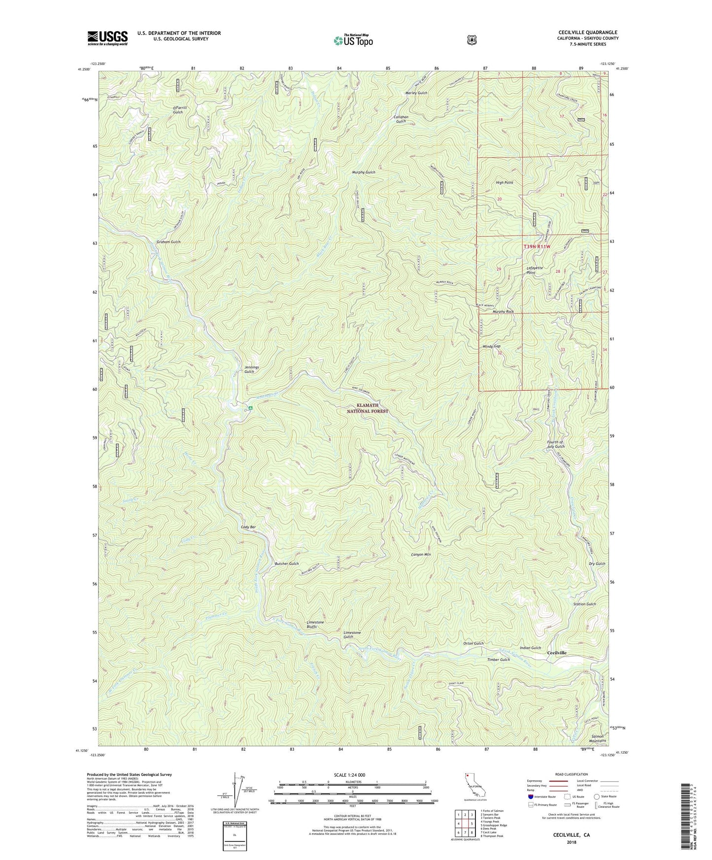
Cecilville California US Topo Map
Couldn't load pickup availability
Also explore the Cecilville Forest Service Topo of this same quad for updated USFS data
2021 topographic map quadrangle Cecilville in the state of California. Scale: 1:24000. Based on the newly updated USGS 7.5' US Topo map series, this map is in the following counties: Siskiyou. The map contains contour data, water features, and other items you are used to seeing on USGS maps, but also has updated roads and other features. This is the next generation of topographic maps. Printed on high-quality waterproof paper with UV fade-resistant inks.
Quads adjacent to this one:
West: Youngs Peak
Northwest: Forks of Salmon
North: Sawyers Bar
Northeast: Tanners Peak
East: Grasshopper Ridge
Southeast: Thompson Peak
South: Cecil Lake
Southwest: Dees Peak
This map covers the same area as the classic USGS quad with code o41123b2.
Contains the following named places: Argus Gulch, Bacon Rind Campground, Big Rock, Black Bear, Black Bear Creek, Blue Ridge Ranch, Butcher Gulch, Callahan Gulch, Canyon Mountain, Cecil Creek, Cecilville, Cody Bar, Cody Creek, Crawford Creek, Crawford Creek Forest Service Station, Dry Gulch, Fourth of July Gulch, French Creek, Graham Gulch, Gunbarrel Mine, High Point, Horse Creek, Indian Creek, Indian Gulch, Jennings Gulch, King Solomon Mine, Lafayette Point, Limestone Bluffs, Limestone Gulch, Marley Gulch, Matthews Creek, Matthews Creek Campground, McDowell Camp, Methodist Creek, Murphy Gulch, Murphy Rock, Orton Gulch, Plummer Creek, Sainte Claire Creek, Smith Creek, Specimen Gulch, Starveout Mine, Station Gulch, Timber Gulch, West Fork Crawford Creek, West Fork Plummer Creek, White Bear Mine, Windy Gap, Yoakumville, ZIP Code: 96031