MyTopo
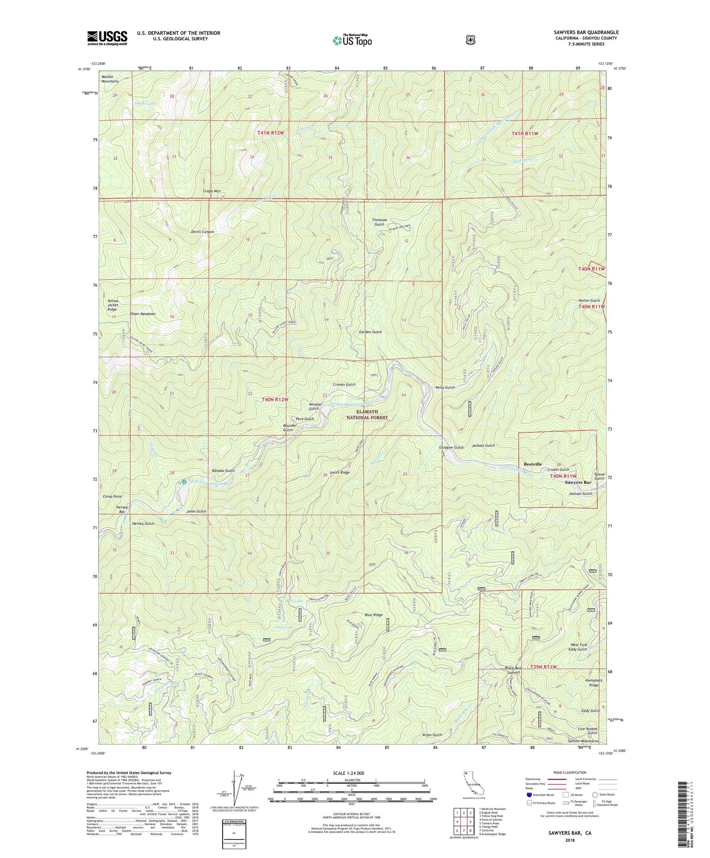
Sawyers Bar California US Topo Map
Couldn't load pickup availability
Also explore the Sawyers Bar Forest Service Topo of this same quad for updated USFS data
2022 topographic map quadrangle Sawyers Bar in the state of California. Scale: 1:24000. Based on the newly updated USGS 7.5' US Topo map series, this map is in the following counties: Siskiyou. The map contains contour data, water features, and other items you are used to seeing on USGS maps, but also has updated roads and other features. This is the next generation of topographic maps. Printed on high-quality waterproof paper with UV fade-resistant inks.
Quads adjacent to this one:
West: Forks of Salmon
Northwest: Medicine Mountain
North: English Peak
Northeast: Yellow Dog Peak
East: Tanners Peak
Southeast: Grasshopper Ridge
South: Cecilville
Southwest: Youngs Peak
This map covers the same area as the classic USGS quad with code o41123c2.
Contains the following named places: Ahlgren Cabin, Ahlgren Ranch, Bestville, Black Bear Mine, Black Bear Summit, Blue Ridge, Blue Ridge Lookout Tower, Boulder Gulch, Box Camp, Burns Ranch, Cherry Creek, China Point, Crapo Mountain, Croaks Gulch, Cronan Gulch, Gallia Mine, Garden Gulch, Garden Gulch Trail, Glasgow Gulch, Godfrey Ranch, Heiney Bar, Heiney Gulch, Hickey Mine, Humpback Ridge, Jackass Gulch, Jessups Gulch, Jones Gulch, Jones Lake, Kanaka Gulch, Kelly Gulch, Left Hand Fork Specimen Creek, Little North Fork Campground, Little North Fork Salmon River, Mud Lake, New Diggings Mine, Nielon Gulch, Olsen Creek, Olsen Meadows, Peck Gulch, Red Bank Campground, Red Hill Mine, Russianville School, Salmon River Ranger Office, Sawyers Bar, Sawyers Bar Catholic Cemetery, Sawyers Bar Cemetery, Sawyers Bar Elementary School, Sawyers Bar Work Center, Shiltos Creek, Smith Ridge, Smiths Lake, Specimen Creek, Sur Cree Creek, Tanner Gulch, Titmouse Gulch, West Fork Eddy Gulch, Windler Gulch, Yellow Jacket Ridge