MyTopo
Sanford Hills Colorado US Topo Map
Couldn't load pickup availability
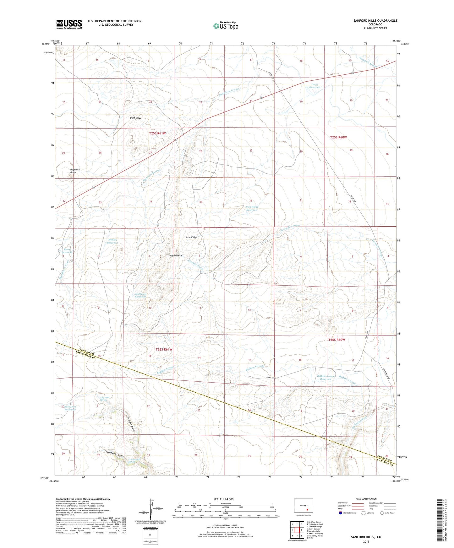
2022 topographic map quadrangle Sanford Hills in the state of Colorado. Scale: 1:24000. Based on the newly updated USGS 7.5' US Topo map series, this map is in the following counties: Pueblo, Las Animas. The map contains contour data, water features, and other items you are used to seeing on USGS maps, but also has updated roads and other features. This is the next generation of topographic maps. Printed on high-quality waterproof paper with UV fade-resistant inks.
Quads adjacent to this one:
West: Myers Canyon
Northwest: Red Top Ranch
North: Yellowbank Creek
Northeast: Apishapa Bridge
East: Snowden Lake
Southeast: Delhi
South: Sun Valley Ranch
Southwest: Jones Lake Spring
This map covers the same area as the classic USGS quad with code o37104g2.
Contains the following named places: Berry Reservoir, Black Ranch, Black Windmill, Blue Ridge, Buffalo Arroyo Dam, Buffalo Arroyo Reservoir, Carr Windmill, Cottonwood Canyon, Cottonwood Spring, Davis Reservoir, English Camp, Fox Windmill, Haystack Butte, Iron Ridge, Iron Ridge Reservoir, Jacobs Ranch, Lily Pond Spring, Linnard Well, Lou Nelson Ranch, Mobley Reservoir, New Windmill, Rock Dam Reservoir, Sanford Hills, Southwest Reservoir