
MyTopo
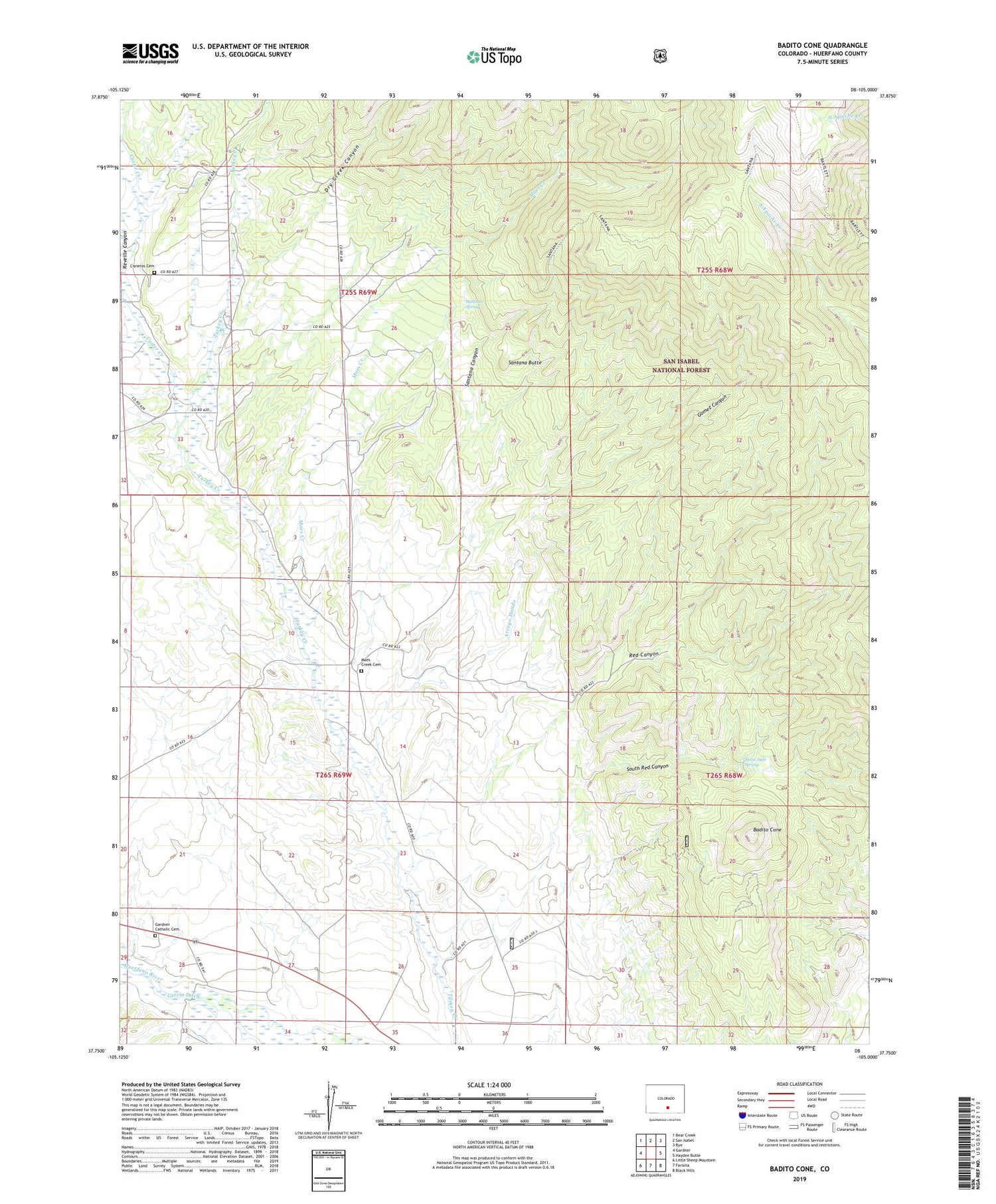
Badito Cone Colorado US Topo Map
Couldn't load pickup availability
Also explore the Badito Cone Forest Service Topo of this same quad for updated USFS data
2022 topographic map quadrangle Badito Cone in the state of Colorado. Scale: 1:24000. Based on the newly updated USGS 7.5' US Topo map series, this map is in the following counties: Huerfano. The map contains contour data, water features, and other items you are used to seeing on USGS maps, but also has updated roads and other features. This is the next generation of topographic maps. Printed on high-quality waterproof paper with UV fade-resistant inks.
Quads adjacent to this one:
West: Gardner
Northwest: Bear Creek
North: San Isabel
Northeast: Rye
East: Hayden Butte
Southeast: Black Hills
South: Farisita
Southwest: Little Sheep Mountain
This map covers the same area as the classic USGS quad with code o37105g1.
Contains the following named places: Arroyo Hondo, Badito Cone, Cisneros Cemetery, Custer Creek, Dry Creek Canyon, Gardner Catholic Cemetery, Gomez Canyon, Greenhorn Mountain Wilderness, Maes Creek, Maes Creek Cemetery, Molla Ditch, Red Canyon, Reveille Canyon, Saint Jude Spring, Santana Butte, Santana Canyon, Santana Spring, Santana Trail, South Red Canyon, Stumbling Stud Mine, Yle Ditch


