MyTopo
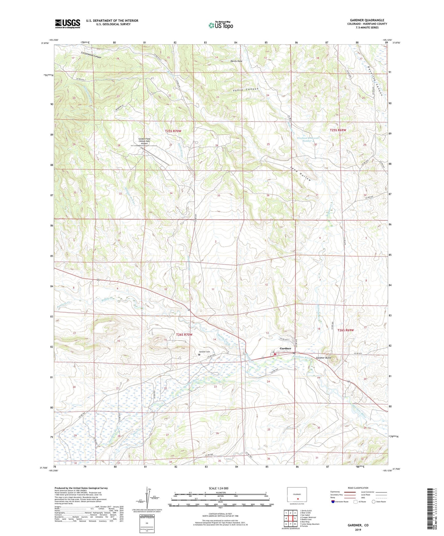
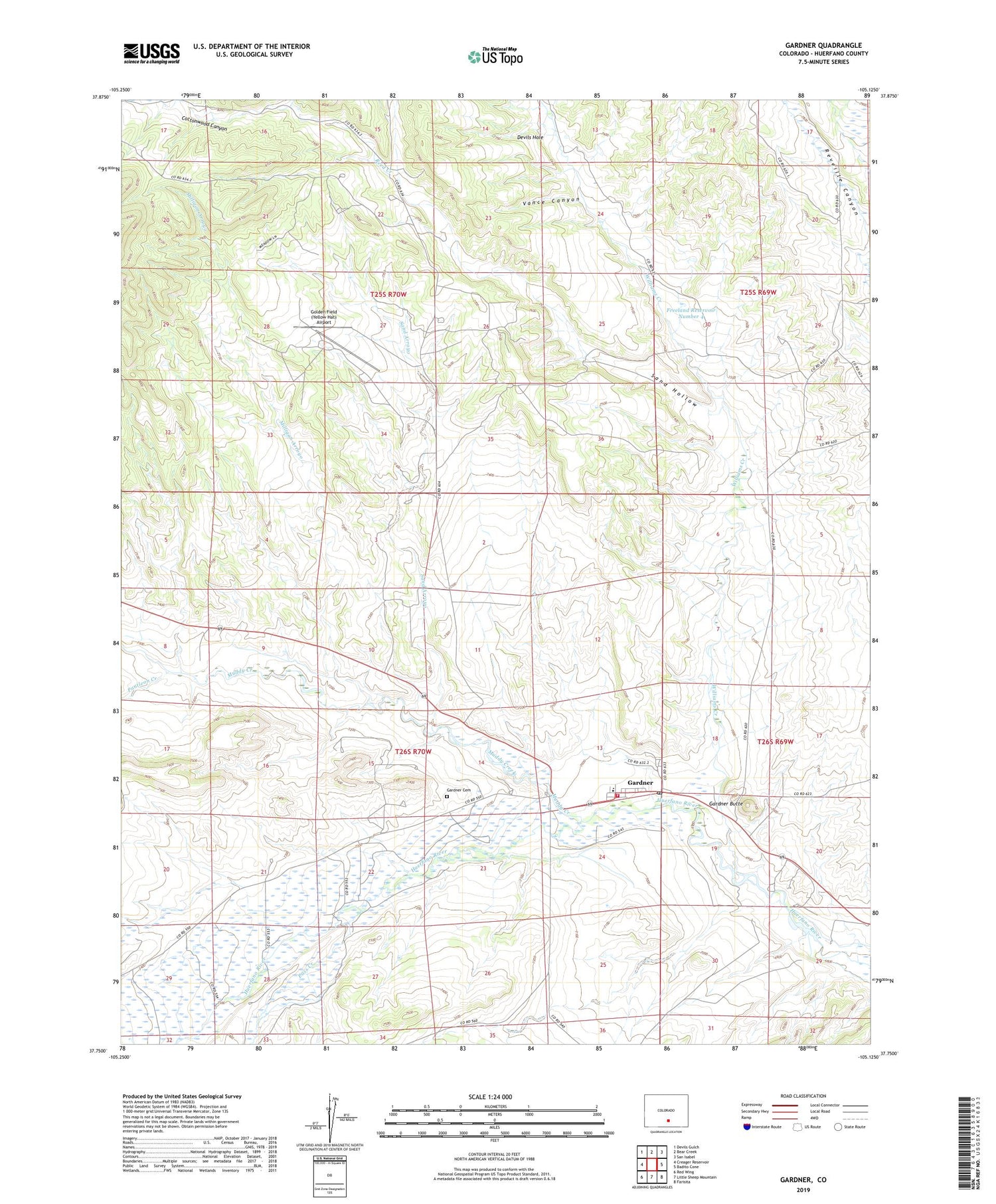
Gardner Colorado US Topo Map
Couldn't load pickup availability
2022 topographic map quadrangle Gardner in the state of Colorado. Scale: 1:24000. Based on the newly updated USGS 7.5' US Topo map series, this map is in the following counties: Huerfano. The map contains contour data, water features, and other items you are used to seeing on USGS maps, but also has updated roads and other features. This is the next generation of topographic maps. Printed on high-quality waterproof paper with UV fade-resistant inks.
Quads adjacent to this one:
West: Creager Reservoir
Northwest: Devils Gulch
North: Bear Creek
Northeast: San Isabel
East: Badito Cone
Southeast: Farisita
South: Little Sheep Mountain
Southwest: Red Wing
This map covers the same area as the classic USGS quad with code o37105g2.
Contains the following named places: Burns Ditch Number 2, Cottonwood Canyon, Francisco Mestes Ditch, Freeland Number 4 Dam, Freeland Reservoir Number 4, Gardner, Gardner Butte, Gardner Cemetery, Gardner Census Designated Place, Gardner Division, Gardner Post Office, Golden Field (Yellow Hat) Airport, Hamlet Ditch, Little Joe Number One Mine, Medina Ditch Number 3, Medina Felipa Ditch, Milligan Arroyo, Muddy Creek, Pantleon Creek, Pass Creek, Polvo Blanco Mine, Reed Creek, Roy Ditch, Sanchez Ditch, Sand Arroyo, Sand Hollow, Upper Huerfano Fire Protection District Gardner Station, Vance Canyon, Williams Creek, ZIP Code: 81040