
MyTopo
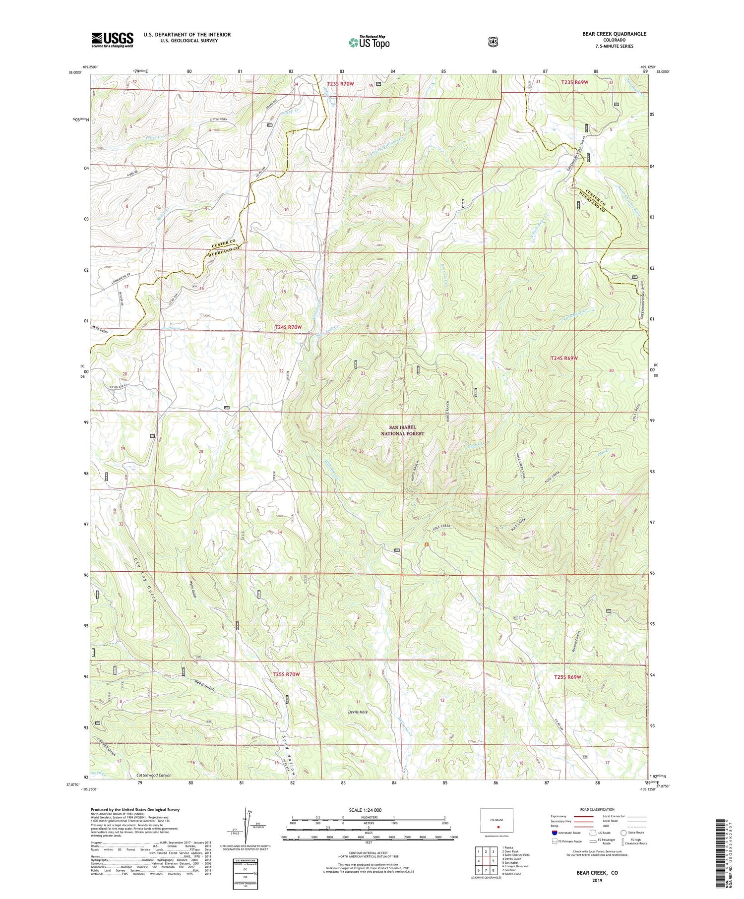
Bear Creek Colorado US Topo Map
Couldn't load pickup availability
Also explore the Bear Creek Forest Service Topo of this same quad for updated USFS data
2022 topographic map quadrangle Bear Creek in the state of Colorado. Scale: 1:24000. Based on the newly updated USGS 7.5' US Topo map series, this map is in the following counties: Huerfano, Custer. The map contains contour data, water features, and other items you are used to seeing on USGS maps, but also has updated roads and other features. This is the next generation of topographic maps. Printed on high-quality waterproof paper with UV fade-resistant inks.
Quads adjacent to this one:
West: Devils Gulch
Northwest: Rosita
North: Deer Peak
Northeast: Saint Charles Peak
East: San Isabel
Southeast: Badito Cone
South: Gardner
Southwest: Creager Reservoir
This map covers the same area as the classic USGS quad with code o37105h2.
Contains the following named places: Bear Creek, Bear Creek Trail, Blue Spring, Buckhorn Mine, Caldwell Gulch, Deer Lick Creek, Devils Hole, East Fork Williams Creek, Horse Ranch Trail, North Fork Bear Creek, Pole Creek, Pole Creek Trail, Reed Gulch, Ricardo Creek, South Fork Bear Creek, Ute Log Gulch, Wylie Gulch


