
MyTopo
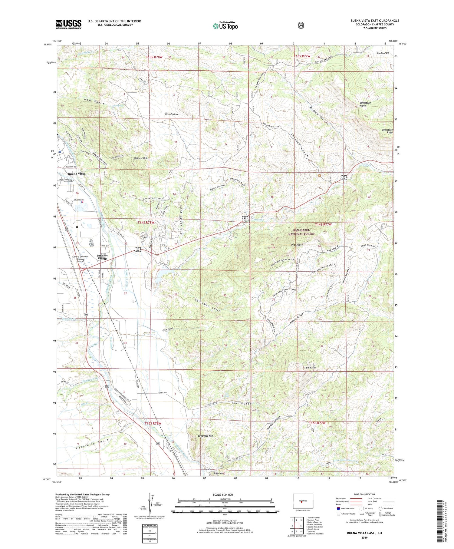
Buena Vista East Colorado US Topo Map
Couldn't load pickup availability
Also explore the Buena Vista East Forest Service Topo of this same quad for updated USFS data
2022 topographic map quadrangle Buena Vista East in the state of Colorado. Scale: 1:24000. Based on the newly updated USGS 7.5' US Topo map series, this map is in the following counties: Chaffee. The map contains contour data, water features, and other items you are used to seeing on USGS maps, but also has updated roads and other features. This is the next generation of topographic maps. Printed on high-quality waterproof paper with UV fade-resistant inks.
Quads adjacent to this one:
West: Buena Vista West
Northwest: Harvard Lakes
North: Marmot Peak
Northeast: Antero Reservoir
East: Castle Rock Gulch
Southeast: Cameron Mountain
South: Nathrop
Southwest: Mount Antero
This map covers the same area as the classic USGS quad with code o38106g1.
Contains the following named places: Arnold Gulch, Bald Mountain, Bald Mountain Gulch, Big Sandy Draw, Bray Ditch, Buena Vista Correctional Facility, Buena Vista Police Department, Central Colorado Regional Airport, Chaffee County Fire Protection District Station 1, Chaffee County Sheriff's Office Buena Vista, Chinaman Gulch, Coal Kiln Gulch, Colorado State Patrol Buena Vista Post, Cottonwood Creek, Dry Creek, Helena Ditch, Johnson Village, Johnson Village Census Designated Place, Lenhardy Cutoff, Limestone Ridge, Lost Spring, Maxwell Creek, McGee Gulch, Midland Bike Trail, Midland Hill, Nellie Bly Mine, Piles Pasture, Shields Gulch, Sugarloaf Mountain, The Falls, Thompson Creek, Tie Gulch, Triad Mine, Triad Ridge, Trout Creek, Trout Creek Ditch


