MyTopo
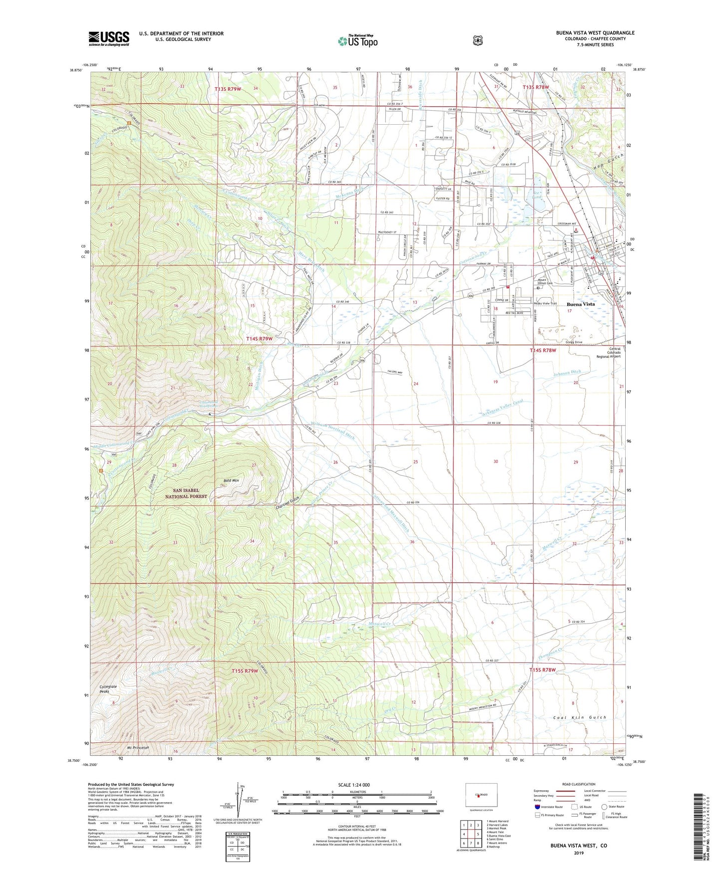
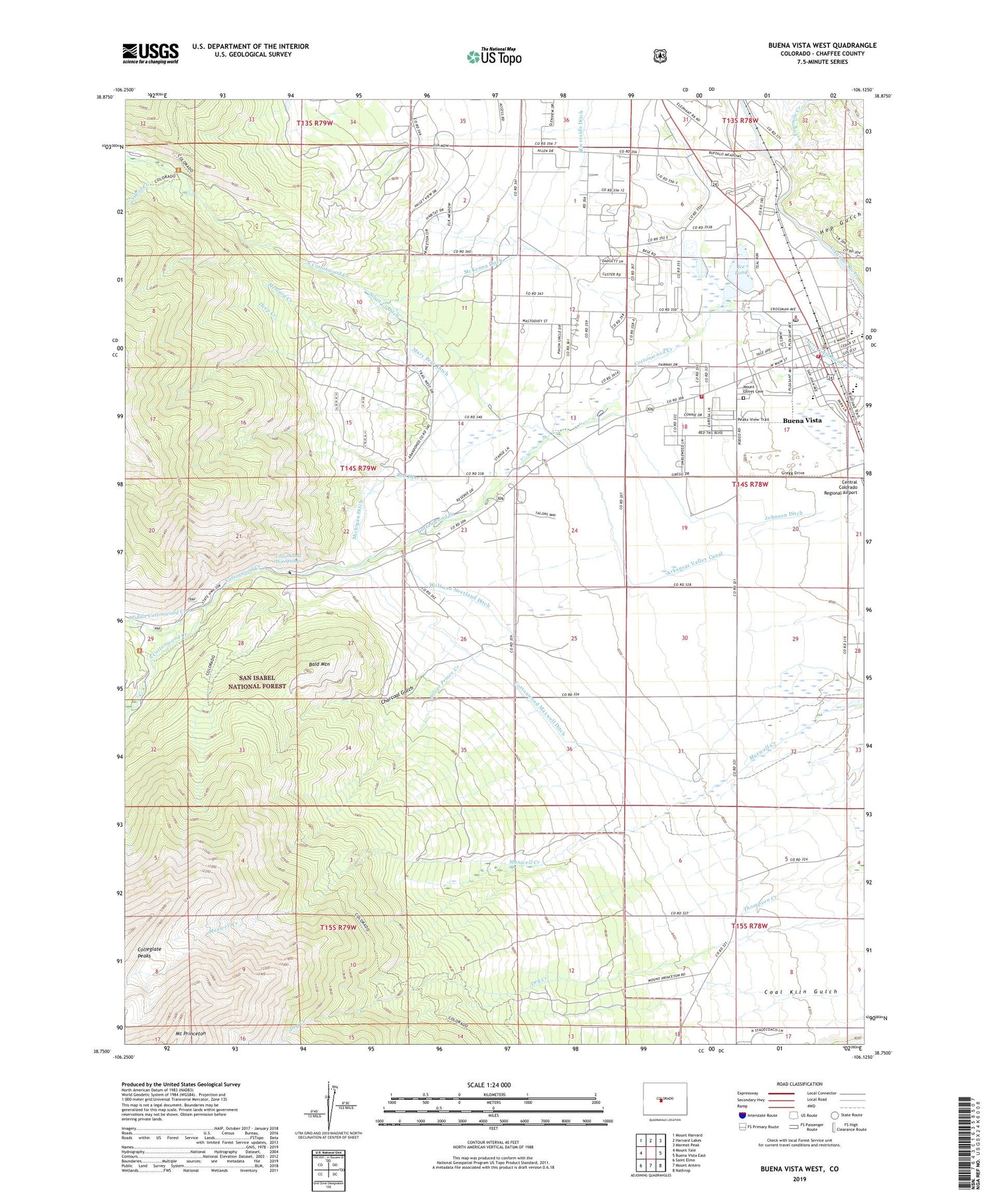
Buena Vista West Colorado US Topo Map
Couldn't load pickup availability
Also explore the Buena Vista West Forest Service Topo of this same quad for updated USFS data
2022 topographic map quadrangle Buena Vista West in the state of Colorado. Scale: 1:24000. Based on the newly updated USGS 7.5' US Topo map series, this map is in the following counties: Chaffee. The map contains contour data, water features, and other items you are used to seeing on USGS maps, but also has updated roads and other features. This is the next generation of topographic maps. Printed on high-quality waterproof paper with UV fade-resistant inks.
Quads adjacent to this one:
West: Mount Yale
Northwest: Mount Harvard
North: Harvard Lakes
Northeast: Marmot Peak
East: Buena Vista East
Southeast: Nathrop
South: Mount Antero
Southwest: Saint Elmo
This map covers the same area as the classic USGS quad with code o38106g2.
Contains the following named places: Annie C Mine, Arkansas Valley Canal, Bald Mountain, Be True Mine, Big Chief Tunnel Mine, Blakes Wonder Placer Mine, Buena Vista, Buena Vista Fire Department, Buena Vista Post Office, Buena Vista Square Shopping Center, Chaffee County Fire Protection District Station 3, Charcoal Gulch, Cottonwood Hot Springs, Cottonwood Maxwell Ditch, Deep Creek, Doris Ruby Group Mine, Eureka Mountain Mine, Fourmile Creek, Hop Gulch, Ice Pond, Indian Flats, Johnson Ditch, Josephine Quarry, KDMN-AM (Buena Vista), Lachaw Mine, Latchaw Mine, Little Annie Mine, Mary A Claims Mine, Mary Bray Ditch, Maxwell School, McKenna Ditch, Mercury Creek, Michigan Ditch, Middle Cottonwood Creek, Mizpah Mine, Mount Olivet Cemetery, North Cottonwood Creek, Quaker Mine, Rancho Sawatch, Red Deer Creek, Silver Creek, Silver Creek Ditch, Silver Prince Creek, South Cottonwood Creek, Speedy Mine, Sunset Shaft Mine, Tom Collins Mine, Town of Buena Vista, Wolf and Neerland Ditch, Yellow Bird Mine