
MyTopo
Cactus Reservoir Colorado US Topo Map
Couldn't load pickup availability
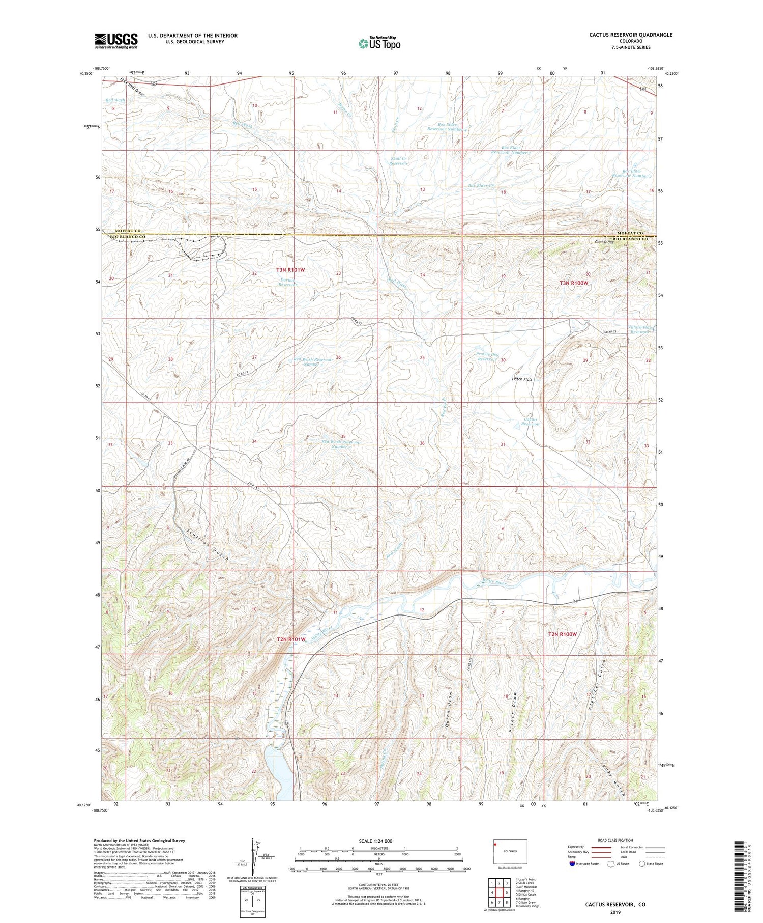
2022 topographic map quadrangle Cactus Reservoir in the state of Colorado. Scale: 1:24000. Based on the newly updated USGS 7.5' US Topo map series, this map is in the following counties: Rio Blanco, Moffat. The map contains contour data, water features, and other items you are used to seeing on USGS maps, but also has updated roads and other features. This is the next generation of topographic maps. Printed on high-quality waterproof paper with UV fade-resistant inks.
Quads adjacent to this one:
West: Rangely NE
Northwest: Lazy Y Point
North: Skull Creek
Northeast: M F Mountain
East: Divide Creek
Southeast: Calamity Ridge
South: Gillam Draw
Southwest: Rangely
This map covers the same area as the classic USGS quad with code o40108b6.
Contains the following named places: Box Elder Creek, Box Elder Reservoir Number 2, Box Elder Reservoir Number 3, Box Elder Reservoir Number 4, Cactus Reservoir, Coal Ridge Dam, Darwin Reservoir, Desperado Mine, Fletcher Gulch, Hatch Flats, Jones Twist, Miller Creek, Prairie Dog Reservoir, Priest Draw, Quinn Draw, Raven Park Dam, Red Wash, Red Wash Reservoir Number 2, Red Wash Reservoir Number 3, Rock Wall Draw, Scullion Gulch, Skull Creek, Skull Creek Reservoir, Spring Creek, Staley-Gordon Mine, Villard Flats Reservoir, Yanks Gulch


