MyTopo
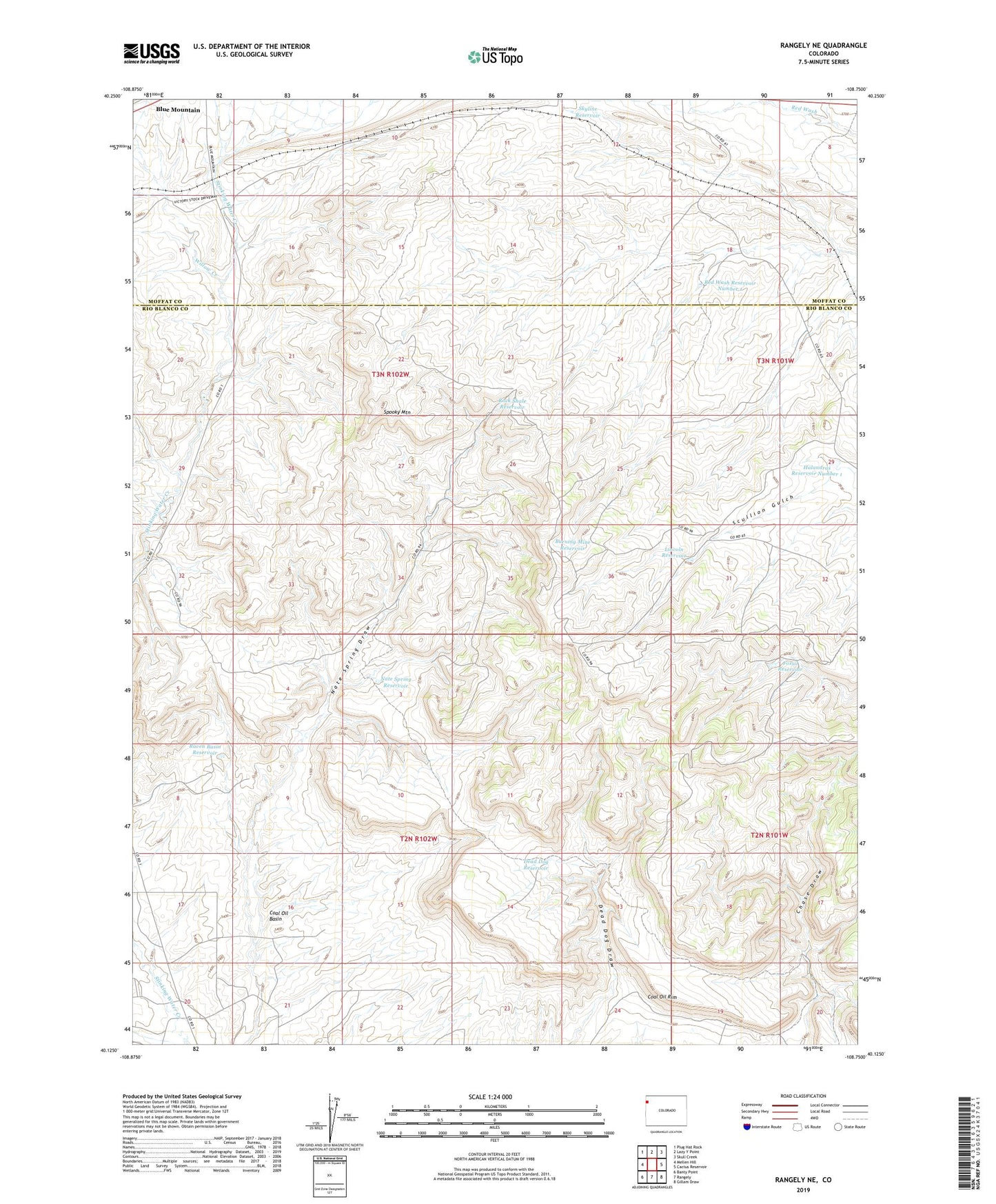
Rangely NE Colorado US Topo Map
Couldn't load pickup availability
2022 topographic map quadrangle Rangely NE in the state of Colorado. Scale: 1:24000. Based on the newly updated USGS 7.5' US Topo map series, this map is in the following counties: Rio Blanco, Moffat. The map contains contour data, water features, and other items you are used to seeing on USGS maps, but also has updated roads and other features. This is the next generation of topographic maps. Printed on high-quality waterproof paper with UV fade-resistant inks.
Quads adjacent to this one:
West: Mellen Hill
Northwest: Plug Hat Rock
North: Lazy Y Point
Northeast: Skull Creek
East: Cactus Reservoir
Southeast: Gillam Draw
South: Rangely
Southwest: Banty Point
This map covers the same area as the classic USGS quad with code o40108b7.
Contains the following named places: Blue Flame Mine, Blue Mountain, Burning Mine Reservoir, Coal Oil Rim, Dead Dog Reservoir, Fossil Reservoir, Halandras Reservoir Number 1, Lincoln Reservoir, Little Red Wash, Nate Spring Reservoir, Raven Basin Reservoir, Red Wash Reservoir Number 1, Rock Shale Reservoir, Skyline Reservoir, Spooky Mountain, White River Mine, Willow Creek