
MyTopo
Divide Creek Colorado US Topo Map
Couldn't load pickup availability
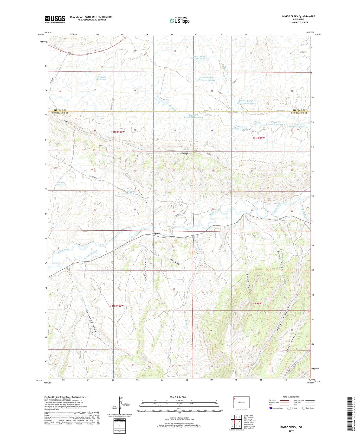
2022 topographic map quadrangle Divide Creek in the state of Colorado. Scale: 1:24000. Based on the newly updated USGS 7.5' US Topo map series, this map is in the following counties: Rio Blanco, Moffat. The map contains contour data, water features, and other items you are used to seeing on USGS maps, but also has updated roads and other features. This is the next generation of topographic maps. Printed on high-quality waterproof paper with UV fade-resistant inks.
Quads adjacent to this one:
West: Cactus Reservoir
Northwest: Skull Creek
North: M F Mountain
Northeast: Elk Springs
East: Rough Gulch
Southeast: Barcus Creek
South: Calamity Ridge
Southwest: Gillam Draw
This map covers the same area as the classic USGS quad with code o40108b5.
Contains the following named places: Alkali Gulch, Angora, Bobcat Reservoir, Boise Creek, Box Elder Reservoir, Burnt Gulch, Coal Ridge, Divide Creek, Divide Creek Detention Dam, Divide Creek Reservoir Number 2, Divide Creek Reservoir Number 3, Divide Creek Reservoir Number 4, Divide Creek Reservoir Number 5, Hall Draw, Hall Draw Reservoir, Hammond Ditch, Hammond Draw, Little Spring Creek, Lower Wolf Creek Reservoir Number 1, Lower Wolf Creek Reservoir Number 2, Lower Wolf Creek Reservoir Number 3, School Gulch, Spring Gulch


