MyTopo
Cobb Lake Colorado US Topo Map
Couldn't load pickup availability
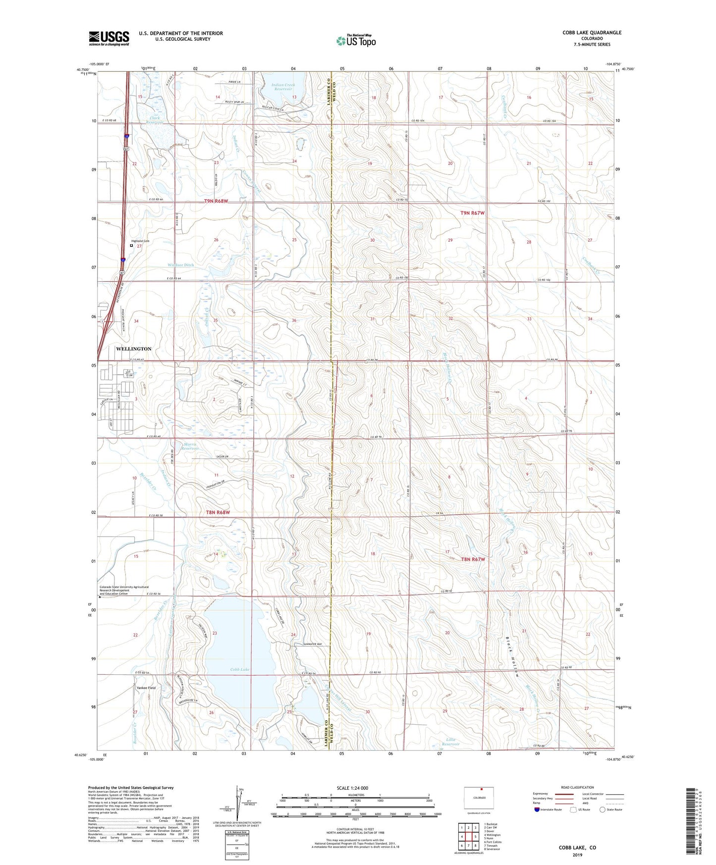
2022 topographic map quadrangle Cobb Lake in the state of Colorado. Scale: 1:24000. Based on the newly updated USGS 7.5' US Topo map series, this map is in the following counties: Weld, Larimer. The map contains contour data, water features, and other items you are used to seeing on USGS maps, but also has updated roads and other features. This is the next generation of topographic maps. Printed on high-quality waterproof paper with UV fade-resistant inks.
Quads adjacent to this one:
West: Wellington
Northwest: Buckeye
North: Carr SW
Northeast: Dover
East: Nunn
Southeast: Severance
South: Timnath
Southwest: Fort Collins
This map covers the same area as the classic USGS quad with code o40104f8.
Contains the following named places: Clark Reservoir, Clarks Lake, Clarks Lake Dam, Cobb Lake, Cobb Lake Dam, Cowan Lateral, Grothe Dam, Grothe Reservoir, Highland Cemetery, Hinkley Lake, Indian Creek, Indian Creek Reservoir, KIMN-FM (Fort Collins), Lillie Reservoir, Morris Reservoir, Mountain Supply Number 18 Dam, Timnath Reservoir Outlet, William T Browder Heliport, Windsor Ditch, Yankee Field